|
|
 |
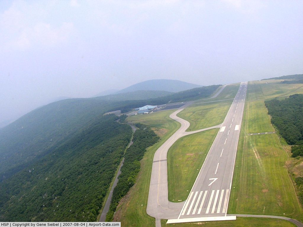
(Click on the photo to enlarge) |
Location & QuickFacts
| FAA Information Effective: | 2008-09-25 |
| Airport Identifier: | HSP |
| Airport Status: | Operational |
| Longitude/Latitude: | 079-50-02.0200W/37-57-05.2000N
-79.833894/37.951444 (Estimated) |
| Elevation: | 3792 ft / 1155.80 m (Surveyed) |
| Land: | 352 acres |
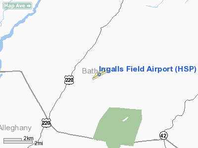
| From nearest city: | 3 nautical miles S of Hot Springs, VA |
| Location: | Bath County, VA |
| Magnetic Variation: | 08W (2000) |
Owner & Manager
| Ownership: | Publicly owned |
| Owner: | Bath County Arpt Auth |
| Address: | Rt 2 Box 225aa
Hot Springs, VA 24445 |
| Phone number: | 540-839-5326 |
| Manager: | Becky Skidmore |
| Address: | Rt 2 Box 225aa
Hot Springs, VA 24445 |
| Phone number: | 540-839-5326 |
Airport Operations and Facilities
| Airport Use: | Open to public |
| Wind indicator: | Yes |
| Segmented Circle: | Yes |
| Control Tower: | No |
| Lighting Schedule: | DUSK-DAWN
ACTVT HIRL RY 07/25, PAPI RYS 07 & 25, REIL RY 25, & TWY LGTS - CTAF. |
| Beacon Color: | Clear-Green (lighted land airport) |
| Landing fee charge: | Yes
LDG FEE WAIVED FOR FUEL PURCHASE MULTI ENGINE ACFT ONLY. |
| Sectional chart: | Cincinnati |
| Region: | AEA - Eastern |
| Boundary ARTCC: | ZDC - Washington |
| Tie-in FSS: | DCA - Leesburg |
| FSS on Airport: | No |
| FSS Toll Free: | 1-800-WX-BRIEF |
| NOTAMs Facility: | HSP (NOTAM-d service avaliable) |
| Federal Agreements: | NGY |
Airport Communications
| CTAF: | 123.000 |
| Unicom: | 123.000 |
Airport Services
| Fuel available: | 100LLA |
| Airframe Repair: | NONE |
| Power Plant Repair: | NONE |
| Bottled Oxygen: | NONE |
| Bulk Oxygen: | NONE |
Runway Information
Runway 07/25
| Dimension: | 5600 x 100 ft / 1706.9 x 30.5 m |
| Surface: | ASPH, Good Condition |
| Surface Treatment: | Porous Friction Course |
| Weight Limit: | Single wheel: 65000 lbs.
Dual wheel: 160000 lbs. |
| Edge Lights: | High |
| |
Runway 07 |
Runway 25 |
| Longitude: | 079-50-31.8991W | 079-49-32.1001W |
| Latitude: | 37-56-50.9029N | 37-57-19.5594N |
| Elevation: | 3790.00 ft | 3763.00 ft |
| Alignment: | 59 | 127 |
| ILS Type: | | ILS
|
| Traffic Pattern: | Left | Left |
| Markings: | Non-precision instrument, Fair Condition | Non-precision instrument, Fair Condition |
| Crossing Height: | 46.00 ft | 58.00 ft |
| VASI: | 4-light PAPI on right side | 4-light PAPI on left side |
| Visual Glide Angle: | 3.00° | 3.00° |
| Runway End Identifier: | | Yes |
| Obstruction: | 32 ft gnd, 200.0 ft from runway, 200 ft right of centerline
07 +32 FT HIGH TERRAIN 200 FT FM RY END 200 FT RIGHT. | , 50:1 slope to clear
+20 FT TREES 0-200 FT FM THLD 300 FT L & 400 FT R. |
|
Radio Navigation Aids
| ID |
Type |
Name |
Ch |
Freq |
Var |
Dist |
| LW | NDB | Bushi | | 346.00 | 06W | 31.8 nm |
| CNQ | NDB | Callahan | | 379.00 | 05W | 44.3 nm |
| VIT | NDB | Vinton | | 277.00 | 06W | 45.0 nm |
| VBW | NDB | Bridgewater | | 241.00 | 07W | 48.2 nm |
| ODR | VOR | Woodrum | | 114.90 | 06W | 38.3 nm |
| RNL | VOR | Rainelle | | 116.60 | 04W | 46.1 nm |
| LWB | VOR/DME | Greenbrier | 107Y | 116.05 | 08W | 27.0 nm |
| MOL | VOR/DME | Montebello | 100X | 115.30 | 05W | 34.6 nm |
| ROA | VORTAC | Roanoke | 031X | 109.40 | 04W | 38.2 nm |
Remarks
- DEER ON & INVOF ARPT.
- DEER & TURKEY ON & INVOF ARPT.
Images and information placed above are from
http://www.airport-data.com/airport/HSP/
We thank them for the data!
| General Info
|
| Country |
United States
|
| State |
VIRGINIA
|
| FAA ID |
HSP
|
| Latitude |
37-57-05.200N
|
| Longitude |
079-50-02.020W
|
| Elevation |
3792 feet
|
| Near City |
HOT SPRINGS
|
We don't guarantee the information is fresh and accurate. The data may
be wrong or outdated.
For more up-to-date information please refer to other sources.
|
|