|
|
 |
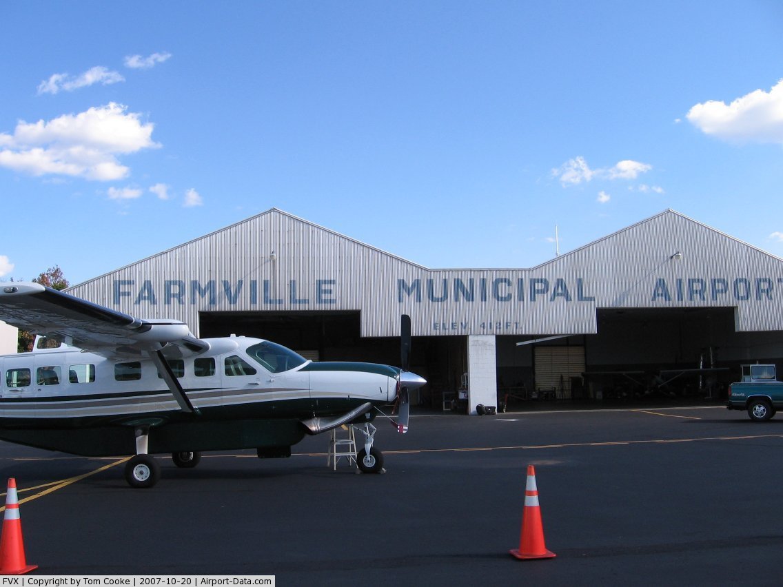
(Click on the photo to enlarge) |
Location & QuickFacts
| FAA Information Effective: | 2008-09-25 |
| Airport Identifier: | FVX |
| Airport Status: | Operational |
| Longitude/Latitude: | 078-26-16.0730W/37-21-27.1030N
-78.437798/37.357529 (Estimated) |
| Elevation: | 417 ft / 127.10 m (Surveyed) |
| Land: | 192 acres |
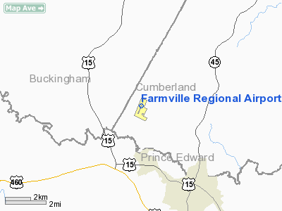
| From nearest city: | 4 nautical miles NW of Farmville, VA |
| Location: | Cumberland County, VA |
| Magnetic Variation: | 09W (2000) |
Owner & Manager
| Ownership: | Publicly owned |
| Owner: | Town Of Farmville |
| Address: | Town Hall
Farmville, VA 23901 |
| Phone number: | 434-392-5686 |
| Manager: | Tommy Grimes |
| Address: | 130 Wedgewood Dr.
Farmville, VA 23901-9116 |
| Phone number: | 434-392-9016 |
Airport Operations and Facilities
| Airport Use: | Open to public |
| Wind indicator: | Yes |
| Control Tower: | No |
| Lighting Schedule: | DUSK-DAWN
RY 03/21 MIRL PRESET LOW INTST; TO INCR INTST ACTVT CTAF. |
| Beacon Color: | Clear-Green (lighted land airport) |
| Landing fee charge: | No |
| Sectional chart: | Washington |
| Region: | AEA - Eastern |
| Boundary ARTCC: | ZDC - Washington |
| Tie-in FSS: | DCA - Leesburg |
| FSS on Airport: | No |
| FSS Toll Free: | 1-800-WX-BRIEF |
| NOTAMs Facility: | FVX (NOTAM-d service avaliable) |
| Federal Agreements: | NGY |
Airport Communications
| CTAF: | 122.800 |
| Unicom: | 122.800 |
Airport Services
| Fuel available: | 100LLA |
| Airframe Repair: | MINOR |
| Power Plant Repair: | MINOR |
| Bottled Oxygen: | NONE |
| Bulk Oxygen: | NONE |
Runway Information
Runway 03/21
| Dimension: | 4400 x 75 ft / 1341.1 x 22.9 m |
| Surface: | ASPH, Good Condition |
| Weight Limit: | Single wheel: 12500 lbs. |
| Edge Lights: | Medium |
| |
Runway 03 |
Runway 21 |
| Longitude: | 078-26-25.4960W | 078-26-06.6500W |
| Latitude: | 37-21-06.6940N | 37-21-47.5120N |
| Elevation: | 410.00 ft | 417.00 ft |
| Alignment: | 20 | 127 |
| Traffic Pattern: | Left | Left |
| Markings: | Non-precision instrument, Poor Condition
RY 03 MARKINGS ARE FADED. | Non-precision instrument, Fair Condition |
| Crossing Height: | 52.00 ft | 52.00 ft |
| VASI: | 2-light PAPI on left side | 2-light PAPI on left side |
| Visual Glide Angle: | 3.00° | 3.00° |
| Runway End Identifier: | | Yes |
| Obstruction: | 42 ft tree, 675.0 ft from runway, 315 ft left of centerline, 11:1 slope to clear | 59 ft tree, 1335.0 ft from runway, 277 ft left of centerline, 19:1 slope to clear |
|
Radio Navigation Aids
| ID |
Type |
Name |
Ch |
Freq |
Var |
Dist |
| FVX | NDB | Farmville | | 367.00 | 07W | 0.3 nm |
| BKT | NDB | Blackstone | | 326.00 | 09W | 23.4 nm |
| LY | NDB | Bojar | | 385.00 | 08W | 38.9 nm |
| AZS | NDB | Azalea Park | | 336.00 | 08W | 39.4 nm |
| PTB | NDB | Petersburg | | 284.00 | 08W | 43.5 nm |
| MBV | NDB | Mecklenburg/dcmsnd | | 356.00 | 08W | 44.0 nm |
| CF | NDB | Pubbs | | 392.00 | 09W | 47.1 nm |
| AEA | NDB | Jones | | 373.00 | 09W | 48.3 nm |
| IQK | NDB | Louisa | | 382.00 | 09W | 48.4 nm |
| MOL | VOR/DME | Montebello | 100X | 115.30 | 05W | 45.6 nm |
| FAK | VORTAC | Flat Rock | 080X | 113.30 | 06W | 30.9 nm |
| LYH | VORTAC | Lynchburg | 029X | 109.20 | 05W | 38.7 nm |
| LVL | VORTAC | Lawrenceville | 076X | 112.90 | 08W | 41.3 nm |
| GVE | VORTAC | Gordonsville | 103X | 115.60 | 06W | 41.7 nm |
| SBV | VORTAC | South Boston | 041X | 110.40 | 05W | 49.5 nm |
Remarks
- DEER ON AND INVOF ARPT.
- LGTD TWR 320 AGL 5.8 MI SW.
- POSSIBLE UNMANNED AERIAL VEHICLE OPERATING 5 NMR FARMVILLE ARPT 3000 FT AGL & BLO.
- GCO AVBL ON FREQ 135.075 THRU ZDC & FLT SVCS.
Images and information placed above are from
http://www.airport-data.com/airport/FVX/
We thank them for the data!
| General Info
|
| Country |
United States
|
| State |
VIRGINIA
|
| FAA ID |
FVX
|
| Latitude |
37-21-27.103N
|
| Longitude |
078-26-16.073W
|
| Elevation |
417 feet
|
| Near City |
FARMVILLE
|
We don't guarantee the information is fresh and accurate. The data may
be wrong or outdated.
For more up-to-date information please refer to other sources.
|
|