 |
|
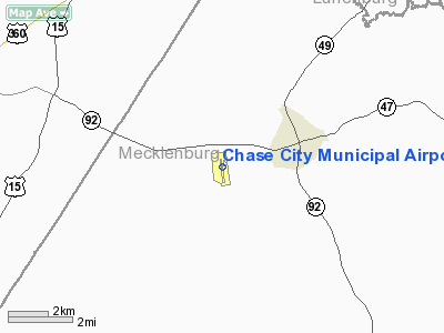
Location & QuickFacts
| FAA Information Effective: | 2008-09-25 |
| Airport Identifier: | CXE |
| Airport Status: | Operational |
| Longitude/Latitude: | 078-30-05.5930W/36-47-18.0080N
-78.501554/36.788336 (Estimated) |
| Elevation: | 503 ft / 153.31 m (Surveyed) |
| Land: | 36 acres |
| From nearest city: | 2 nautical miles W of Chase City, VA |
| Location: | Mecklenburg County, VA |
| Magnetic Variation: | 09W (2005) |
Owner & Manager
| Ownership: | Publicly owned |
| Owner: | Town Of Chase City |
| Address: | 319 N Main St
Chase City, VA 23924 |
| Phone number: | 434-372-5136 |
| Manager: | R.g. Reese
TOWN MANAGER. |
| Address: | 319 N Main St
Chase City, VA 23924 |
| Phone number: | 434-372-5136 |
Airport Operations and Facilities
| Airport Use: | Open to public |
| Wind indicator: | Yes |
| Segmented Circle: | No |
| Control Tower: | No |
| Lighting Schedule: | DUSK-DAWN |
| Beacon Color: | Clear-Green (lighted land airport) |
| Landing fee charge: | No |
| Sectional chart: | Washington |
| Region: | AEA - Eastern |
| Traffic Pattern Alt: | 800 ft |
| Boundary ARTCC: | ZDC - Washington |
| Tie-in FSS: | DCA - Leesburg |
| FSS on Airport: | No |
| FSS Toll Free: | 1-800-WX-BRIEF |
| NOTAMs Facility: | DCA (NOTAM-d service avaliable) |
| Federal Agreements: | GY |
Airport Communications
Airport Services
| Bottled Oxygen: | NONE |
| Bulk Oxygen: | NONE |
Runway Information
Runway 18/36
| Dimension: | 3400 x 50 ft / 1036.3 x 15.2 m |
| Surface: | ASPH, Fair Condition |
| Weight Limit: | Single wheel: 12500 lbs. |
| Edge Lights: | Low |
| |
Runway 18 |
Runway 36 |
| Longitude: | 078-30-07.5280W | 078-30-03.6100W |
| Latitude: | 36-47-34.6960N | 36-47-01.2250N |
| Elevation: | 503.00 ft | 486.00 ft |
| Alignment: | 127 | 127 |
| Traffic Pattern: | Left | Left |
| Markings: | Non-precision instrument, Fair Condition | Non-precision instrument, Fair Condition |
| VASI: | tri-color on left side
TRIL OTS INDEFLY. | tri-color on left side
TRIL OTS INDEFLY. |
| Obstruction: | 23 ft road, 200.0 ft from runway, 108 ft right of centerline
+6' GND; 115'R OF RY END; +20' ROAD 100' FM THR, 125'R. | 24 ft tree, 320.0 ft from runway, 10 ft right of centerline, 5:1 slope to clear
RISING GROUND 150 FT FM END OF RY. |
|
Radio Navigation Aids
| ID |
Type |
Name |
Ch |
Freq |
Var |
Dist |
| MBV | NDB | Mecklenburg/dcmsnd | | 356.00 | 08W | 22.2 nm |
| AEA | NDB | Jones | | 373.00 | 09W | 24.0 nm |
| HXO | NDB | Huntsboro | | 271.00 | 07W | 29.9 nm |
| BKT | NDB | Blackstone | | 326.00 | 09W | 30.0 nm |
| FVX | NDB | Farmville | | 367.00 | 07W | 34.1 nm |
| HUR | NDB | Person | | 220.00 | 08W | 43.1 nm |
| RZZ | NDB | Rapids | | 407.00 | 08W | 43.6 nm |
| LY | NDB | Bojar | | 385.00 | 08W | 45.6 nm |
| PTB | NDB | Petersburg | | 284.00 | 08W | 49.0 nm |
| DAN | VOR | Danville | | 113.10 | 06W | 42.4 nm |
| SBV | VORTAC | South Boston | 041X | 110.40 | 05W | 25.6 nm |
| LVL | VORTAC | Lawrenceville | 076X | 112.90 | 08W | 28.9 nm |
| LYH | VORTAC | Lynchburg | 029X | 109.20 | 05W | 45.1 nm |
Remarks
Images and information placed above are from
http://www.airport-data.com/airport/CXE/
We thank them for the data!
| General Info
|
| Country |
United States
|
| State |
VIRGINIA
|
| FAA ID |
CXE
|
| Latitude |
36-47-18.008N
|
| Longitude |
078-30-05.593W
|
| Elevation |
503 feet
|
| Near City |
CHASE CITY
|
We don't guarantee the information is fresh and accurate. The data may
be wrong or outdated.
For more up-to-date information please refer to other sources.
|
|


