 |
|
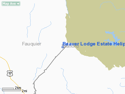
Beaver Lodge Estate Heliport |
Location & QuickFacts
| FAA Information Effective: | 2008-09-25 |
| Airport Identifier: | 3VA6 |
| Airport Status: | Operational |
| Longitude/Latitude: | 077-34-24.9520W/38-31-10.4450N
-77.573598/38.519568 (Estimated) |
| Elevation: | 340 ft / 103.63 m (Estimated) |
| Land: | 6 acres |
| From nearest city: | 2 nautical miles E of Somerville, VA |
| Location: | Fauquier County, VA |
| Magnetic Variation: | 09W (1985) |
Owner & Manager
| Ownership: | Privately owned |
| Owner: | Neil V. Huning |
| Address: | 126 Beaver Lodge Estate
Stafford, VA 22554-3423 |
| Phone number: | 703-752-9700 |
| Manager: | Neil V. Huning |
| Address: | 126 Beaver Lodge Estate
Stafford, VA 22554-3423 |
| Phone number: | 703-752-4570 |
Airport Operations and Facilities
| Airport Use: | Private
PERSONAL USE. |
| Wind indicator: | Yes |
| Segmented Circle: | No |
| Control Tower: | No |
| Lighting Schedule: | DUSK-DAWN |
| Sectional chart: | Washington |
| Region: | AEA - Eastern |
| Boundary ARTCC: | ZDC - Washington |
| Tie-in FSS: | DCA - Leesburg |
| FSS on Airport: | No |
| FSS Toll Free: | 1-800-WX-BRIEF |
Runway Information
Helipad H1
| Dimension: | 200 x 12 ft / 61.0 x 3.7 m |
| Surface: | GRVL, |
| |
Runway H1 |
Runway |
| Traffic Pattern: | Left | Left |
|
Radio Navigation Aids
| ID |
Type |
Name |
Ch |
Freq |
Var |
Dist |
| CJR | NDB | Culpeper | | 252.00 | 09W | 13.4 nm |
| MSQ | NDB | Nailr | | 351.00 | 10W | 16.1 nm |
| EZF | NDB | Shannon | | 237.00 | 10W | 16.3 nm |
| APH | NDB | A P Hill | | 396.00 | 10W | 28.5 nm |
| GDX | NDB | Goodwin Lake | | 227.00 | 08W | 28.8 nm |
| DC | NDB | Oxonn | | 332.00 | 11W | 29.6 nm |
| VKX | NDB | Potomac | | 241.00 | 10W | 32.1 nm |
| GTN | NDB | Georgetown | | 323.00 | 09W | 32.4 nm |
| IQK | NDB | Louisa | | 382.00 | 09W | 32.9 nm |
| TZ | NDB | Cogan | | 364.00 | 10W | 41.2 nm |
| GAI | NDB | Gaithersburg | | 385.00 | 09W | 43.5 nm |
| LUA | NDB | Caverns | | 245.00 | 09W | 43.5 nm |
| LJK | NDB | Ashey | | 280.00 | 09W | 45.1 nm |
| DCA | VOR/DME | Washington | 047X | 111.00 | 09W | 32.4 nm |
| BRV | VORTAC | Brooke | 092X | 114.50 | 09W | 15.1 nm |
| CSN | VORTAC | Casanova | 110X | 116.30 | 06W | 15.5 nm |
| AML | VORTAC | Armel | 082X | 113.50 | 08W | 25.4 nm |
| LDN | VORTAC | Linden | 090X | 114.30 | 06W | 35.8 nm |
| ADW | VORTAC | Andrews | 078X | 113.10 | 10W | 37.4 nm |
| OTT | VORTAC | Nottingham | 084X | 113.70 | 10W | 40.5 nm |
| GVE | VORTAC | Gordonsville | 103X | 115.60 | 06W | 40.9 nm |
| DCA | VOT | Washington National | | 109.40 | | 32.0 nm |
| ADW | VOT | Andrews Afb | | 109.60 | | 36.3 nm |
Images and information placed above are from
http://www.airport-data.com/airport/3VA6/
We thank them for the data!
| General Info
|
| Country |
United States
|
| State |
VIRGINIA
|
| FAA ID |
3VA6
|
| Latitude |
38-31-10.445N
|
| Longitude |
077-34-24.952W
|
| Elevation |
340 feet
|
| Near City |
SOMERVILLE
|
We don't guarantee the information is fresh and accurate. The data may
be wrong or outdated.
For more up-to-date information please refer to other sources.
|
|


