 |
|
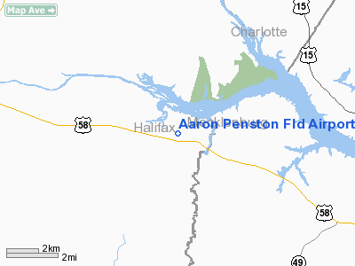
Aaron Penston Fld Airport |
Location & QuickFacts
| FAA Information Effective: | 2008-09-25 |
| Airport Identifier: | 1VA7 |
| Airport Status: | Operational |
| Longitude/Latitude: | 078-43-21.0180W/36-39-57.5010N
-78.722505/36.665972 (Estimated) |
| Elevation: | 413 ft / 125.88 m (Surveyed) |
| Land: | 5 acres |
| From nearest city: | 9 nautical miles SE of South Boston, VA |
| Location: | Halifax County, VA |
| Magnetic Variation: | 07W (1985) |
Owner & Manager
| Ownership: | Privately owned |
| Owner: | W. Garland Smith |
| Address: | Rt 3, Box 133-a
Virgilina, VA 24598 |
| Phone number: | 804-575-5180 |
| Manager: | W. Garland Smith |
| Address: | Rt 3, Box 133-a
Virgilina, VA 24598 |
| Phone number: | 804-575-5180 |
Airport Operations and Facilities
| Airport Use: | Private |
| Wind indicator: | Yes |
| Segmented Circle: | No |
| Control Tower: | No |
| Landing fee charge: | No |
| Sectional chart: | Washington |
| Region: | AEA - Eastern |
| Boundary ARTCC: | ZDC - Washington |
| Tie-in FSS: | DCA - Leesburg |
| FSS on Airport: | No |
| FSS Toll Free: | 1-800-WX-BRIEF |
Airport Services
| Airframe Repair: | NONE |
| Power Plant Repair: | NONE |
Runway Information
Runway 01/19
| Dimension: | 1800 x 110 ft / 548.6 x 33.5 m |
| Surface: | TURF, |
| |
Runway 01 |
Runway 19 |
| Traffic Pattern: | Left | Left |
| Displaced threshold: | 200.00 ft | 0.00 ft |
| Obstruction: | 25 ft pline, 125.0 ft from runway | |
|
Radio Navigation Aids
| ID |
Type |
Name |
Ch |
Freq |
Var |
Dist |
| HXO | NDB | Huntsboro | | 271.00 | 07W | 22.5 nm |
| HUR | NDB | Person | | 220.00 | 08W | 30.9 nm |
| MBV | NDB | Mecklenburg/dcmsnd | | 356.00 | 08W | 32.2 nm |
| AEA | NDB | Jones | | 373.00 | 09W | 32.4 nm |
| BKT | NDB | Blackstone | | 326.00 | 09W | 42.8 nm |
| FVX | NDB | Farmville | | 367.00 | 07W | 43.5 nm |
| LY | NDB | Bojar | | 385.00 | 08W | 43.7 nm |
| LE | NDB | Leevy | | 350.00 | 07W | 44.4 nm |
| DAN | VOR | Danville | | 113.10 | 06W | 30.2 nm |
| SBV | VORTAC | South Boston | 041X | 110.40 | 05W | 14.1 nm |
| LVL | VORTAC | Lawrenceville | 076X | 112.90 | 08W | 40.5 nm |
| LYH | VORTAC | Lynchburg | 029X | 109.20 | 05W | 43.1 nm |
| RDU | VORTAC | Raleigh/durham | 119X | 117.20 | 04W | 47.8 nm |
Remarks
Images and information placed above are from
http://www.airport-data.com/airport/1VA7/
We thank them for the data!
| General Info
|
| Country |
United States
|
| State |
VIRGINIA
|
| FAA ID |
1VA7
|
| Latitude |
36-39-57.501N
|
| Longitude |
078-43-21.018W
|
| Elevation |
413 feet
|
| Near City |
SOUTH BOSTON
|
We don't guarantee the information is fresh and accurate. The data may
be wrong or outdated.
For more up-to-date information please refer to other sources.
|
|


