 |
|
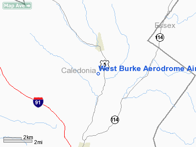
West Burke Aerodrome Airport |
Location & QuickFacts
| FAA Information Effective: | 2008-09-25 |
| Airport Identifier: | VT56 |
| Airport Status: | Operational |
| Longitude/Latitude: | 071-58-51.3440W/44-36-47.1920N
-71.980929/44.613109 (Estimated) |
| Elevation: | 1285 ft / 391.67 m (Estimated) |
| Land: | 0 acres |
| From nearest city: | 2 nautical miles SW of West Burke, VT |
| Location: | Caledonia County, VT |
| Magnetic Variation: | 16W (1985) |
Owner & Manager
| Ownership: | Privately owned |
| Owner: | Philip C. Hax |
| Address: | 1874 Gaskell Hill Rd., Po Box 182
West Burke, VT 05871 |
| Phone number: | 802-467-8351 |
| Manager: | Philip C. Hax |
| Address: | 1874 Gaskell Hill Rd, Po Box 182
West Burke, VT 05871 |
| Phone number: | 802-467-8351
802-467-8351 (VT) |
Airport Operations and Facilities
| Airport Use: | Private
PERSONAL USE. |
| Wind indicator: | Yes |
| Segmented Circle: | No |
| Control Tower: | No |
| Sectional chart: | Montreal |
| Region: | ANE - New England |
| Boundary ARTCC: | ZBW - Boston |
| Tie-in FSS: | BTV - Burlington |
| FSS on Airport: | No |
| FSS Toll Free: | 1-800-WX-BRIEF |
Runway Information
Runway 01/19
| Dimension: | 1000 x 60 ft / 304.8 x 18.3 m |
| Surface: | TURF, |
| |
Runway 01 |
Runway 19 |
| Traffic Pattern: | Right | Left |
|
Radio Navigation Aids
| ID |
Type |
Name |
Ch |
Freq |
Var |
Dist |
| HIE | FAN MARKER | Witey | | | 17W | 23.2 nm |
| MPV | FAN MARKER | Brook | | | | 33.9 nm |
| LLX | NDB | Lyndonville | | 353.00 | 16W | 6.9 nm |
| GMA | NDB | Mahn | | 386.00 | 17W | 19.7 nm |
| EFK | NDB | Newport | | 242.00 | 17W | 22.1 nm |
| JRV | NDB | Morrisville/stowe | | 375.00 | 16W | 26.0 nm |
| VKN | NDB | Mount Mansfield | | 268.00 | 16W | 33.4 nm |
| HXK | NDB | Hornebrook | | 281.00 | 17W | 34.4 nm |
| BML | VOR/DME | Berlin | 041X | 110.40 | 17W | 34.0 nm |
| MPV | VOR/DME | Montpelier | 045X | 110.80 | 16W | 37.6 nm |
| YSC | VORTAC | Sherbrooke | 079X | 113.20 | 17W | 43.1 nm |
Remarks
- OWNER DESIRES ARPT NOT TO BE CHARTED.
- PRVDD DALGT VFR OPNS.
Images and information placed above are from
http://www.airport-data.com/airport/VT56/
We thank them for the data!
| General Info
|
| Country |
United States
|
| State |
VERMONT
|
| FAA ID |
VT56
|
| Latitude |
44-36-47.192N
|
| Longitude |
071-58-51.344W
|
| Elevation |
1285 feet
|
| Near City |
WEST BURKE
|
We don't guarantee the information is fresh and accurate. The data may
be wrong or outdated.
For more up-to-date information please refer to other sources.
|
|


