 |
|
Location & QuickFacts
| FAA Information Effective: | 2008-09-25 |
| Airport Identifier: | VT16 |
| Airport Status: | Operational |
| Longitude/Latitude: | 072-59-34.3870W/43-39-35.2420N
-72.992885/43.659789 (Estimated) |
| Elevation: | 715 ft / 217.93 m (Estimated) |
| Land: | 0 acres |
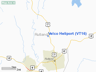
| From nearest city: | 3 nautical miles NW of Rutland, VT |
| Location: | Rutland County, VT |
| Magnetic Variation: | 15W (1985) |
Owner & Manager
| Ownership: | Privately owned |
| Owner: | Vermont Electric Power Co Inc |
| Address: | Box 548
05702-0548 |
| Phone number: | 802-773-9161 |
| Manager: | Edwin Congdon, Mgr Xmsn Svcs |
| Address: | Box 548
05702-0548 |
| Phone number: | 802-773-9161 |
Airport Operations and Facilities
| Airport Use: | Private |
| Wind indicator: | Yes |
| Segmented Circle: | No |
| Control Tower: | No |
| Sectional chart: | New York |
| Region: | ANE - New England |
| Boundary ARTCC: | ZBW - Boston |
| Tie-in FSS: | BTV - Burlington |
| FSS Toll Free: | 1-800-WX-BRIEF |
Runway Information
Helipad H1
| Dimension: | 195 x 125 ft / 59.4 x 38.1 m |
| Surface: | ASPH, |
| |
Runway H1 |
Runway |
| Traffic Pattern: | Left | Left |
|
Radio Navigation Aids
| ID |
Type |
Name |
Ch |
Freq |
Var |
Dist |
| R | FAN MARKER | Chitt | | | 14W | 1.6 nm |
| MPV | FAN MARKER | Brook | | | | 42.3 nm |
| DYO | NDB | Smuto | | 221.00 | 15W | 3.2 nm |
| IVV | NDB | White River | | 379.00 | 16W | 23.7 nm |
| SXD | NDB | Springfield | | 265.00 | 15W | 29.4 nm |
| CNH | NDB | Claremont | | 233.00 | 16W | 32.2 nm |
| LAH | NDB | Hanover | | 276.00 | 15W | 35.5 nm |
| VWD | NDB | Mount Snow | | 224.00 | 15W | 44.4 nm |
| VKN | NDB | Mount Mansfield | | 268.00 | 16W | 45.6 nm |
| RUT | VOR/DME | Rutland | 47X | 111.00 | 15W | 8.2 nm |
| LEB | VOR/DME | Lebanon | 084X | 113.70 | 15W | 33.8 nm |
| MPV | VOR/DME | Montpelier | 045X | 110.80 | 16W | 34.8 nm |
| CAM | VOR/DME | Cambridge | 097X | 115.00 | 14W | 42.8 nm |
| GFL | VORTAC | Glens Falls | 039X | 110.20 | 14W | 33.1 nm |
| BTV | VORTAC | Burlington | 122X | 117.50 | 15W | 45.1 nm |
| BTV | VOT | Burlington Intl | | 109.00 | | 49.0 nm |
Remarks
Images and information placed above are from
http://www.airport-data.com/airport/VT16/
We thank them for the data!
| General Info
|
| Country |
United States
|
| State |
VERMONT
|
| FAA ID |
VT16
|
| Latitude |
43-39-35.242N
|
| Longitude |
072-59-34.387W
|
| Elevation |
715 feet
|
| Near City |
RUTLAND
|
We don't guarantee the information is fresh and accurate. The data may
be wrong or outdated.
For more up-to-date information please refer to other sources.
|
|


