 |
|
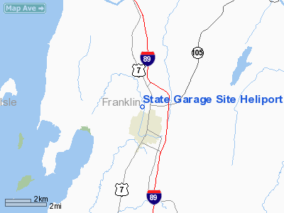
State Garage Site Heliport |
Location & QuickFacts
| FAA Information Effective: | 2008-09-25 |
| Airport Identifier: | VT21 |
| Airport Status: | Operational |
| Longitude/Latitude: | 073-05-17.4890W/44-49-35.1630N
-73.088191/44.826434 (Estimated) |
| Elevation: | 380 ft / 115.82 m (Estimated) |
| Land: | 0 acres |
| From nearest city: | 1 nautical miles N of St Albans, VT |
| Location: | Franklin County, VT |
| Magnetic Variation: | 16W (1985) |
Owner & Manager
| Ownership: | Publicly owned
STATE OWNED. |
| Owner: | Vt National Guard |
| Address: | Camp Johnson
Winooski, VT 05446-3004 |
| Phone number: | 802-864-1400
EXT 1406 |
| Manager: | Lt Col Thomas J. Shailor |
| Address: | Bldg 890 Airport Rd So
S Burlington, VT 05403-6097 |
| Phone number: | 802-864-1400
EXT 1406 |
Airport Operations and Facilities
| Airport Use: | Private |
| Wind indicator: | No |
| Segmented Circle: | No |
| Control Tower: | No |
| Landing fee charge: | No |
| Sectional chart: | New York |
| Region: | ANE - New England |
| Boundary ARTCC: | ZBW - Boston |
| Tie-in FSS: | BTV - Burlington |
| FSS on Airport: | No |
| FSS Toll Free: | 1-800-WX-BRIEF |
Airport Services
| Airframe Repair: | NONE |
| Power Plant Repair: | NONE |
Runway Information
Helipad H1
| Dimension: | 100 x 100 ft / 30.5 x 30.5 m |
| Surface: | TURF, |
| |
Runway H1 |
Runway |
| Traffic Pattern: | Left | Left |
|
Radio Navigation Aids
| ID |
Type |
Name |
Ch |
Freq |
Var |
Dist |
| MPV | FAN MARKER | Brook | | | | 35.6 nm |
| JRV | NDB | Morrisville/stowe | | 375.00 | 16W | 26.1 nm |
| VKN | NDB | Mount Mansfield | | 268.00 | 16W | 31.4 nm |
| EFK | NDB | Newport | | 242.00 | 17W | 39.5 nm |
| JL | NDB | Cote St Luc | | 370.00 | 16W | 45.3 nm |
| H | NDB | Hotel | | 407.00 | 16W | 45.7 nm |
| U | NDB | Uniform | | 201.00 | 15W | 47.6 nm |
| NDB | Mike | | 348.00 | 15W | 48.3 nm |
| LLX | NDB | Lyndonville | | 353.00 | 16W | 49.2 nm |
| L | NDB | Lima | | 284.00 | 16W | 49.3 nm |
| UL | NDB | Montreal | | 248.00 | 16W | 49.9 nm |
| PLB | VORTAC | Plattsburgh | 116X | 116.90 | 15W | 20.4 nm |
| BTV | VORTAC | Burlington | 122X | 117.50 | 15W | 26.1 nm |
| YJN | VORTAC | St Jean | 105X | 115.80 | 16W | 27.6 nm |
| BTV | VOT | Burlington Intl | | 109.00 | | 21.8 nm |
Remarks
Images and information placed above are from
http://www.airport-data.com/airport/VT21/
We thank them for the data!
| General Info
|
| Country |
United States
|
| State |
VERMONT
|
| FAA ID |
VT21
|
| Latitude |
44-49-35.163N
|
| Longitude |
073-05-17.489W
|
| Elevation |
380 feet
|
| Near City |
ST ALBANS
|
We don't guarantee the information is fresh and accurate. The data may
be wrong or outdated.
For more up-to-date information please refer to other sources.
|
|


