|
|
|
 |
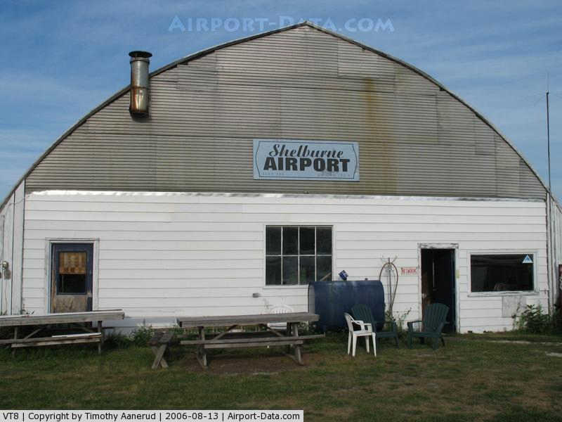
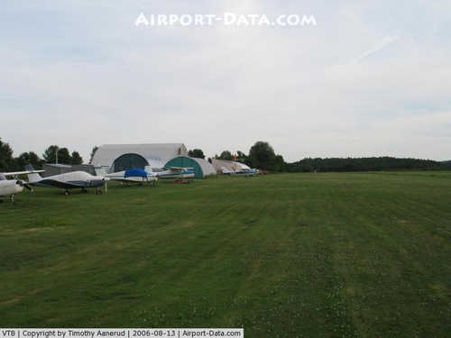
(Click on the photo to enlarge) |
|
 |
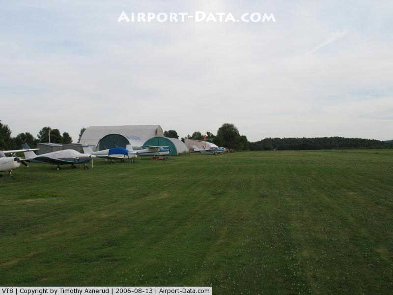
(Click on the photo to enlarge) |
Location & QuickFacts
| FAA Information Effective: | 2008-09-25 |
| Airport Identifier: | VT8 |
| Airport Status: | Operational |
| Longitude/Latitude: | 073-14-30.4520W/44-21-38.1840N
-73.241792/44.360607 (Estimated) |
| Elevation: | 325 ft / 99.06 m (Estimated) |
| Land: | 23 acres |
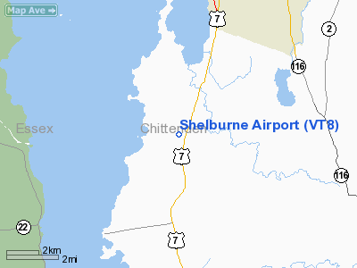
| From nearest city: | 2 nautical miles S of Shelburne, VT |
| Location: | Chittenden County, VT |
| Magnetic Variation: | 15W (1985) |
Owner & Manager
| Ownership: | Privately owned |
| Owner: | Ray C. Magee |
| Address: | 144 Airpark Rd.
Shelburne, VT 05482 |
| Phone number: | 802-985-2100 |
| Manager: | Ray C. Magee |
| Address: | 144 Airpark Rd.
Shelburne, VT 05482 |
| Phone number: | 802-985-2100 |
Airport Operations and Facilities
| Airport Use: | Open to public |
| Wind indicator: | Yes |
| Segmented Circle: | No |
| Control Tower: | No |
| Landing fee charge: | No |
| Sectional chart: | Montreal |
| Region: | ANE - New England |
| Boundary ARTCC: | ZBW - Boston |
| Tie-in FSS: | BTV - Burlington |
| FSS on Airport: | No |
| FSS Toll Free: | 1-800-WX-BRIEF |
| NOTAMs Facility: | BTV (NOTAM-d service avaliable) |
Airport Communications
| CTAF: | 122.800 |
| Unicom: | 122.800 |
Airport Services
| Fuel available: | MOGAS |
| Airframe Repair: | MAJOR |
| Power Plant Repair: | MAJOR |
Runway Information
Runway 01/19
| Dimension: | 2250 x 60 ft / 685.8 x 18.3 m
RY 01/19 REMESURED. |
| Surface: | TURF, |
| |
Runway 01 |
Runway 19 |
| Traffic Pattern: | Left | Left |
| Markings: | None, | None, |
| Obstruction: | 45 ft trees, 363.0 ft from runway, 153 ft right of centerline, 8:1 slope to clear | 55 ft trees, 381.0 ft from runway, 319 ft right of centerline, 7:1 slope to clear |
|
Radio Navigation Aids
| ID |
Type |
Name |
Ch |
Freq |
Var |
Dist |
| MPV | FAN MARKER | Brook | | | | 25.3 nm |
| R | FAN MARKER | Chitt | | | 14W | 45.0 nm |
| VKN | NDB | Mount Mansfield | | 268.00 | 16W | 23.6 nm |
| JRV | NDB | Morrisville/stowe | | 375.00 | 16W | 31.0 nm |
| DYO | NDB | Smuto | | 221.00 | 15W | 41.2 nm |
| MPV | VOR/DME | Montpelier | 045X | 110.80 | 16W | 37.9 nm |
| SLK | VOR/DME | Saranac Lake | 029X | 109.20 | 14W | 41.4 nm |
| BTV | VORTAC | Burlington | 122X | 117.50 | 15W | 3.4 nm |
| PLB | VORTAC | Plattsburgh | 116X | 116.90 | 15W | 22.9 nm |
| BTV | VOT | Burlington Intl | | 109.00 | | 7.5 nm |
Remarks
- HOURS OF OPERATION DAYLIGHT HOURS.
- PRVDD ALL OPNS BE RESTRICTED TO SMALL ACFT ONLY; VFR OPNS; AND ALL USERS ARE NOTIFIED AND COMPLY WITH THESE CONDITIONS.
Images and information placed above are from
http://www.airport-data.com/airport/VT8/
We thank them for the data!
| General Info
| |
| Country |
United States
|
| State |
VERMONT
|
| FAA ID |
VT8
|
| Latitude |
44-21-38.184N
|
| Longitude |
073-14-30.452W
|
| Elevation |
325 feet
|
| Near City |
SHELBURNE
|
We don't guarantee the information is fresh and accurate. The data may
be wrong or outdated.
For more up-to-date information please refer to other sources.
|
|