 |
|
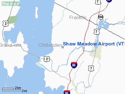
Location & QuickFacts
| FAA Information Effective: | 2008-09-25 |
| Airport Identifier: | VT52 |
| Airport Status: | Operational |
| Longitude/Latitude: | 073-11-15.4730W/44-38-36.1670N
-73.187631/44.643380 (Estimated) |
| Elevation: | 230 ft / 70.10 m (Estimated) |
| Land: | 8 acres |
| From nearest city: | 4 nautical miles W of Milton, VT |
| Location: | Chittenden County, VT |
| Magnetic Variation: | 16W (1990) |
Owner & Manager
| Ownership: | Privately owned |
| Owner: | Adam L. Alpert |
| Address: | 70 Lionheart Dr
Milton, VT 05468 |
| Phone number: | 802-893-2480 |
| Manager: | Adam L. Alpert |
| Address: | 70 Lionheart Dr
Milton, VT 05468 |
| Phone number: | 802-655-4040 |
Airport Operations and Facilities
| Airport Use: | Private |
| Wind indicator: | Yes |
| Segmented Circle: | Yes |
| Control Tower: | No |
| Sectional chart: | Montreal |
| Region: | ANE - New England |
| Boundary ARTCC: | ZBW - Boston |
| Tie-in FSS: | BTV - Burlington |
| FSS on Airport: | No |
| FSS Toll Free: | 1-800-WX-BRIEF |
Runway Information
Runway 01/19
| Dimension: | 2150 x 150 ft / 655.3 x 45.7 m |
| Surface: | TURF, |
| |
Runway 01 |
Runway 19 |
| Traffic Pattern: | Left | Right |
| Displaced threshold: | 300.00 ft
DSPLCD THLD MKD WITH ORANGE CONES. | 50.00 ft |
|
Radio Navigation Aids
| ID |
Type |
Name |
Ch |
Freq |
Var |
Dist |
| MPV | FAN MARKER | Brook | | | | 29.9 nm |
| JRV | NDB | Morrisville/stowe | | 375.00 | 16W | 26.0 nm |
| VKN | NDB | Mount Mansfield | | 268.00 | 16W | 26.2 nm |
| EFK | NDB | Newport | | 242.00 | 17W | 46.9 nm |
| MPV | VOR/DME | Montpelier | 045X | 110.80 | 16W | 46.2 nm |
| SLK | VOR/DME | Saranac Lake | 029X | 109.20 | 14W | 46.3 nm |
| PLB | VORTAC | Plattsburgh | 116X | 116.90 | 15W | 14.5 nm |
| BTV | VORTAC | Burlington | 122X | 117.50 | 15W | 14.8 nm |
| YJN | VORTAC | St Jean | 105X | 115.80 | 16W | 37.2 nm |
| BTV | VOT | Burlington Intl | | 109.00 | | 10.7 nm |
Remarks
- PRVDD OPNS ARE CONDUCTED IN ACCORDANCE WITH FAR 91.215, DAYTIME VFR.
Images and information placed above are from
http://www.airport-data.com/airport/VT52/
We thank them for the data!
| General Info
|
| Country |
United States
|
| State |
VERMONT
|
| FAA ID |
VT52
|
| Latitude |
44-38-36.167N
|
| Longitude |
073-11-15.473W
|
| Elevation |
230 feet
|
| Near City |
MILTON
|
We don't guarantee the information is fresh and accurate. The data may
be wrong or outdated.
For more up-to-date information please refer to other sources.
|
|


