|
|
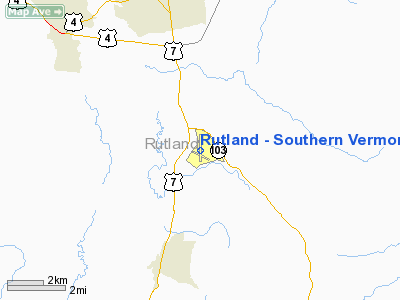
Rutland - Southern Vermont Regional Airport |
Coordinates: 43°31′48″N 072°56′59″W / 43.53°N 72.94972°W / 43.53; -72.94972
| Rutland Southern Vermont Regional Airport |
 |
| IATA: RUT – ICAO: KRUT – FAA LID: RUT |
| Summary |
| Airport type |
Public |
| Owner |
State of Vermont |
| Serves |
Rutland, Vermont |
| Location |
North Clarendon |
| Elevation AMSL |
787 ft / 240 m |
| Website |
www.FlyRutlandVT.com |
| Runways |
| Direction |
Length |
Surface |
| ft |
m |
| 1/19 |
5,000 |
1,524 |
Asphalt |
| 13/31 |
3,170 |
966 |
Asphalt |
| Statistics (2007) |
| Aircraft operations |
22,735 |
| Based aircraft |
57 |
| Source: Federal Aviation Administration |
Rutland Southern Vermont Regional Airport (IATA: RUT, ICAO: KRUT, FAA LID: RUT), formerly known as Rutland State Airport, is a state-owned public-use airport located in North Clarendon, five miles (8 km) south of the central business district of Rutland, a city in Rutland County, Vermont, United States. Scheduled commercial service is subsidized by the Essential Air Service and provided by Cape Air, with three flights daily on nine-passenger Cessna 402 aircraft to Boston with typical flight times of 40 minutes.
Rutland-Southern Vermont is a FAA Part 139 certificated airport. As per Federal Aviation Administration records, the airport had 2,689 passenger boardings (enplanements) in calendar year 2004. In the FAA's National Plan of Integrated Airport Systems (2007-2011) it was a categorized as a commercial service airport, which requires at least 2,500 passenger boardings per year.
Total air cargo carried in 2006 was approximately 520,000 pounds with 1,560 cargo operations via FedEx and UPS.
Rutland-Southern Vermont Regional Airport is the closest commercial service airport to the mountain resorts of Killington, Pico, Okemo, Stratton, Bromley, Magic Mountain, Bear Creek Mountain, and Mount Snow. In addition, Suicide Six and Ascutney Mountain Resorts are included in RSVRA's airport service area. Name change
Legislation was introduced into the Vermont Senate in January 2007 to change the official name of the airport to Rutland–Southern Vermont Regional Airport. The state agency of transportation, meanwhile, had plans to change the name to Rutland/Southwest Vermont Regional Airport. This provoked some opposition from the town of Bennington on the grounds that the William H. Morse State Airport (located in the town), is currently known as "Southwest Vermont's Airport". The agency indicated that it intended to go ahead with the name change anyway, claiming that Bennington's opposition came too late in the process. However, the agency changed the name to Rutland Southern Vermont Regional Airport on August 15, 2007.
Facilities and aircraft
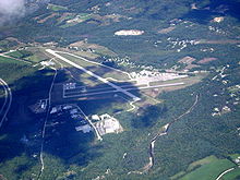
Rutland Southern Vermont Regional Airport covers an area of 345 acres (140 ha) which contains two asphalt paved runways: 1/19 measuring 5,000 x 100 ft (1,524 x 30 m) and 13/31 measuring 3,170 x 75 ft (966 x 23 m).
For the 12-month period ending May 31, 2008, the airport had 42,735 aircraft operations, an average of 62 per day: 71% general aviation, 20% air taxi, 5% scheduled commercial and 4% military. There are 57 aircraft based at this airport: 88% single-engine, 5% multi-engine, 4% jet, 2% helicopters and 2% ultralight.
Currently, the Rutland Southern Vermont Regional Airport Technical Advisory Committee is proposing a 1,000 feet (300 m) runway extension to alleviate the constraints posed by the current main runway length and the limited road access to the region. In its current configuration, the main runway is severely limiting to charters, business jets, and 50+ passenger regional jets.Part 91 Subpart K, imposed by the FAA on fractional jet operators in 2005 has reduced runway planning performance by 40 percent.
Airlines and destinations
| Airlines |
Destinations |
| Cape Air |
Boston |
The above content comes from Wikipedia and is published under free licenses – click here to read more.
|
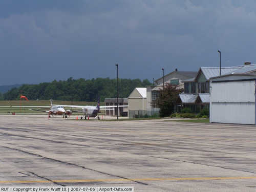 |
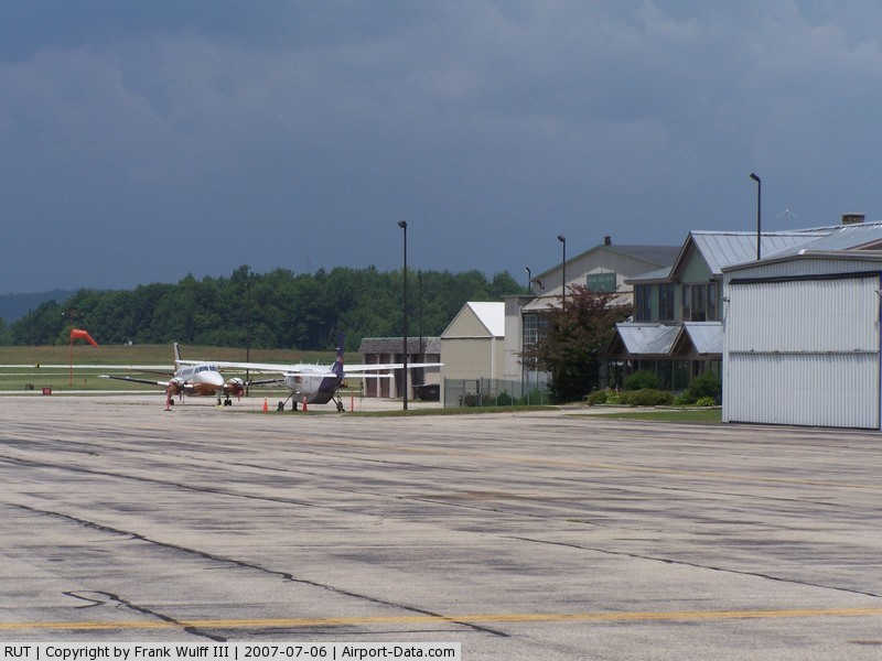
(Click on the photo to enlarge) |
Location & QuickFacts
| FAA Information Effective: | 2008-09-25 |
| Airport Identifier: | RUT |
| Airport Status: | Operational |
| Longitude/Latitude: | 072-56-58.6140W/43-31-47.6650N
-72.949615/43.529907 (Estimated) |
| Elevation: | 787 ft / 239.88 m (Surveyed) |
| Land: | 345 acres |
| From nearest city: | 5 nautical miles S of Rutland, VT |
| Location: | Rutland County, VT |
| Magnetic Variation: | 15W (1995) |
Owner & Manager
| Ownership: | Publicly owned |
| Owner: | State Of Vermont |
| Address: | Vt Agency Of Trans., Ops Division, One National Life Drive
Montpelier, VT 05633-5001 |
| Phone number: | 802-828-2833 |
| Manager: | Thomas Trudeau |
| Address: | 1002 Airport Rd, Terminal Bldg
North Clarendon, VT 05759 |
| Phone number: | 802-786-8881 |
Airport Operations and Facilities
| Airport Use: | Open to public |
| Wind indicator: | Yes |
| Segmented Circle: | Yes |
| Control Tower: | No |
| Lighting Schedule: | RDO-CTL
ACTVT MIRL RYS 01/19 & 13/31; ODALS RY 19 & REILS RYS 13 & 19; PAPI RY 13 - CTAF. LOW INTST LIGHTING NOT AVBL DAWN - DUSK. |
| Beacon Color: | Clear-Green (lighted land airport) |
| Landing fee charge: | Yes
LNDG/PARKING FEES MAY APPLY FOR NON-BASED ACFT. |
| Sectional chart: | New York |
| Region: | ANE - New England |
| Traffic Pattern Alt: | 1000 ft |
| Boundary ARTCC: | ZBW - Boston |
| Tie-in FSS: | BTV - Burlington |
| FSS on Airport: | No |
| FSS Toll Free: | 1-800-WX-BRIEF |
| NOTAMs Facility: | RUT (NOTAM-d service avaliable) |
| Certification type/date: | IV A U 11/200 |
| Federal Agreements: | NGY3 |
Airport Communications
| CTAF: | 122.800 |
| Unicom: | 122.800 |
Airport Services
| Fuel available: | 100LLA |
| Airframe Repair: | MAJOR |
| Power Plant Repair: | MAJOR |
| Bottled Oxygen: | NONE |
| Bulk Oxygen: | NONE |
Runway Information
Runway 01/19
| Dimension: | 5000 x 100 ft / 1524.0 x 30.5 m |
| Surface: | ASPH, Good Condition |
| Surface Treatment: | Saw-cut or plastic Grooved |
| Weight Limit: | Single wheel: 40000 lbs.
Dual wheel: 68000 lbs. |
| Edge Lights: | Medium |
| |
Runway 01 |
Runway 19 |
| Longitude: | 072-56-58.1320W | 072-56-59.9100W |
| Latitude: | 43-31-29.5560N | 43-32-18.9200N |
| Elevation: | 782.00 ft | 776.00 ft |
| Alignment: | 127 | 127 |
| ILS Type: | | LOC/DME
|
| Traffic Pattern: | Left | Right |
| Markings: | Non-precision instrument, Good Condition | Non-precision instrument, Good Condition |
| Crossing Height: | 0.00 ft | 50.00 ft |
| VASI: | pulsating/steady burning on right side | 4-box on left side |
| Visual Glide Angle: | 3.50° | 3.50° |
| Approach lights: | | ODALS |
| Runway End Identifier: | | Yes |
| Obstruction: | 135 ft hill, 4800.0 ft from runway, 34:1 slope to clear | , 50:1 slope to clear |
|
Runway 13/31
| Dimension: | 3170 x 75 ft / 966.2 x 22.9 m |
| Surface: | ASPH, Good Condition |
| Weight Limit: | Single wheel: 30000 lbs. |
| Edge Lights: | Medium |
| |
Runway 13 |
Runway 31 |
| Longitude: | 072-57-16.8510W | 072-56-39.0930W |
| Latitude: | 43-31-44.7990N | 43-31-29.7950N |
| Elevation: | 782.00 ft | 783.00 ft |
| Alignment: | 119 | 127 |
| Traffic Pattern: | Left | Left |
| Markings: | Basic, Good Condition | Basic, Good Condition |
| Crossing Height: | 34.00 ft | 0.00 ft |
| VASI: | 2-light PAPI on left side | |
| Visual Glide Angle: | 3.75° | 0.00° |
| Runway End Identifier: | Yes | |
| Obstruction: | 16 ft road, 325.0 ft from runway, 7:1 slope to clear | 20 ft trees, 600.0 ft from runway, 100 ft right of centerline, 20:1 slope to clear |
|
Radio Navigation Aids
| ID |
Type |
Name |
Ch |
Freq |
Var |
Dist |
| R | FAN MARKER | Chitt | | | 14W | 6.5 nm |
| MPV | FAN MARKER | Brook | | | | 49.2 nm |
| DYO | NDB | Smuto | | 221.00 | 15W | 10.6 nm |
| IVV | NDB | White River | | 379.00 | 16W | 21.2 nm |
| SXD | NDB | Springfield | | 265.00 | 15W | 22.3 nm |
| CNH | NDB | Claremont | | 233.00 | 16W | 27.0 nm |
| LAH | NDB | Hanover | | 276.00 | 15W | 35.2 nm |
| VWD | NDB | Mount Snow | | 224.00 | 15W | 36.4 nm |
| RUT | VOR/DME | Rutland | 47X | 111.00 | 15W | 0.2 nm |
| LEB | VOR/DME | Lebanon | 084X | 113.70 | 15W | 33.2 nm |
| CAM | VOR/DME | Cambridge | 097X | 115.00 | 14W | 36.5 nm |
| MPV | VOR/DME | Montpelier | 045X | 110.80 | 16W | 39.8 nm |
| GFL | VORTAC | Glens Falls | 039X | 110.20 | 14W | 31.0 nm |
Remarks
- ACFT WITH WING SPANS EXCEEDING 79 FT AUTHORIZED TO USE TWY A & TWY B EAST OF RY 1/19 & RY 13/31 FOR TAXIING & RYS 01 & 19 FOR TKOF AND LDG. 150 FT TURNAROUNDS AT ENDS OF RYS 01 & 19. NOISE SENSITIVE AREA SE OF ARPT CTC AMGR.
- RY CONDS MAY NOT BE MONITORED OR REPORTED WHEN THE ARPT IS UNATNDD.
- TYPE I & TYPE IV DEICING AVBL.
- CAMPING AVBL.
- EXISTED PRIOR TO 1959.
Images and information placed above are from
http://www.airport-data.com/airport/RUT/
We thank them for the data!
| General Info
|
| Country |
United States
|
| State |
VERMONT
|
| FAA ID |
RUT
|
| Latitude |
43-31-47.665N
|
| Longitude |
072-56-58.614W
|
| Elevation |
787 feet
|
| Near City |
RUTLAND
|
We don't guarantee the information is fresh and accurate. The data may
be wrong or outdated.
For more up-to-date information please refer to other sources.
|
|