 |
|
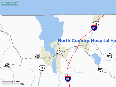
North Country Hospital Heliport |
Location & QuickFacts
| FAA Information Effective: | 2008-09-25 |
| Airport Identifier: | VT70 |
| Airport Status: | Operational |
| Longitude/Latitude: | 072-11-58.3660W/44-57-23.1670N
-72.199546/44.956435 (Estimated) |
| Elevation: | 720 ft / 219.46 m (Estimated) |
| Land: | 29 acres |
| From nearest city: | 1 nautical miles N of Newport, VT |
| Location: | Orleans County, VT |
| Magnetic Variation: | 17W (1985) |
Owner & Manager
| Ownership: | Privately owned |
| Owner: | North Country Hospital |
| Address: | Prouty Drive
Newport, VT 05855 |
| Phone number: | 802-334-7331 |
| Manager: | Bruce Hamilton, P.e. |
| Address: | Prouty Drive
Newport, VT 05855 |
| Phone number: | 802-334-3282 |
Airport Operations and Facilities
| Airport Use: | Private |
| Wind indicator: | Yes |
| Segmented Circle: | No |
| Control Tower: | No |
| Lighting Schedule: | PHONE REQ
FOR PERIMETER LIGHTS CALL 802-334-7331. |
| Landing fee charge: | No |
| Sectional chart: | Montreal |
| Region: | ANE - New England |
| Boundary ARTCC: | ZBW - Boston |
| Tie-in FSS: | BTV - Burlington |
| FSS on Airport: | No |
| FSS Toll Free: | 1-800-WX-BRIEF |
Runway Information
Helipad H1
| Dimension: | 50 x 50 ft / 15.2 x 15.2 m |
| Surface: | ASPH, Good Condition |
| |
Runway H1 |
Runway |
| Traffic Pattern: | Left | Left |
|
Radio Navigation Aids
| ID |
Type |
Name |
Ch |
Freq |
Var |
Dist |
| MPV | FAN MARKER | Brook | | | | 42.9 nm |
| HIE | FAN MARKER | Witey | | | 17W | 44.7 nm |
| EFK | NDB | Newport | | 242.00 | 17W | 1.0 nm |
| JRV | NDB | Morrisville/stowe | | 375.00 | 16W | 28.1 nm |
| LLX | NDB | Lyndonville | | 353.00 | 16W | 28.1 nm |
| SC | NDB | Sherbrooke | | 362.00 | 17W | 35.7 nm |
| VKN | NDB | Mount Mansfield | | 268.00 | 16W | 40.2 nm |
| GMA | NDB | Mahn | | 386.00 | 17W | 41.9 nm |
| HXK | NDB | Hornebrook | | 281.00 | 17W | 49.2 nm |
| BML | VOR/DME | Berlin | 041X | 110.40 | 17W | 47.4 nm |
| YSC | VORTAC | Sherbrooke | 079X | 113.20 | 17W | 27.8 nm |
Remarks
Images and information placed above are from
http://www.airport-data.com/airport/VT70/
We thank them for the data!
| General Info
|
| Country |
United States
|
| State |
VERMONT
|
| FAA ID |
VT70
|
| Latitude |
44-57-23.167N
|
| Longitude |
072-11-58.366W
|
| Elevation |
720 feet
|
| Near City |
NEWPORT
|
We don't guarantee the information is fresh and accurate. The data may
be wrong or outdated.
For more up-to-date information please refer to other sources.
|
|


