 |
|
| Middlebury State Airport |
| IATA: none – ICAO: none – FAA LID: 6B0 |
| Summary |
| Airport type |
Public |
| Owner |
State of Vermont |
| Serves |
Middlebury, Vermont |
| Elevation AMSL |
490 ft / 149 m |
| Coordinates |
43°59′05.218″N 073°05′45.416″W / 43.98478278°N 73.09594889°W / 43.98478278; -73.09594889 |
| Runways |
| Direction |
Length |
Surface |
| ft |
m |
| 01/19 |
2,500 |
762 |
Asphalt |
| Statistics (2008) |
| Aircraft operations |
16,451 |
| Based aircraft |
48 |
| Source: Federal Aviation Administration |
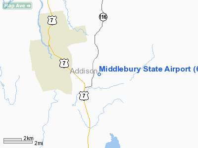
Middlebury State Airport is a public use airport in Addison County, Vermont, United States. It is owned by the State of Vermont and is located three nautical miles (5.56 km) southeast of the central business district of the Town of Middlebury.
Although most U.S. airports use the same three-letter location identifier for the FAA and IATA, this airport is assigned 6B0 by the FAA but has no designation from the IATA
Facilities and aircraft
Middlebury State Airport covers an area of 156 acres (63.1 ha) at an elevation of 490 feet (149 m) above mean sea level. It has one runway designated 01/19 with an asphalt surface measuring 2,500 by 50 feet (762 x 15 m).
For the 12-month period ending May 30, 2008, the airport had 16,451 aircraft operations, an average of 45 per day: 91% general aviation, 5% military, 4% air taxi and a few ultralights. At that time there were 48 aircraft based at this airport: 77% single-engine, 10% multi-engine, 4% jet, 4% helicopter, 2% glider and 2% ultralights.
The above content comes from Wikipedia and is published under free licenses – click here to read more.
|
 |
(Click on the photo to enlarge) |
Location & QuickFacts
| FAA Information Effective: | 2008-09-25 |
| Airport Identifier: | 6B0 |
| Airport Status: | Operational |
| Longitude/Latitude: | 073-05-45.4160W/43-59-05.2180N
-73.095949/43.984783 (Estimated) |
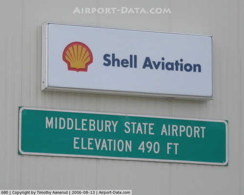
| Elevation: | 490 ft / 149.35 m (Estimated) |
| Land: | 156 acres |
| From nearest city: | 3 nautical miles SE of Middlebury, VT |
| Location: | Addison County, VT |
| Magnetic Variation: | 15W (1985) |
Owner & Manager
| Ownership: | Publicly owned |
| Owner: | State Of Vermont |
| Address: | 133 State St.
Montpelier, VT 05602 |
| Phone number: | 802-828-1083 |
| Manager: | Michael Vincent |
| Address: | 467 Airport Rd
Middlebury, VT 05753 |
| Phone number: | 802-388-2022 |
Airport Operations and Facilities
| Airport Use: | Open to public |
| Wind indicator: | Yes
ATOP HANGAR MIDFIELD. |
| Segmented Circle: | No |
| Control Tower: | No |
| Landing fee charge: | No |
| Sectional chart: | New York |
| Region: | ANE - New England |
| Boundary ARTCC: | ZBW - Boston |
| Tie-in FSS: | BTV - Burlington |
| FSS on Airport: | No |
| FSS Toll Free: | 1-800-WX-BRIEF |
| NOTAMs Facility: | BTV (NOTAM-d service avaliable) |
| Federal Agreements: | NGY |
Airport Communications
| CTAF: | 122.800 |
| Unicom: | 122.800 |
Airport Services
| Fuel available: | 100LL |
| Airframe Repair: | MAJOR |
| Power Plant Repair: | MAJOR |
| Bottled Oxygen: | NONE |
| Bulk Oxygen: | NONE |
Runway Information
Runway 01/19
| Dimension: | 2500 x 50 ft / 762.0 x 15.2 m |
| Surface: | ASPH, Good Condition |
| Weight Limit: | Single wheel: 12500 lbs. |
| |
Runway 01 |
Runway 19 |
| Traffic Pattern: | Left | Right |
| Markings: | Basic, Good Condition | Basic, Good Condition |
| Runway End Identifier: | No | No |
| Centerline Lights: | No | No |
| Touchdown Lights: | No | No |
| Obstruction: | 52 ft trees, 405.0 ft from runway, 187 ft left of centerline, 4:1 slope to clear | 76 ft trees, 2102.0 ft from runway, 451 ft left of centerline, 25:1 slope to clear |
|
Radio Navigation Aids
| ID |
Type |
Name |
Ch |
Freq |
Var |
Dist |
| R | FAN MARKER | Chitt | | | 14W | 21.6 nm |
| MPV | FAN MARKER | Brook | | | | 27.7 nm |
| DYO | NDB | Smuto | | 221.00 | 15W | 17.8 nm |
| VKN | NDB | Mount Mansfield | | 268.00 | 16W | 29.7 nm |
| IVV | NDB | White River | | 379.00 | 16W | 37.4 nm |
| JRV | NDB | Morrisville/stowe | | 375.00 | 16W | 41.9 nm |
| LAH | NDB | Hanover | | 276.00 | 15W | 43.3 nm |
| SXD | NDB | Springfield | | 265.00 | 15W | 48.4 nm |
| CNH | NDB | Claremont | | 233.00 | 16W | 48.6 nm |
| RUT | VOR/DME | Rutland | 47X | 111.00 | 15W | 28.3 nm |
| MPV | VOR/DME | Montpelier | 045X | 110.80 | 16W | 28.6 nm |
| LEB | VOR/DME | Lebanon | 084X | 113.70 | 15W | 42.4 nm |
| BTV | VORTAC | Burlington | 122X | 117.50 | 15W | 25.1 nm |
| GFL | VORTAC | Glens Falls | 039X | 110.20 | 14W | 44.7 nm |
| PLB | VORTAC | Plattsburgh | 116X | 116.90 | 15W | 45.9 nm |
| BTV | VOT | Burlington Intl | | 109.00 | | 29.1 nm |
Remarks
- HIGH HILLS EAST OF ARPT.
- RY CONDS MAY NOT BE MONITORED OR REPORTED WHEN THE ARPT IS UNATNDD.
- ULTRA-LIGHT & AGRICULTURAL ACFT ACTVTY ON & INVOF ARPT.
- RY 01/19 HAS HANGER & SEVERAL ACFT TIE DOWNS LOCATED IN TWY SAFETY AREA & OBSTRUCTION FREE ZONE; PILOTS SHOULD CAREFULLY MONITOR WING TIP CLEARANCES & USE CAUTION WHILE TAXIING ACFT.
- EXISTED PRIOR TO 1959.
Images and information placed above are from
http://www.airport-data.com/airport/6B0/
We thank them for the data!
| General Info
|
| Country |
United States
|
| State |
VERMONT
|
| FAA ID |
6B0
|
| Latitude |
43-59-05.218N
|
| Longitude |
073-05-45.416W
|
| Elevation |
490 feet
|
| Near City |
MIDDLEBURY
|
We don't guarantee the information is fresh and accurate. The data may
be wrong or outdated.
For more up-to-date information please refer to other sources.
|
|


