 |
|
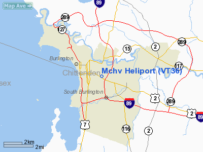
Location & QuickFacts
| FAA Information Effective: | 2008-09-25 |
| Airport Identifier: | VT36 |
| Airport Status: | Operational |
| Longitude/Latitude: | 073-11-19.4580W/44-28-24.1770N
-73.188738/44.473382 (Estimated) |
| Elevation: | 345 ft / 105.16 m (Estimated) |
| Land: | 0 acres |
| From nearest city: | 1 nautical miles E of Burlington, VT |
| Location: | Chittenden County, VT |
| Magnetic Variation: | 15W (1985) |
Owner & Manager
| Ownership: | Privately owned |
| Owner: | Fletcher Allen Health Care |
| Address: | 111 Colchester Ave
Burlington, VT 05401 |
| Phone number: | 802-847-0000 |
| Manager: | Ashley Bond
PROPERTY MANAGER |
| Address: | 1 S. Prospect St.
Burlington, VT 05401 |
| Phone number: | 802-847-4573 |
Airport Operations and Facilities
| Airport Use: | Private
MEDICAL USE. |
| Segmented Circle: | No |
| Control Tower: | No |
| Sectional chart: | Montreal |
| Region: | ANE - New England |
| Boundary ARTCC: | ZBW - Boston |
| Tie-in FSS: | BTV - Burlington |
| FSS on Airport: | No |
| FSS Toll Free: | 1-800-WX-BRIEF |
Runway Information
Helipad H1
| Dimension: | 100 x 100 ft / 30.5 x 30.5 m |
| Surface: | ASPH, |
| |
Runway H1 |
Runway |
| Traffic Pattern: | Left | Left |
|
Radio Navigation Aids
| ID |
Type |
Name |
Ch |
Freq |
Var |
Dist |
| MPV | FAN MARKER | Brook | | | | 24.6 nm |
| VKN | NDB | Mount Mansfield | | 268.00 | 16W | 21.9 nm |
| JRV | NDB | Morrisville/stowe | | 375.00 | 16W | 26.5 nm |
| DYO | NDB | Smuto | | 221.00 | 15W | 47.2 nm |
| LLX | NDB | Lyndonville | | 353.00 | 16W | 49.8 nm |
| MPV | VOR/DME | Montpelier | 045X | 110.80 | 16W | 39.4 nm |
| SLK | VOR/DME | Saranac Lake | 029X | 109.20 | 14W | 43.9 nm |
| BTV | VORTAC | Burlington | 122X | 117.50 | 15W | 4.6 nm |
| PLB | VORTAC | Plattsburgh | 116X | 116.90 | 15W | 19.1 nm |
| YJN | VORTAC | St Jean | 105X | 115.80 | 16W | 47.4 nm |
| BTV | VOT | Burlington Intl | | 109.00 | | 1.7 nm |
Remarks
- PROVIDED OPERATIONS ARE CONDUCTED IN VFR CONDITIONS, INGRESS/EGRESS LIMITED TO ARC 000 DEG THROUGH 180 DEG CLOCKWISE.
Images and information placed above are from
http://www.airport-data.com/airport/VT36/
We thank them for the data!
| General Info
|
| Country |
United States
|
| State |
VERMONT
|
| FAA ID |
VT36
|
| Latitude |
44-28-24.177N
|
| Longitude |
073-11-19.458W
|
| Elevation |
345 feet
|
| Near City |
BURLINGTON
|
We don't guarantee the information is fresh and accurate. The data may
be wrong or outdated.
For more up-to-date information please refer to other sources.
|
|


