 |
|
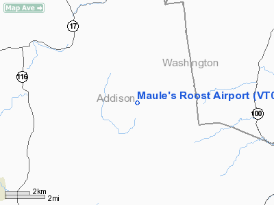
Location & QuickFacts
| FAA Information Effective: | 2008-09-25 |
| Airport Identifier: | VT03 |
| Airport Status: | Operational |
| Longitude/Latitude: | 072-58-51.4170W/44-05-19.2160N
-72.980949/44.088671 (Estimated) |
| Elevation: | 1100 ft / 335.28 m (Estimated) |
| Land: | 0 acres |
| From nearest city: | 1 nautical miles SE of Lincoln, VT |
| Location: | Addison County, VT |
| Magnetic Variation: | 15W (1985) |
Owner & Manager
| Ownership: | Privately owned |
| Owner: | Steven C. Buker |
| Address: | R. D. 1 Box 745
Bristol, VT 05443 |
| Phone number: | 802-453-2131 |
| Manager: | Steven C. Buker |
| Address: | R. D. 1 Box 745
Bristol, VT 05443 |
| Phone number: | 802-453-2131 |
Airport Operations and Facilities
| Airport Use: | Private |
| Segmented Circle: | No |
| Control Tower: | No |
| Landing fee charge: | No |
| Sectional chart: | Montreal |
| Region: | ANE - New England |
| Boundary ARTCC: | ZBW - Boston |
| Tie-in FSS: | BTV - Burlington |
| FSS Toll Free: | 1-800-WX-BRIEF |
Runway Information
Runway 18/36
| Dimension: | 1200 x 70 ft / 365.8 x 21.3 m |
| Surface: | TURF, |
| |
Runway 18 |
Runway 36 |
| Traffic Pattern: | Left | Left |
|
Radio Navigation Aids
| ID |
Type |
Name |
Ch |
Freq |
Var |
Dist |
| MPV | FAN MARKER | Brook | | | | 19.7 nm |
| R | FAN MARKER | Chitt | | | 14W | 27.2 nm |
| VKN | NDB | Mount Mansfield | | 268.00 | 16W | 21.8 nm |
| DYO | NDB | Smuto | | 221.00 | 15W | 23.0 nm |
| JRV | NDB | Morrisville/stowe | | 375.00 | 16W | 34.0 nm |
| IVV | NDB | White River | | 379.00 | 16W | 38.8 nm |
| LAH | NDB | Hanover | | 276.00 | 15W | 41.8 nm |
| LLX | NDB | Lyndonville | | 353.00 | 16W | 48.0 nm |
| MPV | VOR/DME | Montpelier | 045X | 110.80 | 16W | 23.0 nm |
| RUT | VOR/DME | Rutland | 47X | 111.00 | 15W | 33.8 nm |
| LEB | VOR/DME | Lebanon | 084X | 113.70 | 15W | 41.3 nm |
| BTV | VORTAC | Burlington | 122X | 117.50 | 15W | 20.5 nm |
| PLB | VORTAC | Plattsburgh | 116X | 116.90 | 15W | 42.7 nm |
| BTV | VOT | Burlington Intl | | 109.00 | | 23.9 nm |
Remarks
Images and information placed above are from
http://www.airport-data.com/airport/VT03/
We thank them for the data!
| General Info
|
| Country |
United States
|
| State |
VERMONT
|
| FAA ID |
VT03
|
| Latitude |
44-05-19.216N
|
| Longitude |
072-58-51.417W
|
| Elevation |
1100 feet
|
| Near City |
LINCOLN
|
We don't guarantee the information is fresh and accurate. The data may
be wrong or outdated.
For more up-to-date information please refer to other sources.
|
|


