 |
|
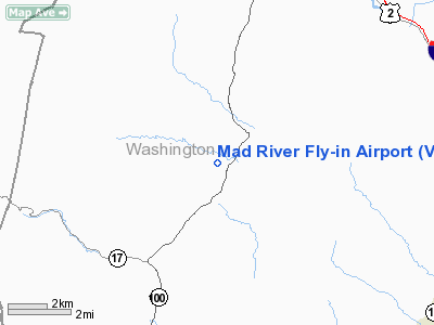
Location & QuickFacts
| FAA Information Effective: | 2008-09-25 |
| Airport Identifier: | VT29 |
| Airport Status: | Operational |
| Longitude/Latitude: | 072-47-43.4180W/44-13-35.2110N
-72.795394/44.226448 (Estimated) |
| Elevation: | 710 ft / 216.41 m (Estimated) |
| Land: | 15 acres |
| From nearest city: | 3 nautical miles N of Waitsfield, VT |
| Location: | Washington County, VT |
| Magnetic Variation: | 16W (1985) |
Owner & Manager
| Ownership: | Privately owned |
| Owner: | Q. A. Pearson |
| Address: | Star Rte 1
Waitsfield, VT 05673 |
| Phone number: | 802-496-3000 |
| Address: |
|
Airport Operations and Facilities
| Airport Use: | Private |
| Segmented Circle: | No |
| Control Tower: | No |
| Landing fee charge: | No |
| Sectional chart: | Montreal |
| Region: | ANE - New England |
| Boundary ARTCC: | ZBW - Boston |
| Tie-in FSS: | BTV - Burlington |
| FSS on Airport: | No |
| FSS Toll Free: | 1-800-WX-BRIEF |
Airport Services
| Airframe Repair: | NONE |
| Power Plant Repair: | NONE |
Runway Information
Runway 13/31
| Dimension: | 1000 x 300 ft / 304.8 x 91.4 m |
| Surface: | TURF, |
| |
Runway 13 |
Runway 31 |
| Traffic Pattern: | Left | Left |
| Obstruction: | 15 ft , 500.0 ft from runway | |
|
Radio Navigation Aids
| ID |
Type |
Name |
Ch |
Freq |
Var |
Dist |
| MPV | FAN MARKER | Brook | | | | 8.2 nm |
| R | FAN MARKER | Chitt | | | 14W | 36.3 nm |
| VKN | NDB | Mount Mansfield | | 268.00 | 16W | 10.6 nm |
| JRV | NDB | Morrisville/stowe | | 375.00 | 16W | 23.0 nm |
| DYO | NDB | Smuto | | 221.00 | 15W | 32.0 nm |
| LLX | NDB | Lyndonville | | 353.00 | 16W | 36.9 nm |
| LAH | NDB | Hanover | | 276.00 | 15W | 41.3 nm |
| IVV | NDB | White River | | 379.00 | 16W | 42.5 nm |
| GMA | NDB | Mahn | | 386.00 | 17W | 48.4 nm |
| MPV | VOR/DME | Montpelier | 045X | 110.80 | 16W | 17.2 nm |
| LEB | VOR/DME | Lebanon | 084X | 113.70 | 15W | 41.4 nm |
| RUT | VOR/DME | Rutland | 47X | 111.00 | 15W | 42.6 nm |
| BTV | VORTAC | Burlington | 122X | 117.50 | 15W | 19.6 nm |
| PLB | VORTAC | Plattsburgh | 116X | 116.90 | 15W | 41.6 nm |
| BTV | VOT | Burlington Intl | | 109.00 | | 21.0 nm |
Remarks
- CLOSED SUNDAYS DURING THE SUMMER; FIELD OPEN MAY THRU SEPT.
- ARPT NOW A POLO FIELD; MAY BE USED IN EMERGENCY BY GLIDERS & POWERED ACFT.
- VFR ONLY.
Images and information placed above are from
http://www.airport-data.com/airport/VT29/
We thank them for the data!
| General Info
|
| Country |
United States
|
| State |
VERMONT
|
| FAA ID |
VT29
|
| Latitude |
44-13-35.211N
|
| Longitude |
072-47-43.418W
|
| Elevation |
710 feet
|
| Near City |
WAITSFIELD
|
We don't guarantee the information is fresh and accurate. The data may
be wrong or outdated.
For more up-to-date information please refer to other sources.
|
|


