 |
|
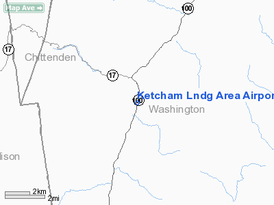
Ketcham Lndg Area Airport |
Location & QuickFacts
| FAA Information Effective: | 2008-09-25 |
| Airport Identifier: | VT30 |
| Airport Status: | Operational |
| Longitude/Latitude: | 072-50-02.4130W/44-09-45.2140N
-72.834004/44.162559 (Estimated) |
| Elevation: | 780 ft / 237.74 m (Estimated) |
| Land: | 0 acres |
| From nearest city: | 2 nautical miles S of Waitsfield, VT |
| Location: | Washington County, VT |
| Magnetic Variation: | 16W (1985) |
Owner & Manager
| Ownership: | Privately owned |
| Owner: | Warren M Ketcham |
| Address: | Rfd Box23
Waitsfield, VT 05673 |
| Phone number: | 802-496-3332 |
| Address: |
|
Airport Operations and Facilities
| Airport Use: | Private |
| Wind indicator: | Yes |
| Segmented Circle: | No |
| Control Tower: | No |
| Sectional chart: | Montreal |
| Region: | ANE - New England |
| Boundary ARTCC: | ZBW - Boston |
| Tie-in FSS: | BTV - Burlington |
| FSS Toll Free: | 1-800-WX-BRIEF |
Airport Services
| Airframe Repair: | NONE |
| Power Plant Repair: | NONE |
Runway Information
Runway N/S
| Dimension: | 1050 x 150 ft / 320.0 x 45.7 m |
| Surface: | TURF, |
| |
Runway N |
Runway S |
| Traffic Pattern: | Left | Left |
|
Radio Navigation Aids
| ID |
Type |
Name |
Ch |
Freq |
Var |
Dist |
| MPV | FAN MARKER | Brook | | | | 12.2 nm |
| R | FAN MARKER | Chitt | | | 14W | 32.2 nm |
| VKN | NDB | Mount Mansfield | | 268.00 | 16W | 14.8 nm |
| JRV | NDB | Morrisville/stowe | | 375.00 | 16W | 27.2 nm |
| DYO | NDB | Smuto | | 221.00 | 15W | 27.9 nm |
| IVV | NDB | White River | | 379.00 | 16W | 39.6 nm |
| LAH | NDB | Hanover | | 276.00 | 15W | 39.7 nm |
| LLX | NDB | Lyndonville | | 353.00 | 16W | 40.2 nm |
| MPV | VOR/DME | Montpelier | 045X | 110.80 | 16W | 17.2 nm |
| RUT | VOR/DME | Rutland | 47X | 111.00 | 15W | 38.6 nm |
| LEB | VOR/DME | Lebanon | 084X | 113.70 | 15W | 39.5 nm |
| BTV | VORTAC | Burlington | 122X | 117.50 | 15W | 20.6 nm |
| PLB | VORTAC | Plattsburgh | 116X | 116.90 | 15W | 43.1 nm |
| BTV | VOT | Burlington Intl | | 109.00 | | 22.8 nm |
Remarks
Images and information placed above are from
http://www.airport-data.com/airport/VT30/
We thank them for the data!
| General Info
|
| Country |
United States
|
| State |
VERMONT
|
| FAA ID |
VT30
|
| Latitude |
44-09-45.214N
|
| Longitude |
072-50-02.413W
|
| Elevation |
780 feet
|
| Near City |
WAITSFIELD
|
We don't guarantee the information is fresh and accurate. The data may
be wrong or outdated.
For more up-to-date information please refer to other sources.
|
|


