 |
|
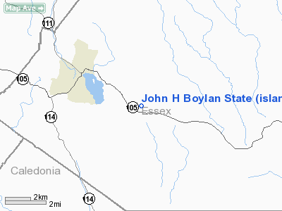
John H Boylan State (island Pond) Airport |
Location & QuickFacts
| FAA Information Effective: | 2008-09-25 |
| Airport Identifier: | 5B1 |
| Airport Status: | Operational |
| Longitude/Latitude: | 071-49-18.3380W/44-47-29.1770N
-71.821761/44.791438 (Estimated) |
| Elevation: | 1194 ft / 363.93 m (Surveyed) |
| Land: | 188 acres |
| From nearest city: | 3 nautical miles SE of Island Pond, VT |
| Location: | Essex County, VT |
| Magnetic Variation: | 17W (1985) |
Owner & Manager
| Ownership: | Publicly owned |
| Owner: | State Of Vermont |
| Address: | 133 State Street
Montpelier, VT 05633 |
| Phone number: | 802-626-3353 |
| Manager: | Thomas Winans
ARPT INFO FM VT AGENCY F TRANSPORTATION 802-626-3353. |
| Address: | Rfd 1
Lyndonville, VT 05851 |
| Phone number: | 802-626-3353 |
Airport Operations and Facilities
| Airport Use: | Open to public |
| Wind indicator: | Yes |
| Segmented Circle: | Yes |
| Control Tower: | No |
| Landing fee charge: | No |
| Sectional chart: | Montreal |
| Region: | ANE - New England |
| Boundary ARTCC: | ZBW - Boston |
| Tie-in FSS: | BTV - Burlington |
| FSS on Airport: | No |
| FSS Toll Free: | 1-800-WX-BRIEF |
| NOTAMs Facility: | BTV (NOTAM-d service avaliable) |
| Federal Agreements: | 1 |
Airport Communications
Airport Services
| Airframe Repair: | NONE |
| Power Plant Repair: | NONE |
| Bottled Oxygen: | NONE |
| Bulk Oxygen: | NONE |
Runway Information
Runway 14/32
| Dimension: | 2650 x 120 ft / 807.7 x 36.6 m |
| Surface: | TURF, Good Condition |
| |
Runway 14 |
Runway 32 |
| Traffic Pattern: | Left | Left |
| Obstruction: | 45 ft trees, 500.0 ft from runway, 11:1 slope to clear | 30 ft trees, 600.0 ft from runway, 20:1 slope to clear |
|
Radio Navigation Aids
| ID |
Type |
Name |
Ch |
Freq |
Var |
Dist |
| HIE | FAN MARKER | Witey | | | 17W | 27.8 nm |
| MPV | FAN MARKER | Brook | | | | 45.6 nm |
| EFK | NDB | Newport | | 242.00 | 17W | 18.0 nm |
| LLX | NDB | Lyndonville | | 353.00 | 16W | 19.4 nm |
| GMA | NDB | Mahn | | 386.00 | 17W | 26.4 nm |
| HXK | NDB | Hornebrook | | 281.00 | 17W | 30.3 nm |
| JRV | NDB | Morrisville/stowe | | 375.00 | 16W | 35.1 nm |
| SC | NDB | Sherbrooke | | 362.00 | 17W | 41.1 nm |
| VKN | NDB | Mount Mansfield | | 268.00 | 16W | 44.5 nm |
| RQM | NDB | Rangeley | | 221.00 | 18W | 46.4 nm |
| BML | VOR/DME | Berlin | 041X | 110.40 | 17W | 28.8 nm |
| YSC | VORTAC | Sherbrooke | 079X | 113.20 | 17W | 31.6 nm |
Remarks
- SKI OPERATIONS IN WINTER.
Images and information placed above are from
http://www.airport-data.com/airport/5B1/
We thank them for the data!
| General Info
|
| Country |
United States
|
| State |
VERMONT
|
| FAA ID |
5B1
|
| Latitude |
44-47-29.177N
|
| Longitude |
071-49-18.338W
|
| Elevation |
1194 feet
|
| Near City |
ISLAND POND
|
We don't guarantee the information is fresh and accurate. The data may
be wrong or outdated.
For more up-to-date information please refer to other sources.
|
|


