|
|
Hartness State (springfield) Airport |
Coordinates: 43°20′37″N 072°31′02″W / 43.34361°N 72.51722°W / 43.34361; -72.51722
| Hartness State Airport |
| IATA: VSF – ICAO: KVSF – FAA LID: VSF |
| Summary |
| Airport type |
Public |
| Owner |
State of Vermont |
| Serves |
Springfield, Vermont |
| Elevation AMSL |
577 ft / 176 m |
| Runways |
| Direction |
Length |
Surface |
| ft |
m |
| 5/23 |
5,498 |
1,676 |
Asphalt |
| 11/29 |
3,000 |
914 |
Asphalt |
| Statistics (1998) |
| Aircraft operations |
9,300 |
| Based aircraft |
37 |
| Source: Federal Aviation Administration |
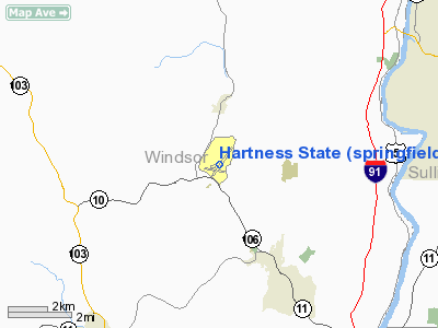
Hartness State Airport (IATA: VSF, ICAO: KVSF, FAA LID: VSF) is a public airport located three miles (5 km) northwest of the central business district of Springfield, a town in Windsor County, Vermont, United States. It is owned by the State of Vermont.
Facilities and aircraft
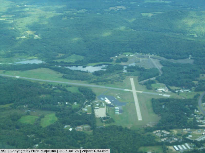
Hartness State Airport covers an area of 185 acres (75 ha) which contains two asphalt paved runways: 5/23 measuring 5,498 x 100 ft (1,676 x 30 m) and 11/29 measuring 3,000 x 75 ft (914 x 23 m).
For the 12-month period ending November 2, 1998, the airport had 9,300 aircraft operations, an average of 25 per day: 97% general aviation, 2% air taxi and 1% military. There are 37 aircraft based at this airport: 76% single engine, 22% gliders and 3% multi-engine.
The above content comes from Wikipedia and is published under free licenses – click here to read more.
|
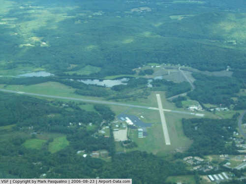 |
(Click on the photo to enlarge) |
Location & QuickFacts
| FAA Information Effective: | 2008-09-25 |
| Airport Identifier: | VSF |
| Airport Status: | Operational |
| Longitude/Latitude: | 072-31-02.3250W/43-20-37.0640N
-72.517313/43.343629 (Estimated) |
| Elevation: | 577 ft / 175.87 m (Surveyed) |
| Land: | 185 acres |
| From nearest city: | 3 nautical miles NW of Springfield, VT |
| Location: | Windsor County, VT |
| Magnetic Variation: | 15W (1995) |
Owner & Manager
| Ownership: | Publicly owned |
| Owner: | State Of Vermont |
| Address: | 133 State St
Montpelier, VT 05602 |
| Phone number: | 802-828-2833 |
| Manager: | Steve Buckingham |
| Address: | Rt 1 Box 88
No. Springfield, VT 05150 |
| Phone number: | 802-886-8594 |
Airport Operations and Facilities
| Airport Use: | Open to public |
| Wind indicator: | Yes |
| Segmented Circle: | No |
| Control Tower: | No |
| Lighting Schedule: | DUSK-DAWN |
| Beacon Color: | Clear-Green (lighted land airport) |
| Landing fee charge: | No |
| Sectional chart: | New York |
| Region: | ANE - New England |
| Boundary ARTCC: | ZBW - Boston |
| Tie-in FSS: | BTV - Burlington |
| FSS on Airport: | No |
| FSS Toll Free: | 1-800-WX-BRIEF |
| NOTAMs Facility: | VSF (NOTAM-d service avaliable) |
| Federal Agreements: | NGSY |
Airport Communications
| CTAF: | 122.800 |
| Unicom: | 122.800 |
Airport Services
| Fuel available: | 100LLA |
| Airframe Repair: | MAJOR |
| Power Plant Repair: | MAJOR |
| Bottled Oxygen: | NONE |
| Bulk Oxygen: | NONE |
Runway Information
Runway 05/23
| Dimension: | 5498 x 100 ft / 1675.8 x 30.5 m |
| Surface: | ASPH, Fair Condition |
| Weight Limit: | Single wheel: 32000 lbs.
Dual wheel: 45000 lbs. |
| Edge Lights: | Medium |
| |
Runway 05 |
Runway 23 |
| Longitude: | 072-31-16.5620W | 072-30-34.2670W |
| Latitude: | 43-20-20.1040N | 43-21-04.7730N |
| Elevation: | 571.00 ft | 554.00 ft |
| Alignment: | 35 | 127 |
| ILS Type: | LOC/DME
| |
| Traffic Pattern: | Left | Left |
| Markings: | Non-precision instrument, Fair Condition | Non-precision instrument, Fair Condition |
| Crossing Height: | 59.00 ft | 0.00 ft |
| VASI: | 4-box on left side | |
| Visual Glide Angle: | 4.00° | 0.00° |
| Runway End Identifier: | Yes | No |
| Centerline Lights: | No | No |
| Touchdown Lights: | No | No |
| Obstruction: | 45 ft trees, 560.0 ft from runway, 280 ft left of centerline, 8:1 slope to clear
+45 FT TREES AT THLD 210 FT L. | 100 ft trees, 1800.0 ft from runway, 16:1 slope to clear |
|
Runway 11/29
| Dimension: | 3000 x 75 ft / 914.4 x 22.9 m |
| Surface: | ASPH, Good Condition |
| Weight Limit: | Single wheel: 30000 lbs. |
| Edge Lights: | Medium |
| |
Runway 11 |
Runway 29 |
| Longitude: | 072-31-34.8300W | 072-30-54.6900W |
| Latitude: | 43-20-30.2500N | 43-20-25.7500N |
| Elevation: | 576.00 ft | 568.00 ft |
| Alignment: | 99 | 127 |
| Traffic Pattern: | Left | Left |
| Markings: | Basic, Fair Condition | Basic, Fair Condition |
| Runway End Identifier: | No | No |
| Centerline Lights: | No | No |
| Touchdown Lights: | No | No |
| Obstruction: | 65 ft trees, 1000.0 ft from runway, 240 ft right of centerline, 12:1 slope to clear | 325 ft pole, 4250.0 ft from runway, 350 ft left of centerline, 12:1 slope to clear |
|
Radio Navigation Aids
| ID |
Type |
Name |
Ch |
Freq |
Var |
Dist |
| R | FAN MARKER | Chitt | | | 14W | 26.6 nm |
| LCI | FAN MARKER | Laconia | | | | 48.8 nm |
| SXD | NDB | Springfield | | 265.00 | 15W | 5.4 nm |
| CNH | NDB | Claremont | | 233.00 | 16W | 6.6 nm |
| IVV | NDB | White River | | 379.00 | 16W | 13.2 nm |
| LAH | NDB | Hanover | | 276.00 | 15W | 26.2 nm |
| DYO | NDB | Smuto | | 221.00 | 15W | 29.0 nm |
| VWD | NDB | Mount Snow | | 224.00 | 15W | 29.3 nm |
| LC | NDB | Blnap | | 328.00 | 16W | 44.3 nm |
| ORE | NDB | Orange | | 205.00 | 15W | 47.7 nm |
| CO | NDB | Epsom | | 216.00 | 16W | 48.6 nm |
| RUT | VOR/DME | Rutland | 47X | 111.00 | 15W | 21.9 nm |
| LEB | VOR/DME | Lebanon | 084X | 113.70 | 15W | 24.1 nm |
| CAM | VOR/DME | Cambridge | 097X | 115.00 | 14W | 41.9 nm |
| MPV | VOR/DME | Montpelier | 045X | 110.80 | 16W | 44.7 nm |
| EEN | VORTAC | Keene | 031X | 109.40 | 14W | 34.5 nm |
| CON | VORTAC | Concord | 076X | 112.90 | 15W | 41.9 nm |
| GFL | VORTAC | Glens Falls | 039X | 110.20 | 14W | 47.8 nm |
Remarks
- CFR NOT AVBL ON ARPT.
- RY CONDS MAY NOT BE MONITORED OR REPORTED WHEN THE ARPT IS UNATNDD.
- GEESE ON & INVOF ARPT.
- APRON & TWYS A & B PAVEMENT CAPACITY IS S-46 & D-62.
- NOISE SENSITIVE AREA WEST OF ARPT.
- RY 23 IS PREFERRED FOR DAY, VFR, NO WIND CONDITIONS.
- MAINTAIN RECOMMENDED PATTERN ALTITUDE ON DOWNWIND LEG FOR RY 05.
- EXISTED PRIOR TO 1959.
Images and information placed above are from
http://www.airport-data.com/airport/VSF/
We thank them for the data!
| General Info
|
| Country |
United States
|
| State |
VERMONT
|
| FAA ID |
VSF
|
| Latitude |
43-20-37.064N
|
| Longitude |
072-31-02.325W
|
| Elevation |
577 feet
|
| Near City |
SPRINGFIELD
|
We don't guarantee the information is fresh and accurate. The data may
be wrong or outdated.
For more up-to-date information please refer to other sources.
|
|