|
|
Franklin County State Airport |
Coordinates: 44°56′25″N 073°05′51″W / 44.94028°N 73.0975°W / 44.94028; -73.0975
| Franklin County State Airport |
| IATA: none – ICAO: KFSO – FAA LID: FSO |
| Summary |
| Airport type |
Public |
| Owner |
State of Vermont |
| Serves |
Franklin County, Vermont |
| Location |
Highgate, Vermont |
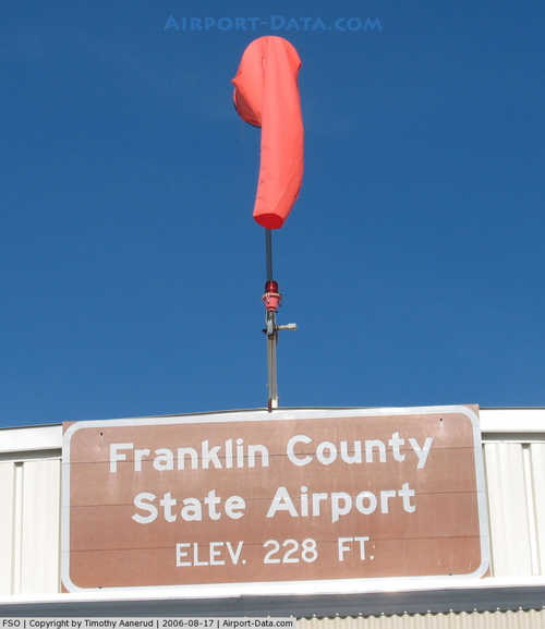
| Elevation AMSL |
228 ft / 69 m |
| Runways |
| Direction |
Length |
Surface |
| ft |
m |
| 1/19 |
3,000 |
914 |
Asphalt |
| Statistics (2009) |
| Aircraft operations |
10,200 |
| Based aircraft |
86 |
|
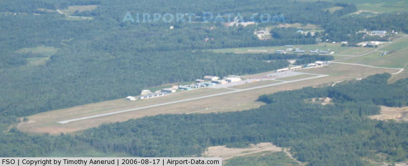
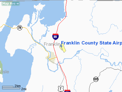
Franklin County State Airport (ICAO: KFSO, FAA LID: FSO) is a public airport located three miles (5 km) west of the central business district of Highgate, a town in Franklin County, Vermont, United States. It is owned by the State of Vermont.
Although most U.S. airports use the same three-letter location identifier for the FAA and IATA, Franklin County State Airport is assigned FSO by the FAA but has no designation from the IATA.
Facilities and aircraft
Franklin County State Airport covers an area of 348 acres (141 ha) which contains one asphalt paved runway (1/19) measuring 3,000 x 60 ft (914 x 18 m). For the 12-month period ending August 31, 2009, the airport had 10,200 aircraft operations, an average of 28 per day: 93% general aviation, 7% military and <1% air taxi. There are 86 aircraft based at this airport: 90% single engine, 3% multi-engine, 1% helicopters and 6% ultralights.
The above content comes from Wikipedia and is published under free licenses – click here to read more.
|
 |
(Click on the photo to enlarge) |
|
 |
(Click on the photo to enlarge) |
Location & QuickFacts
| FAA Information Effective: | 2008-09-25 |
| Airport Identifier: | FSO |
| Airport Status: | Operational |
| Longitude/Latitude: | 073-05-50.8560W/44-56-25.0110N
-73.097460/44.940281 (Estimated) |
| Elevation: | 228 ft / 69.49 m (Surveyed) |
| Land: | 348 acres |
| From nearest city: | 3 nautical miles W of Highgate, VT |
| Location: | Franklin County, VT |
| Magnetic Variation: | 16W (1995) |
Owner & Manager
| Ownership: | Publicly owned |
| Owner: | State Of Vermont |
| Address: | 133 State Street
Montpelier, VT 05602 |
| Phone number: | 802-828-2833 |
| Manager: | George Coy |
| Address: | 629 Airport Rd
Swanton, VT 05488 |
| Phone number: | 802-868-2822 |
Airport Operations and Facilities
| Airport Use: | Open to public |
| Wind indicator: | Yes |
| Segmented Circle: | Yes |
| Control Tower: | No |
| Lighting Schedule: | DUSK-DAWN
ACTVT MIRL RY 01/19; VASI RY 01 & REIL RYS 01 & 19 - CTAF. |
| Beacon Color: | Clear-Green (lighted land airport) |
| Landing fee charge: | No |
| Sectional chart: | Montreal |
| Region: | ANE - New England |
| Boundary ARTCC: | ZBW - Boston |
| Tie-in FSS: | BTV - Burlington |
| FSS on Airport: | No |
| FSS Toll Free: | 1-800-WX-BRIEF |
| NOTAMs Facility: | BTV (NOTAM-d service avaliable) |
| Federal Agreements: | NGY |
Airport Communications
| CTAF: | 122.800 |
| Unicom: | 122.800 |
Airport Services
| Fuel available: | 100LL
FUEL AVBL 24 HRS SELF-SERVE. |
| Airframe Repair: | MAJOR |
| Power Plant Repair: | MAJOR |
| Bottled Oxygen: | NONE |
| Bulk Oxygen: | NONE |
Runway Information
Runway 01/19
| Dimension: | 3000 x 60 ft / 914.4 x 18.3 m |
| Surface: | ASPH, Good Condition |
| Weight Limit: | Single wheel: 12500 lbs. |
| Edge Lights: | Medium |
| |
Runway 01 |
Runway 19 |
| Longitude: | 073-05-47.0472W | 073-05-54.6689W |
| Latitude: | 44-56-10.4465N | 44-56-39.5708N |
| Elevation: | 228.00 ft | 228.00 ft |
| Alignment: | 127 | 127 |
| Traffic Pattern: | Left | Left |
| Markings: | Non-precision instrument, Fair Condition | Non-precision instrument, Fair Condition |
| VASI: | 2-box on left side
VASI OTS INDEFLY. | |
| Visual Glide Angle: | 3.00° | 0.00° |
| Runway End Identifier: | Yes | Yes |
| Obstruction: | 83 ft tree, 1630.0 ft from runway, 387 ft left of centerline, 17:1 slope to clear | 7 ft road, 222.0 ft from runway, 241 ft left of centerline, 4:1 slope to clear |
|
Radio Navigation Aids
| ID |
Type |
Name |
Ch |
Freq |
Var |
Dist |
| MPV | FAN MARKER | Brook | | | | 41.8 nm |
| JRV | NDB | Morrisville/stowe | | 375.00 | 16W | 30.8 nm |
| VKN | NDB | Mount Mansfield | | 268.00 | 16W | 37.5 nm |
| H | NDB | Hotel | | 407.00 | 16W | 39.0 nm |
| EFK | NDB | Newport | | 242.00 | 17W | 39.2 nm |
| JL | NDB | Cote St Luc | | 370.00 | 16W | 39.4 nm |
| U | NDB | Uniform | | 201.00 | 15W | 42.1 nm |
| NDB | Mike | | 348.00 | 15W | 42.3 nm |
| L | NDB | Lima | | 284.00 | 16W | 43.3 nm |
| UL | NDB | Montreal | | 248.00 | 16W | 44.6 nm |
| YJN | VORTAC | St Jean | 105X | 115.80 | 16W | 21.2 nm |
| PLB | VORTAC | Plattsburgh | 116X | 116.90 | 15W | 23.8 nm |
| BTV | VORTAC | Burlington | 122X | 117.50 | 15W | 32.9 nm |
| BTV | VOT | Burlington Intl | | 109.00 | | 28.6 nm |
Remarks
- RY CONDS MAY NOT BE MONITORED OR REPORTED WHEN THE ARPT IS UNATNDD.
- MILITARY EQUIPMENT MAY BE NEAR THE RY.
- TURF LANDING AREA EAST SIDE OF RY 01/19; NO SIMULTANEOUS OPS.
- GCO AVBL ON FREQ 121.725 THRU BTV CD & FLT SVCS.
Images and information placed above are from
http://www.airport-data.com/airport/FSO/
We thank them for the data!
| General Info
|
| Country |
United States
|
| State |
VERMONT
|
| FAA ID |
FSO
|
| Latitude |
44-56-25.011N
|
| Longitude |
073-05-50.856W
|
| Elevation |
228 feet
|
| Near City |
HIGHGATE
|
We don't guarantee the information is fresh and accurate. The data may
be wrong or outdated.
For more up-to-date information please refer to other sources.
|
|