 |
|
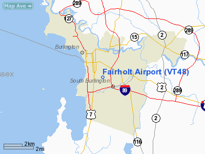
Location & QuickFacts
| FAA Information Effective: | 2008-09-25 |
| Airport Identifier: | VT48 |
| Airport Status: | Operational |
| Longitude/Latitude: | 073-11-45.4570W/44-27-41.1780N
-73.195960/44.461438 (Estimated) |
| Elevation: | 350 ft / 106.68 m (Estimated) |
| Land: | 0 acres |
| From nearest city: | 2 nautical miles SE of Burlington, VT |
| Location: | Chittenden County, VT |
| Magnetic Variation: | 15W (1985) |
Owner & Manager
| Ownership: | Privately owned |
| Owner: | Willett Foster |
| Address: | Fairholt
Burlington, VT 05401 |
| Phone number: | 802-862-5287 |
| Address: |
|
Airport Operations and Facilities
| Airport Use: | Private |
| Wind indicator: | Yes |
| Segmented Circle: | No |
| Control Tower: | No |
| Landing fee charge: | No |
| Sectional chart: | Montreal |
| Region: | ANE - New England |
| Boundary ARTCC: | ZBW - Boston |
| Tie-in FSS: | BTV - Burlington |
| FSS on Airport: | No |
| FSS Toll Free: | 1-800-WX-BRIEF |
Runway Information
Runway 02/20
| Dimension: | 1100 x 50 ft / 335.3 x 15.2 m |
| Surface: | TURF, |
| |
Runway 02 |
Runway 20 |
| Traffic Pattern: | Left | Left |
| Obstruction: | 50 ft trees, 50.0 ft from runway | 50 ft trees, 100.0 ft from runway |
|
Radio Navigation Aids
| ID |
Type |
Name |
Ch |
Freq |
Var |
Dist |
| MPV | FAN MARKER | Brook | | | | 24.7 nm |
| VKN | NDB | Mount Mansfield | | 268.00 | 16W | 22.0 nm |
| JRV | NDB | Morrisville/stowe | | 375.00 | 16W | 27.0 nm |
| DYO | NDB | Smuto | | 221.00 | 15W | 46.5 nm |
| MPV | VOR/DME | Montpelier | 045X | 110.80 | 16W | 39.3 nm |
| SLK | VOR/DME | Saranac Lake | 029X | 109.20 | 14W | 43.5 nm |
| BTV | VORTAC | Burlington | 122X | 117.50 | 15W | 3.9 nm |
| PLB | VORTAC | Plattsburgh | 116X | 116.90 | 15W | 19.4 nm |
| YJN | VORTAC | St Jean | 105X | 115.80 | 16W | 48.0 nm |
| BTV | VOT | Burlington Intl | | 109.00 | | 2.0 nm |
Remarks
- ARPT CLSD IN SNOW CONDITIONS.
- E111: VFR USE ONLY; TFC PATTERNS ESTABLISHED TO REMAIN SOUTHWEST OF RWY; OPNS CONDUCTED TO AVOID BURLINGTON INTL ARPT TRAFFIC PATTERN.
Images and information placed above are from
http://www.airport-data.com/airport/VT48/
We thank them for the data!
| General Info
|
| Country |
United States
|
| State |
VERMONT
|
| FAA ID |
VT48
|
| Latitude |
44-27-41.178N
|
| Longitude |
073-11-45.457W
|
| Elevation |
350 feet
|
| Near City |
BURLINGTON
|
We don't guarantee the information is fresh and accurate. The data may
be wrong or outdated.
For more up-to-date information please refer to other sources.
|
|


