 |
|
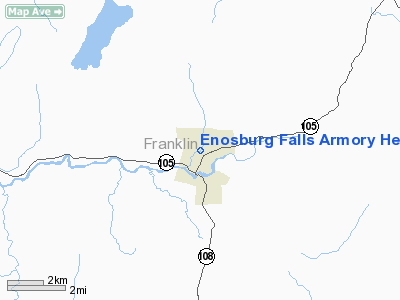
Enosburg Falls Armory Heliport |
Location & QuickFacts
| FAA Information Effective: | 2008-09-25 |
| Airport Identifier: | VT50 |
| Airport Status: | Operational |
| Longitude/Latitude: | 072-48-18.4840W/44-54-50.1660N
-72.805134/44.913935 (Estimated) |
| Elevation: | 410 ft / 124.97 m (Estimated) |
| Land: | 0 acres |
| From nearest city: | 0 nautical miles E of Enosburg Falls, VT |
| Location: | Franklin County, VT |
| Magnetic Variation: | 16W (1985) |
Owner & Manager
| Ownership: | Privately owned |
| Owner: | Ruth Frazier |
| Address: | Enosburg Falls Armory
Enosbury Falls, VT 05450 |
| Manager: | Maj Maurice D Racine
STATE AVIATION OFFICER. |
| Address: | Bldg 890 Airport Rd So
Burlington, VT 05401 |
| Phone number: | 802-655-0270
EXTN 40 & 77. |
Airport Operations and Facilities
| Airport Use: | Private |
| Wind indicator: | No |
| Segmented Circle: | No |
| Control Tower: | No |
| Landing fee charge: | No |
| Sectional chart: | Montreal |
| Region: | ANE - New England |
| Boundary ARTCC: | ZBW - Boston |
| Tie-in FSS: | BTV - Burlington |
| FSS on Airport: | No |
| FSS Toll Free: | 1-800-WX-BRIEF |
Runway Information
Helipad H1
| Dimension: | 400 x 400 ft / 121.9 x 121.9 m |
| Surface: | TURF, |
| |
Runway H1 |
Runway |
| Traffic Pattern: | Left | Left |
|
Radio Navigation Aids
| ID |
Type |
Name |
Ch |
Freq |
Var |
Dist |
| MPV | FAN MARKER | Brook | | | | 36.2 nm |
| JRV | NDB | Morrisville/stowe | | 375.00 | 16W | 22.2 nm |
| EFK | NDB | Newport | | 242.00 | 17W | 26.8 nm |
| VKN | NDB | Mount Mansfield | | 268.00 | 16W | 32.1 nm |
| LLX | NDB | Lyndonville | | 353.00 | 16W | 41.3 nm |
| H | NDB | Hotel | | 407.00 | 16W | 45.3 nm |
| JL | NDB | Cote St Luc | | 370.00 | 16W | 48.9 nm |
| YJN | VORTAC | St Jean | 105X | 115.80 | 16W | 30.0 nm |
| PLB | VORTAC | Plattsburgh | 116X | 116.90 | 15W | 33.6 nm |
| BTV | VORTAC | Burlington | 122X | 117.50 | 15W | 35.0 nm |
| YSC | VORTAC | Sherbrooke | 079X | 113.20 | 17W | 49.5 nm |
| BTV | VOT | Burlington Intl | | 109.00 | | 30.6 nm |
Remarks
Images and information placed above are from
http://www.airport-data.com/airport/VT50/
We thank them for the data!
| General Info
|
| Country |
United States
|
| State |
VERMONT
|
| FAA ID |
VT50
|
| Latitude |
44-54-50.166N
|
| Longitude |
072-48-18.484W
|
| Elevation |
410 feet
|
| Near City |
ENOSBURG FALLS
|
We don't guarantee the information is fresh and accurate. The data may
be wrong or outdated.
For more up-to-date information please refer to other sources.
|
|


