 |
|
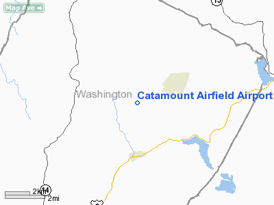
Catamount Airfield Airpor |
Location & QuickFacts
| FAA Information Effective: | 2008-09-25 |
| Airport Identifier: | VT62 |
| Airport Status: | Operational |
| Longitude/Latitude: | 072-21-02.3000W/44-23-25.3200N
-72.350639/44.390367 (Estimated) |
| Elevation: | 1350 ft / 411.48 m (Estimated) |
| Land: | 0 acres |
| From nearest city: | 2 nautical miles W of Cabot, VT |
| Location: | Washington County, VT |
| Magnetic Variation: | 16W (1995) |
Owner & Manager
| Ownership: | Privately owned |
| Owner: | William Ameden |
| Address: | 1009 Ducharme Road
Cabot, VT 05647 |
| Phone number: | 802-563-2351 |
| Manager: | William Ameden |
| Address: | 1009 Ducharme Road
Cabot, VT 05647 |
| Phone number: | 802-563-2351 |
Airport Operations and Facilities
| Airport Use: | Private |
| Wind indicator: | Yes |
| Segmented Circle: | No |
| Control Tower: | No |
| Sectional chart: | Montreal |
| Region: | ANE - New England |
| Boundary ARTCC: | ZBW - Boston |
| Tie-in FSS: | BTV - Burlington |
| FSS on Airport: | No |
| FSS Toll Free: | 1-800-WX-BRIEF |
Runway Information
Runway 04/22
| Dimension: | 1390 x 40 ft / 423.7 x 12.2 m |
| Surface: | TURF-GRVL, |
| |
Runway 04 |
Runway 22 |
| Traffic Pattern: | Left | Left |
|
Radio Navigation Aids
| ID |
Type |
Name |
Ch |
Freq |
Var |
Dist |
| MPV | FAN MARKER | Brook | | | | 13.8 nm |
| HIE | FAN MARKER | Witey | | | 17W | 33.8 nm |
| VKN | NDB | Mount Mansfield | | 268.00 | 16W | 14.7 nm |
| JRV | NDB | Morrisville/stowe | | 375.00 | 16W | 15.2 nm |
| LLX | NDB | Lyndonville | | 353.00 | 16W | 15.4 nm |
| GMA | NDB | Mahn | | 386.00 | 17W | 28.6 nm |
| EFK | NDB | Newport | | 242.00 | 17W | 34.6 nm |
| LAH | NDB | Hanover | | 276.00 | 15W | 42.0 nm |
| DYO | NDB | Smuto | | 221.00 | 15W | 48.8 nm |
| MPV | VOR/DME | Montpelier | 045X | 110.80 | 16W | 18.8 nm |
| LEB | VOR/DME | Lebanon | 084X | 113.70 | 15W | 43.2 nm |
| BTV | VORTAC | Burlington | 122X | 117.50 | 15W | 35.7 nm |
| BTV | VOT | Burlington Intl | | 109.00 | | 34.6 nm |
Remarks
Images and information placed above are from
http://www.airport-data.com/airport/VT62/
We thank them for the data!
| General Info
|
| Country |
United States
|
| State |
VERMONT
|
| FAA ID |
VT62
|
| Latitude |
44-23-25.320N
|
| Longitude |
072-21-02.300W
|
| Elevation |
1350 feet
|
| Near City |
CABOT
|
We don't guarantee the information is fresh and accurate. The data may
be wrong or outdated.
For more up-to-date information please refer to other sources.
|
|


