 |
|
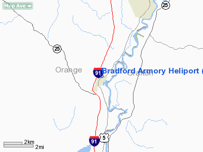
Location & QuickFacts
| FAA Information Effective: | 2008-09-25 |
| Airport Identifier: | VT08 |
| Airport Status: | Operational |
| Longitude/Latitude: | 072-07-23.3250W/44-00-05.2390N
-72.123146/44.001455 (Estimated) |
| Elevation: | 465 ft / 141.73 m (Estimated) |
| Land: | 0 acres |
| From nearest city: | 1 nautical miles S of Bradford, VT |
| Location: | Orange County, VT |
| Magnetic Variation: | 16W (1985) |
Owner & Manager
| Ownership: | Publicly owned
STATE OWNED |
| Owner: | Vt National Guard |
| Address: | Camp Johnson
Winoo15403-6097 |
| Phone number: | 802-864-1400
EXT 1406 |
| Manager: | Lt Col Thomas J. Shailor |
| Address: | Bldg 890 Airport Road
S Burlington, VT 05403-6097 |
| Phone number: | 802-864-1400
EXT 1406 |
Airport Operations and Facilities
| Airport Use: | Private |
| Wind indicator: | No |
| Segmented Circle: | No |
| Control Tower: | No |
| Landing fee charge: | No |
| Sectional chart: | New York |
| Region: | ANE - New England |
| Boundary ARTCC: | ZBW - Boston |
| Tie-in FSS: | BTV - Burlington |
| FSS on Airport: | No |
| FSS Toll Free: | 1-800-WX-BRIEF |
Airport Services
| Airframe Repair: | NONE |
| Power Plant Repair: | NONE |
Runway Information
Helipad H1
| Dimension: | 90 x 90 ft / 27.4 x 27.4 m |
| Surface: | TURF, |
| |
Runway H1 |
Runway |
| Traffic Pattern: | Left | Left |
|
Radio Navigation Aids
| ID |
Type |
Name |
Ch |
Freq |
Var |
Dist |
| MPV | FAN MARKER | Brook | | | | 29.9 nm |
| HIE | FAN MARKER | Witey | | | 17W | 32.6 nm |
| LCI | FAN MARKER | Laconia | | | | 39.5 nm |
| R | FAN MARKER | Chitt | | | 14W | 42.9 nm |
| LAH | NDB | Hanover | | 276.00 | 15W | 18.1 nm |
| GMA | NDB | Mahn | | 386.00 | 17W | 28.7 nm |
| IVV | NDB | White River | | 379.00 | 16W | 30.4 nm |
| LLX | NDB | Lyndonville | | 353.00 | 16W | 30.5 nm |
| VKN | NDB | Mount Mansfield | | 268.00 | 16W | 33.8 nm |
| LC | NDB | Blnap | | 328.00 | 16W | 37.8 nm |
| CNH | NDB | Claremont | | 233.00 | 16W | 39.5 nm |
| JRV | NDB | Morrisville/stowe | | 375.00 | 16W | 40.0 nm |
| DYO | NDB | Smuto | | 221.00 | 15W | 40.3 nm |
| SXD | NDB | Springfield | | 265.00 | 15W | 48.4 nm |
| MPV | VOR/DME | Montpelier | 045X | 110.80 | 16W | 15.0 nm |
| LEB | VOR/DME | Lebanon | 084X | 113.70 | 15W | 19.8 nm |
| RUT | VOR/DME | Rutland | 47X | 111.00 | 15W | 45.9 nm |
Remarks
Images and information placed above are from
http://www.airport-data.com/airport/VT08/
We thank them for the data!
| General Info
|
| Country |
United States
|
| State |
VERMONT
|
| FAA ID |
VT08
|
| Latitude |
44-00-05.239N
|
| Longitude |
072-07-23.325W
|
| Elevation |
465 feet
|
| Near City |
BRADFORD
|
We don't guarantee the information is fresh and accurate. The data may
be wrong or outdated.
For more up-to-date information please refer to other sources.
|
|


