 |
|
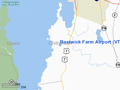
Location & QuickFacts
| FAA Information Effective: | 2008-09-25 |
| Airport Identifier: | VT23 |
| Airport Status: | Operational |
| Longitude/Latitude: | 073-15-01.4530W/44-22-15.1820N
-73.250404/44.370884 (Estimated) |
| Elevation: | 220 ft / 67.06 m (Surveyed) |
| Land: | 500 acres |
| From nearest city: | 2 nautical miles SW of Shelburne, VT |
| Location: | Chittenden County, VT |
| Magnetic Variation: | 15W (1985) |
Owner & Manager
| Ownership: | Privately owned |
| Owner: | Meach Cove Trust |
| Address: | Po Box 309
Shelburne, VT 05482 |
| Phone number: | 802-985-9218 |
| Manager: | Meach Cove Trust |
| Address: | Christopher Davis, Po Box 309
Shelburne, VT 05482 |
| Phone number: | 802-985-9218 |
Airport Operations and Facilities
| Airport Use: | Private |
| Wind indicator: | Yes |
| Segmented Circle: | No |
| Control Tower: | No |
| Landing fee charge: | No |
| Sectional chart: | Montreal |
| Region: | ANE - New England |
| Boundary ARTCC: | ZBW - Boston |
| Tie-in FSS: | BTV - Burlington |
| FSS on Airport: | No |
| FSS Toll Free: | 1-800-WX-BRIEF |
Airport Services
| Airframe Repair: | NONE |
| Power Plant Repair: | NONE |
Runway Information
Runway 01/19
| Dimension: | 2500 x 100 ft / 762.0 x 30.5 m |
| Surface: | TURF, |
| |
Runway 01 |
Runway 19 |
| Traffic Pattern: | Left | Left |
| Obstruction: | 50 ft wire, 500.0 ft from runway | |
|
Radio Navigation Aids
| ID |
Type |
Name |
Ch |
Freq |
Var |
Dist |
| MPV | FAN MARKER | Brook | | | | 25.7 nm |
| R | FAN MARKER | Chitt | | | 14W | 45.7 nm |
| VKN | NDB | Mount Mansfield | | 268.00 | 16W | 23.9 nm |
| JRV | NDB | Morrisville/stowe | | 375.00 | 16W | 31.1 nm |
| DYO | NDB | Smuto | | 221.00 | 15W | 41.9 nm |
| MPV | VOR/DME | Montpelier | 045X | 110.80 | 16W | 38.5 nm |
| SLK | VOR/DME | Saranac Lake | 029X | 109.20 | 14W | 41.0 nm |
| BTV | VORTAC | Burlington | 122X | 117.50 | 15W | 3.3 nm |
| PLB | VORTAC | Plattsburgh | 116X | 116.90 | 15W | 22.2 nm |
| BTV | VOT | Burlington Intl | | 109.00 | | 7.2 nm |
Remarks
Images and information placed above are from
http://www.airport-data.com/airport/VT23/
We thank them for the data!
| General Info
|
| Country |
United States
|
| State |
VERMONT
|
| FAA ID |
VT23
|
| Latitude |
44-22-15.182N
|
| Longitude |
073-15-01.453W
|
| Elevation |
220 feet
|
| Near City |
SHELBURNE
|
We don't guarantee the information is fresh and accurate. The data may
be wrong or outdated.
For more up-to-date information please refer to other sources.
|
|


