 |
|
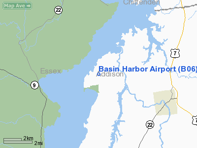
Location & QuickFacts
| FAA Information Effective: | 2008-09-25 |
| Airport Identifier: | B06 |
| Airport Status: | Operational |
| Longitude/Latitude: | 073-20-58.4510W/44-11-45.1910N
-73.349570/44.195886 (Estimated) |
| Elevation: | 132 ft / 40.23 m (Surveyed) |
| Land: | 14 acres |
| From nearest city: | 4 nautical miles NW of Vergennes, VT |
| Location: | Addison County, VT |
| Magnetic Variation: | 15W (1985) |
Owner & Manager
| Ownership: | Privately owned |
| Owner: | Beach Properties Inc |
| Address: | Basin Habor Airport
Vergennes, VT 05491 |
| Phone number: | 802-475-2311 |
| Manager: | Robert Beach, Jr. |
| Address: | Basin Harbor Airport
Vergennes, VT 05491 |
| Phone number: | 802-475-2311 |
Airport Operations and Facilities
| Airport Use: | Open to public |
| Wind indicator: | Yes |
| Segmented Circle: | No |
| Control Tower: | No |
| Landing fee charge: | No |
| Sectional chart: | Montreal |
| Region: | ANE - New England |
| Boundary ARTCC: | ZBW - Boston |
| Tie-in FSS: | BTV - Burlington |
| FSS on Airport: | No |
| FSS Toll Free: | 1-800-WX-BRIEF |
| NOTAMs Facility: | BTV (NOTAM-d service avaliable) |
Airport Communications
| CTAF: | 122.800 |
| Unicom: | 122.800 |
Airport Services
| Airframe Repair: | NONE |
| Power Plant Repair: | NONE |
Runway Information
Runway 02/20
| Dimension: | 3000 x 90 ft / 914.4 x 27.4 m |
| Surface: | TURF, Good Condition |
| |
Runway 02 |
Runway 20 |
| Traffic Pattern: | Left | Left |
| Obstruction: | 29 ft trees, 107.0 ft from runway, 97 ft left of centerline, 3:1 slope to clear | 44 ft trees, 437.0 ft from runway, 136 ft right of centerline, 10:1 slope to clear |
|
Radio Navigation Aids
| ID |
Type |
Name |
Ch |
Freq |
Var |
Dist |
| MPV | FAN MARKER | Brook | | | | 30.8 nm |
| R | FAN MARKER | Chitt | | | 14W | 37.3 nm |
| VKN | NDB | Mount Mansfield | | 268.00 | 16W | 30.5 nm |
| DYO | NDB | Smuto | | 221.00 | 15W | 34.0 nm |
| JRV | NDB | Morrisville/stowe | | 375.00 | 16W | 40.0 nm |
| SLK | VOR/DME | Saranac Lake | 029X | 109.20 | 14W | 38.5 nm |
| MPV | VOR/DME | Montpelier | 045X | 110.80 | 16W | 39.4 nm |
| RUT | VOR/DME | Rutland | 47X | 111.00 | 15W | 43.8 nm |
| BTV | VORTAC | Burlington | 122X | 117.50 | 15W | 14.1 nm |
| PLB | VORTAC | Plattsburgh | 116X | 116.90 | 15W | 30.3 nm |
| BTV | VOT | Burlington Intl | | 109.00 | | 18.4 nm |
Remarks
- ARPT CLSD FM LATE FALL TO EARLY SPRING - CTC AMGR 802-475-2311.
- GLIDERS ON AND INVOF ARPT.
- EXISTED PRIOR TO 1959.
Images and information placed above are from
http://www.airport-data.com/airport/B06/
We thank them for the data!
| General Info
|
| Country |
United States
|
| State |
VERMONT
|
| FAA ID |
B06
|
| Latitude |
44-11-45.191N
|
| Longitude |
073-20-58.451W
|
| Elevation |
132 feet
|
| Near City |
VERGENNES
|
We don't guarantee the information is fresh and accurate. The data may
be wrong or outdated.
For more up-to-date information please refer to other sources.
|
|


