 |
|
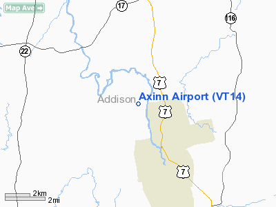
Location & QuickFacts
| FAA Information Effective: | 2008-09-25 |
| Airport Identifier: | VT14 |
| Airport Status: | Operational |
| Longitude/Latitude: | 073-11-22.4270W/44-02-42.2100N
-73.189563/44.045058 (Estimated) |
| Elevation: | 450 ft / 137.16 m (Estimated) |
| Land: | 0 acres |
| From nearest city: | 2 nautical miles S of Weybridge, VT |
| Location: | Addison County, VT |
| Magnetic Variation: | 15W (1985) |
Owner & Manager
| Ownership: | Privately owned |
| Owner: | Donald E & Joan Axinn |
| Address: | 131 Jericho Turnpike
Jericho, NY 11753 |
| Phone number: | 516-333-8500 |
| Manager: | Stephen Butler |
| Address: | P O Box 595
Middlebury, VT 05753 |
| Phone number: | 802-388-3847 |
Airport Operations and Facilities
| Airport Use: | Private
PERSONAL USE. |
| Wind indicator: | Yes |
| Segmented Circle: | No |
| Control Tower: | No |
| Sectional chart: | Montreal |
| Region: | ANE - New England |
| Boundary ARTCC: | ZBW - Boston |
| Tie-in FSS: | BTV - Burlington |
| FSS Toll Free: | 1-800-WX-BRIEF |
Runway Information
Runway 02/20
| Dimension: | 1400 x 90 ft / 426.7 x 27.4 m |
| Surface: | TURF, |
| |
Runway 02 |
Runway 20 |
| Traffic Pattern: | Left | Right |
|
Radio Navigation Aids
| ID |
Type |
Name |
Ch |
Freq |
Var |
Dist |
| R | FAN MARKER | Chitt | | | 14W | 26.3 nm |
| MPV | FAN MARKER | Brook | | | | 28.3 nm |
| DYO | NDB | Smuto | | 221.00 | 15W | 22.7 nm |
| VKN | NDB | Mount Mansfield | | 268.00 | 16W | 29.6 nm |
| JRV | NDB | Morrisville/stowe | | 375.00 | 16W | 41.2 nm |
| IVV | NDB | White River | | 379.00 | 16W | 42.8 nm |
| LAH | NDB | Hanover | | 276.00 | 15W | 48.5 nm |
| MPV | VOR/DME | Montpelier | 045X | 110.80 | 16W | 32.1 nm |
| RUT | VOR/DME | Rutland | 47X | 111.00 | 15W | 32.8 nm |
| LEB | VOR/DME | Lebanon | 084X | 113.70 | 15W | 47.6 nm |
| SLK | VOR/DME | Saranac Lake | 029X | 109.20 | 14W | 48.3 nm |
| BTV | VORTAC | Burlington | 122X | 117.50 | 15W | 21.2 nm |
| PLB | VORTAC | Plattsburgh | 116X | 116.90 | 15W | 41.0 nm |
| GFL | VORTAC | Glens Falls | 039X | 110.20 | 14W | 46.1 nm |
| BTV | VOT | Burlington Intl | | 109.00 | | 25.4 nm |
Remarks
- DAYTIME VFR USE ONLY; RY MKD & APCHS CLEARED TO 20:1.
Images and information placed above are from
http://www.airport-data.com/airport/VT14/
We thank them for the data!
| General Info
|
| Country |
United States
|
| State |
VERMONT
|
| FAA ID |
VT14
|
| Latitude |
44-02-42.210N
|
| Longitude |
073-11-22.427W
|
| Elevation |
450 feet
|
| Near City |
WEYBRIDGE
|
We don't guarantee the information is fresh and accurate. The data may
be wrong or outdated.
For more up-to-date information please refer to other sources.
|
|


