 |
|
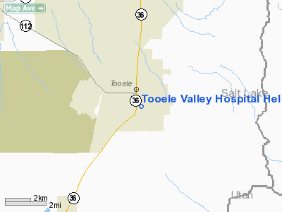
Tooele Valley Hospital Heliport |
Location & QuickFacts
| FAA Information Effective: | 2008-09-25 |
| Airport Identifier: | UT71 |
| Airport Status: | Operational |
| Longitude/Latitude: | 112-17-37.8080W/40-31-29.7990N
-112.293836/40.524944 (Estimated) |
| Elevation: | 5100 ft / 1554.48 m (Estimated) |
| Land: | 0 acres |
| From nearest city: | 0 nautical miles N of Tooele, UT |
| Location: | Tooele County, UT |
| Magnetic Variation: | 15E (1985) |
Owner & Manager
| Ownership: | Publicly owned |
| Owner: | Tooele Valley Med Ctr. |
| Address: | 211 South 1st East
Tooele, UT 84074 |
| Phone number: | 801-882-1697 |
| Manager: | Linda Neese |
| Address: | 211 South 1st East
Tooele, UT 84074 |
| Phone number: | 801-882-1697 |
Airport Operations and Facilities
| Airport Use: | Private
MEDICAL USE. |
| Wind indicator: | Yes |
| Segmented Circle: | Yes |
| Control Tower: | No |
| Sectional chart: | Salt Lake City |
| Region: | ANM - Northwest Mountain |
| Boundary ARTCC: | ZLC - Salt Lake City |
| Tie-in FSS: | CDC - Cedar City |
| FSS Toll Free: | 1-800-WX-BRIEF |
Runway Information
Helipad H1
| Dimension: | 20 x 20 ft / 6.1 x 6.1 m |
| Surface: | CONC, |
| |
Runway H1 |
Runway |
| Traffic Pattern: | Left | Left |
|
Radio Navigation Aids
| ID |
Type |
Name |
Ch |
Freq |
Var |
Dist |
| TVY | NDB | Tooele | | 371.00 | 13E | 5.7 nm |
| DPG | NDB | Dugway | | 284.00 | 15E | 36.0 nm |
| MIJ | TACAN | Michael | 079X | | 15E | 35.1 nm |
| HIF | TACAN | Hill | 049X | | 14E | 38.8 nm |
| PVU | VOR/DME | Provo | 021X | 108.40 | 15E | 32.2 nm |
| FFU | VORTAC | Fairfield | 113X | 116.60 | 16E | 22.1 nm |
| TCH | VORTAC | Wasatch | 115X | 116.80 | 16E | 24.2 nm |
| OGD | VORTAC | Ogden | 104X | 115.70 | 14E | 43.0 nm |
| SLC | VOT | Salt Lake City | | 111.00 | | 14.9 nm |
Remarks
- PROVIDED FORMER HELIPAD IS ABANDONED; APP FM NORTH AND DEPART TO SOUTH; LIGHT POLES AND WIRES ARE REMOVED; TREES TO SOUTH ARE TOPPED OR REMOVED; MARKING,LIGHTING & FENCING AS PER AC.
Images and information placed above are from
http://www.airport-data.com/airport/UT71/
We thank them for the data!
| General Info
|
| Country |
United States
|
| State |
UTAH
|
| FAA ID |
UT71
|
| Latitude |
40-31-29.799N
|
| Longitude |
112-17-37.808W
|
| Elevation |
5100 feet
|
| Near City |
TOOELE
|
We don't guarantee the information is fresh and accurate. The data may
be wrong or outdated.
For more up-to-date information please refer to other sources.
|
|


