 |
|
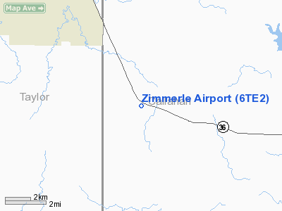
Location & QuickFacts
| FAA Information Effective: | 2008-09-25 |
| Airport Identifier: | 6TE2 |
| Airport Status: | Operational |
| Longitude/Latitude: | 099-35-52.2890W/32-16-13.4700N
-99.597858/32.270408 (Estimated) |
| Elevation: | 2057 ft / 626.97 m (Estimated) |
| Land: | 31 acres |
| From nearest city: | 14 nautical miles SE of Abilene, TX |
| Location: | Callahan County, TX |
| Magnetic Variation: | 08E (1985) |
Owner & Manager
| Ownership: | Privately owned |
| Owner: | Earl Zimmerle |
| Address: | 717e N 12th St
Abilene, TX 79601 |
| Phone number: | 915-672-9840 |
| Manager: | Earl Zimmerle |
| Address: | 717 E N 12th St
Abilene, TX 79601 |
| Phone number: | 915-672-9840 |
Airport Operations and Facilities
| Airport Use: | Private |
| Wind indicator: | Yes |
| Segmented Circle: | No |
| Control Tower: | No |
| Landing fee charge: | No |
| Sectional chart: | Dallas-ft Worth |
| Region: | ASW - Southwest |
| Boundary ARTCC: | ZFW - Fort Worth |
| Tie-in FSS: | FTW - Fort Worth |
| FSS on Airport: | No |
| FSS Phone: | 817-541-3474 |
| FSS Toll Free: | 1-800-WX-BRIEF |
Airport Services
| Airframe Repair: | NONE |
| Power Plant Repair: | NONE |
Runway Information
Runway 15/33
| Dimension: | 1200 x 100 ft / 365.8 x 30.5 m |
| Surface: | TURF, Fair Condition |
| |
Runway 15 |
Runway 33 |
| Traffic Pattern: | Right | Right |
| Obstruction: | 15 ft road | 4 ft fence, 0.0 ft from runway |
|
Radio Navigation Aids
| ID |
Type |
Name |
Ch |
Freq |
Var |
Dist |
| COM | NDB | Coleman | | 385.00 | 07E | 27.6 nm |
| IEW | NDB | Winters | | 396.00 | 08E | 27.8 nm |
| TMV | NDB | Stamford | | 290.00 | 08E | 36.6 nm |
| UBC | NDB | Ballinger | | 239.00 | 08E | 40.3 nm |
| OIP | NDB | Old Rip | | 410.00 | 07E | 40.7 nm |
| SWW | NDB | Sweetwater | | 275.00 | 08E | 45.5 nm |
| BKD | NDB | Breckenridge | | 245.00 | 07E | 45.9 nm |
| DYS | TACAN | Dyess | 063X | | 08E | 15.9 nm |
| TQA | VOR/DME | Tuscola | 053X | 111.60 | 10E | 11.3 nm |
| BWD | VOR/DME | Brownwood | 023X | 108.60 | 08E | 39.7 nm |
| ABI | VORTAC | Abilene | 084X | 113.70 | 10E | 18.5 nm |
Images and information placed above are from
http://www.airport-data.com/airport/6TE2/
We thank them for the data!
| General Info
|
| Country |
United States
|
| State |
TEXAS
|
| FAA ID |
6TE2
|
| Latitude |
32-16-13.470N
|
| Longitude |
099-35-52.289W
|
| Elevation |
2057 feet
|
| Near City |
ABILENE
|
We don't guarantee the information is fresh and accurate. The data may
be wrong or outdated.
For more up-to-date information please refer to other sources.
|
|


