 |
|
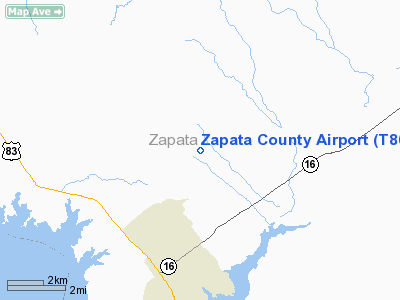
Location & QuickFacts
| FAA Information Effective: | 2008-09-25 |
| Airport Identifier: | T86 |
| Airport Status: | Operational |
| Longitude/Latitude: | 099-14-56.0700W/26-58-07.6300N
-99.248908/26.968786 (Estimated) |
| Elevation: | 422 ft / 128.63 m (Surveyed) |
| Land: | 66 acres |
| From nearest city: | 4 nautical miles NE of Zapata, TX |
| Location: | Zapata County, TX |
| Magnetic Variation: | 08E (1985) |
Owner & Manager
| Ownership: | Publicly owned |
| Owner: | Zapata County |
| Address: | Po Box 99
Zapata, TX 78076 |
| Phone number: | 956-765-9920 |
| Manager: | Charlie Avaritt |
| Address: | Po Box 99
Zapata, TX 78076 |
| Phone number: | 956-765-9794 |
Airport Operations and Facilities
| Airport Use: | Open to public |
| Wind indicator: | Yes |
| Segmented Circle: | Yes |
| Control Tower: | No |
| Lighting Schedule: | DUSK-DAWN
MIRL RY 12/30 PRESET MED INTST; TO INCR INTST ACTVT - CTAF. |
| Beacon Color: | Clear-Green (lighted land airport) |
| Sectional chart: | Brownsville |
| Region: | ASW - Southwest |
| Boundary ARTCC: | ZHU - Houston |
| Tie-in FSS: | SJT - San Angelo |
| FSS Toll Free: | 1-800-WX-BRIEF |
| NOTAMs Facility: | SJT (NOTAM-d service avaliable) |
Airport Communications
| CTAF: | 122.700 |
| Unicom: | 122.700 |
Airport Services
Runway Information
Runway 12/30
| Dimension: | 5000 x 60 ft / 1524.0 x 18.3 m |
| Surface: | ASPH, Good Condition |
| Weight Limit: | Single wheel: 12500 lbs. |
| Edge Lights: | Medium |
| |
Runway 12 |
Runway 30 |
| Longitude: | 099-15-17.4080W | 099-14-34.7270W |
| Latitude: | 26-58-23.3460N | 26-57-51.9030N |
| Elevation: | 421.00 ft | 408.00 ft |
| Alignment: | 127 | 127 |
| Traffic Pattern: | Left | Left |
| Markings: | Non-precision instrument, Good Condition | Non-precision instrument, Good Condition |
| Displaced threshold: | 112.00 ft | 113.00 ft |
| Obstruction: | 3 ft fence, 204.0 ft from runway, 1:1 slope to clear
APCH RATIO 25:1 FM DSPLCD THR TO +16 FT TREES 125 FT LEFT AT 400 FT. | 12 ft trees, 200.0 ft from runway, 120L/ ft right of centerline
APCH RATIO 21:1 FM DSPLCD THLD TO +15 FT TREE 145 FT LEFT AT 315 FT. |
|
Radio Navigation Aids
| ID |
Type |
Name |
Ch |
Freq |
Var |
Dist |
| HBV | NDB | Hebbronville | | 266.00 | 06E | 35.6 nm |
| SNE | NDB | Santa Elena | | 260.00 | 07E | 39.0 nm |
| NLD | VOR/DME | Nuevo Laredo | 073X | 112.60 | 09E | 32.7 nm |
| LRD | VORTAC | Laredo | 121X | 117.40 | 09E | 32.0 nm |
Remarks
- FOR SVC CALL 956-765-9794 BTN 0800-1800.
Images and information placed above are from
http://www.airport-data.com/airport/T86/
We thank them for the data!
| General Info
|
| Country |
United States
|
| State |
TEXAS
|
| FAA ID |
T86
|
| Latitude |
26-58-07.630N
|
| Longitude |
099-14-56.070W
|
| Elevation |
422 feet
|
| Near City |
ZAPATA
|
We don't guarantee the information is fresh and accurate. The data may
be wrong or outdated.
For more up-to-date information please refer to other sources.
|
|


