 |
|
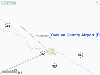
Location & QuickFacts
| FAA Information Effective: | 2008-09-25 |
| Airport Identifier: | F98 |
| Airport Status: | Operational |
| Longitude/Latitude: | 102-49-48.3469W/33-13-02.2519N
-102.830096/33.217292 (Estimated) |
| Elevation: | 3704 ft / 1128.98 m (Estimated) |
| Land: | 417 acres |
| From nearest city: | 1 nautical miles NW of Plains, TX |
| Location: | Yoakum County, TX |
| Magnetic Variation: | 07E (2010) |
Owner & Manager
| Ownership: | Publicly owned |
| Owner: | Yoakum County |
| Address: | Yoakum Co. Courthouse
Plains, TX 79355 |
| Phone number: | 806-456-7491 |
| Manager: | Jack Cobb |
| Address: | Box 10
Plains, TX 79355 |
| Phone number: | 806-456-3580 |
Airport Operations and Facilities
| Airport Use: | Open to public |
| Wind indicator: | Yes |
| Segmented Circle: | Yes |
| Control Tower: | No |
| Lighting Schedule: | DUSK-DAWN
MIRL RYS 03/21 & 17/35 PRESET LOW INTST; TO INCR INTST ACTVT - CTAF. |
| Beacon Color: | Clear-Green (lighted land airport) |
| Landing fee charge: | No |
| Sectional chart: | Albuquerque |
| Region: | ASW - Southwest |
| Boundary ARTCC: | ZFW - Fort Worth |
| Tie-in FSS: | FTW - Fort Worth |
| FSS on Airport: | No |
| FSS Phone: | 817-541-3474 |
| FSS Toll Free: | 1-800-WX-BRIEF |
| NOTAMs Facility: | FTW (NOTAM-d service avaliable) |
| Federal Agreements: | 1 |
Airport Communications
Airport Services
| Fuel available: | 100LL
FOR FUEL CALL 806-456-3580/2100/7452. |
| Airframe Repair: | MINOR |
| Power Plant Repair: | MINOR |
| Bottled Oxygen: | NONE |
| Bulk Oxygen: | NONE |
Runway Information
Runway 03/21
| Dimension: | 5001 x 75 ft / 1524.3 x 22.9 m |
| Surface: | ASPH, |
| Edge Lights: | Medium |
| |
Runway 03 |
Runway 21 |
| Longitude: | 102-49-56.0360W | 102-49-17.9810W |
| Latitude: | 33-12-44.2570N | 33-13-22.0000N |
| Elevation: | 3676.00 ft | 3704.00 ft |
| Alignment: | 40 | 127 |
| Traffic Pattern: | Left | Left |
| Markings: | Non-precision instrument, Good Condition | Non-precision instrument, Good Condition |
| Crossing Height: | 30.00 ft | 30.00 ft |
| VASI: | 2-light PAPI on left side | 2-light PAPI on left side |
| Visual Glide Angle: | 3.00° | 3.00° |
| Obstruction: | , 50:1 slope to clear | 35 ft pole, 1400.0 ft from runway, 125 ft left of centerline, 34:1 slope to clear |
|
Runway 17/35
| Dimension: | 3925 x 60 ft / 1196.3 x 18.3 m |
| Surface: | ASPH, |
| Weight Limit: | Single wheel: 12500 lbs. |
| Edge Lights: | Medium |
| |
Runway 17 |
Runway 35 |
| Longitude: | 102-50-02.6123W | 102-50-02.9751W |
| Latitude: | 33-13-20.5556N | 33-12-41.7144N |
| Elevation: | 3687.00 ft | 3679.00 ft |
| Alignment: | 127 | 127 |
| Traffic Pattern: | Left | Left |
| Markings: | Basic, Fair Condition | Basic, Fair Condition |
| Crossing Height: | 24.00 ft | 26.00 ft |
| VASI: | 2-light PAPI on left side | 2-light PAPI on left side |
| Visual Glide Angle: | 3.15° | 3.15° |
| Obstruction: | 4 ft fence, 200.0 ft from runway, 109 ft left of centerline
RY 17 4 FT FENCE 109 FT L. | 30 ft pole, 1075.0 ft from runway, 75 ft right of centerline, 29:1 slope to clear
+4 FT BRUSH 0-200 FT 125 FEET RIGHT. |
|
Radio Navigation Aids
| ID |
Type |
Name |
Ch |
Freq |
Var |
Dist |
| LLN | NDB | Levelland | | 266.00 | 09E | 30.6 nm |
| BFE | NDB | Brownfield | | 311.00 | 09E | 32.2 nm |
| GNC | NDB | Gaines County | | 344.00 | 09E | 34.1 nm |
| LIU | NDB | Littlefield | | 212.00 | 10E | 47.7 nm |
| HOB | VORTAC | Hobbs | 047X | 111.00 | 11E | 41.3 nm |
Images and information placed above are from
http://www.airport-data.com/airport/F98/
We thank them for the data!
| General Info
|
| Country |
United States
|
| State |
TEXAS
|
| FAA ID |
F98
|
| Latitude |
33-12-53.368N
|
| Longitude |
102-50-02.761W
|
| Elevation |
3678 feet
|
| Near City |
PLAINS
|
We don't guarantee the information is fresh and accurate. The data may
be wrong or outdated.
For more up-to-date information please refer to other sources.
|
|


