 |
|
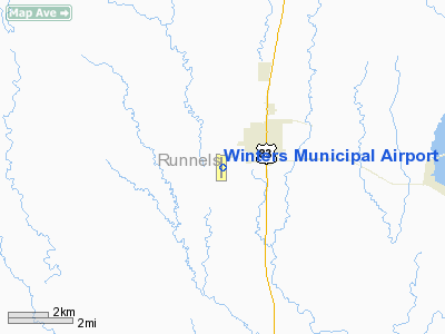
Location & QuickFacts
| FAA Information Effective: | 2008-09-25 |
| Airport Identifier: | 77F |
| Airport Status: | Operational |
| Longitude/Latitude: | 099-59-09.0602W/31-56-49.8991N
-99.985850/31.947194 (Estimated) |
| Elevation: | 1871 ft / 570.28 m (Surveyed) |
| Land: | 48 acres |
| From nearest city: | 2 nautical miles SW of Winters, TX |
| Location: | Runnels County, TX |
| Magnetic Variation: | 08E (1980) |
Owner & Manager
| Ownership: | Publicly owned |
| Owner: | City Of Winters |
| Address: | 310 S Main
Winters, TX 79567 |
| Phone number: | 325-754-4424 |
| Manager: | Wes Hayes
CITY ADMINISTRATOR. |
| Address: | 606 State St.
Winters, TX 79567 |
| Phone number: | 325-754-4424 |
Airport Operations and Facilities
| Airport Use: | Open to public |
| Wind indicator: | Yes |
| Segmented Circle: | Yes |
| Control Tower: | No |
| Lighting Schedule: | DUSK-DAWN |
| Beacon Color: | Clear-Green (lighted land airport) |
| Landing fee charge: | No |
| Sectional chart: | San Antonio |
| Region: | ASW - Southwest |
| Boundary ARTCC: | ZFW - Fort Worth |
| Tie-in FSS: | SJT - San Angelo |
| FSS on Airport: | No |
| FSS Toll Free: | 1-800-WX-BRIEF |
| NOTAMs Facility: | SJT (NOTAM-d service avaliable) |
Airport Communications
Airport Services
Runway Information
Runway 17/35
| Dimension: | 3204 x 40 ft / 976.6 x 12.2 m |
| Surface: | ASPH, Good Condition |
| Weight Limit: | Single wheel: 12000 lbs. |
| Edge Lights: | Low |
| |
Runway 17 |
Runway 35 |
| Longitude: | 099-59-08.9346W | 099-59-09.1857W |
| Latitude: | 31-57-05.7524N | 31-56-34.0458N |
| Elevation: | 1866.00 ft | 1871.00 ft |
| Alignment: | 127 | 0 |
| Traffic Pattern: | Left | Left |
| Markings: | Basic, Good Condition | Non-precision instrument, Good Condition |
| Obstruction: | 5 ft fence, 200.0 ft from runway, 243 ft right of centerline
+5 FT FENCE 243 FT RIGHT OF CNTRLN AT THLD. | 4 ft fence, 200.0 ft from runway, 200 ft left of centerline
+4 FT FENCE 200 FT LEFT OF CNTRLN AT THLD. |
|
Radio Navigation Aids
| ID |
Type |
Name |
Ch |
Freq |
Var |
Dist |
| IEW | NDB | Winters | | 396.00 | 08E | 0.1 nm |
| UBC | NDB | Ballinger | | 239.00 | 08E | 16.0 nm |
| COM | NDB | Coleman | | 385.00 | 07E | 30.3 nm |
| SWW | NDB | Sweetwater | | 275.00 | 08E | 39.4 nm |
| DYS | TACAN | Dyess | 063X | | 08E | 29.1 nm |
| TQA | VOR/DME | Tuscola | 053X | 111.60 | 10E | 19.4 nm |
| ABI | VORTAC | Abilene | 084X | 113.70 | 10E | 32.7 nm |
| SJT | VORTAC | San Angelo | 098X | 115.10 | 10E | 41.9 nm |
Remarks
- 4 FT PROPERTY LINE FENCE 200-250 FT WEST OF RY.
Images and information placed above are from
http://www.airport-data.com/airport/77F/
We thank them for the data!
| General Info
|
| Country |
United States
|
| State |
TEXAS
|
| FAA ID |
77F
|
| Latitude |
31-56-49.899N
|
| Longitude |
099-59-09.060W
|
| Elevation |
1871 feet
|
| Near City |
WINTERS
|
We don't guarantee the information is fresh and accurate. The data may
be wrong or outdated.
For more up-to-date information please refer to other sources.
|
|


