 |
|
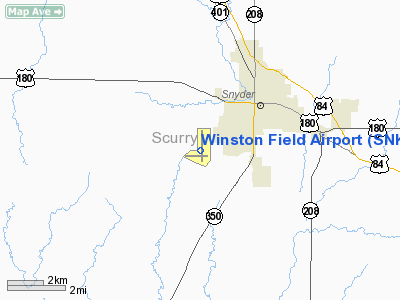
Location & QuickFacts
| FAA Information Effective: | 2008-09-25 |
| Airport Identifier: | SNK |
| Airport Status: | Operational |
| Longitude/Latitude: | 100-57-01.7000W/32-41-36.2000N
-100.950472/32.693389 (Estimated) |
| Elevation: | 2430 ft / 740.66 m (Surveyed) |
| Land: | 314 acres |
| From nearest city: | 2 nautical miles SW of Snyder, TX |
| Location: | Scurry County, TX |
| Magnetic Variation: | 08E (1990) |
Owner & Manager
| Ownership: | Publicly owned |
| Owner: | Scurry County |
| Address: | Courthouse
Snyder, TX 79549 |
| Phone number: | 325-573-5332 |
| Manager: | Rodger Sullenger |
| Address: | 2757 Round Rock Avenue
Snyder, TX 79549 |
| Phone number: | 325-573-1122 |
Airport Operations and Facilities
| Airport Use: | Open to public |
| Wind indicator: | Yes |
| Segmented Circle: | Yes |
| Control Tower: | No |
| Lighting Schedule: | DUSK-DAWN
MIRL RY 17/35 PRESET LOW INTST; TO INCR INTST & ACTVT PAPI RYS 17 & 35 - CTAF. |
| Beacon Color: | Clear-Green (lighted land airport) |
| Landing fee charge: | No |
| Sectional chart: | Dallas-ft Worth |
| Region: | ASW - Southwest |
| Traffic Pattern Alt: | 1000 ft |
| Boundary ARTCC: | ZFW - Fort Worth |
| Tie-in FSS: | FTW - Fort Worth |
| FSS on Airport: | No |
| FSS Phone: | 817-541-3474 |
| FSS Toll Free: | 1-800-WX-BRIEF |
| NOTAMs Facility: | SNK (NOTAM-d service avaliable) |
| Federal Agreements: | NGY |
Airport Communications
| CTAF: | 122.800 |
| Unicom: | 122.800 |
Airport Services
| Fuel available: | 100LLA1
FOR FUEL AFT HRS CALL 325-573-9506; FEE CHARGED. |
| Bottled Oxygen: | NONE |
| Bulk Oxygen: | NONE |
Runway Information
Runway 08/26
| Dimension: | 4200 x 75 ft / 1280.2 x 22.9 m |
| Surface: | ASPH, Fair Condition |
| Weight Limit: | Single wheel: 24000 lbs. |
| |
Runway 08 |
Runway 26 |
| Longitude: | 100-57-34.0050W | 100-56-44.8755W |
| Latitude: | 32-41-25.1949N | 32-41-24.9369N |
| Elevation: | 2376.00 ft | 2430.00 ft |
| Alignment: | 90 | 127 |
| Traffic Pattern: | Right | Left |
| Markings: | Basic, Fair Condition | Basic, Fair Condition |
| Obstruction: | 12 ft trees, 360.0 ft from runway, 100 ft right of centerline, 13:1 slope to clear | , 50:1 slope to clear |
|
Runway 17/35
| Dimension: | 5599 x 100 ft / 1706.6 x 30.5 m |
| Surface: | ASPH, Fair Condition |
| Weight Limit: | Single wheel: 24000 lbs. |
| Edge Lights: | Medium |
| |
Runway 17 |
Runway 35 |
| Longitude: | 100-56-55.6625W | 100-56-56.0450W |
| Latitude: | 32-42-12.2429N | 32-41-16.8468N |
| Elevation: | 2418.00 ft | 2426.00 ft |
| Alignment: | 127 | 0 |
| Traffic Pattern: | Right | Left |
| Markings: | Non-precision instrument, Fair Condition | Non-precision instrument, Fair Condition |
| Crossing Height: | 35.00 ft | 40.00 ft |
| VASI: | 4-light PAPI on right side | 4-light PAPI on left side |
| Visual Glide Angle: | 3.00° | 3.00° |
| Runway End Identifier: | Yes | Yes |
| Obstruction: | 16 ft pole, 480.0 ft from runway, 200 ft right of centerline, 17:1 slope to clear | , 50:1 slope to clear |
|
Radio Navigation Aids
| ID |
Type |
Name |
Ch |
Freq |
Var |
Dist |
| SDR | NDB | Snyder | | 359.00 | 08E | 0.5 nm |
| SWW | NDB | Sweetwater | | 275.00 | 08E | 28.2 nm |
| LSA | NDB | Lamesa | | 338.00 | 09E | 49.0 nm |
| BGS | VORTAC | Big Spring | 090X | 114.30 | 11E | 32.7 nm |
Images and information placed above are from
http://www.airport-data.com/airport/SNK/
We thank them for the data!
| General Info
|
| Country |
United States
|
| State |
TEXAS
|
| FAA ID |
SNK
|
| Latitude |
32-41-36.192N
|
| Longitude |
100-57-01.629W
|
| Elevation |
2430 feet
|
| Near City |
SNYDER
|
We don't guarantee the information is fresh and accurate. The data may
be wrong or outdated.
For more up-to-date information please refer to other sources.
|
|


