 |
|
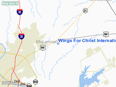
Wings For Christ Intl Flight Academy Airport |
Location & QuickFacts
| FAA Information Effective: | 2008-09-25 |
| Airport Identifier: | 73F |
| Airport Status: | Operational |
| Longitude/Latitude: | 097-01-20.9910W/31-37-25.5950N
-97.022498/31.623776 (Estimated) |
| Elevation: | 455 ft / 138.68 m (Estimated) |
| Land: | 12 acres |
| From nearest city: | 8 nautical miles NE of Waco, TX |
| Location: | Mc Lennan County, TX |
| Magnetic Variation: | 07E (1985) |
Owner & Manager
| Ownership: | Privately owned |
| Owner: | Wings For Christ Intl Flight
ACADEMY. |
| Address: | Rt 4 Box 825d
Waco, TX 76705 |
| Phone number: | 254-799-4059 |
| Manager: | Mike Majors |
| Address: | 304 Stallion Road
Waco, TX 78712 |
| Phone number: | 254-399-9229 |
Airport Operations and Facilities
| Airport Use: | Open to public |
| Wind indicator: | Yes |
| Segmented Circle: | No |
| Control Tower: | No |
| Lighting Schedule: | RDO-CTL
ACTVT LIRL RY 16/34 - CTAF. |
| Landing fee charge: | No |
| Sectional chart: | San Antonio |
| Region: | ASW - Southwest |
| Boundary ARTCC: | ZFW - Fort Worth |
| Tie-in FSS: | FTW - Fort Worth |
| FSS on Airport: | No |
| FSS Phone: | 817-541-3474 |
| FSS Toll Free: | 1-800-WX-BRIEF |
| NOTAMs Facility: | FTW (NOTAM-d service avaliable) |
Airport Communications
Airport Services
| Airframe Repair: | NONE |
| Power Plant Repair: | NONE |
Runway Information
Runway 16/34
| Dimension: | 3000 x 80 ft / 914.4 x 24.4 m |
| Surface: | TURF, Good Condition |
| Edge Lights: | Non-standard lighting system
NSTD LIRL DUE TO COLOR. |
| |
Runway 16 |
Runway 34 |
| Traffic Pattern: | Left | Right |
| Displaced threshold: | 315.00 ft | 0.00 ft |
| Obstruction: | 10 ft road, 89.0 ft from runway, 8:1 slope to clear
APCH SLOPE 25:1 TO ROAD 25 FT ABOVE RY, ACROSS THE APCH, 640 FT FROM THE DSPLCD THLD. | 32 ft tree, 88.0 ft from runway, 90 ft right of centerline, 2:1 slope to clear |
|
Radio Navigation Aids
| ID |
Type |
Name |
Ch |
Freq |
Var |
Dist |
| ROB | NDB | Robinson | | 400.00 | 07E | 7.6 nm |
| LXY | NDB | Mexia | | 329.00 | 07E | 26.1 nm |
| CRS | NDB | Corsicana | | 396.00 | 06E | 40.2 nm |
| CGQ | NDB | Powell | | 344.00 | 06E | 40.3 nm |
| PYF | NDB | Pyramid | | 418.00 | 06E | 44.5 nm |
| HLR | NDB | Hood | | 347.00 | 07E | 46.2 nm |
| GNL | VOR/DME | Groesbeck | 025X | 108.80 | 05E | 24.4 nm |
| TPL | VOR/DME | Temple | 041X | 110.40 | 09E | 32.4 nm |
| ACT | VORTAC | Waco | 100X | 115.30 | 09E | 12.8 nm |
Remarks
- +4 FT FENCE ALONG BOTH SIDES OF RY 70 FT FM CNTRLN SOUTH HALF OF RY.
- TRAFFIC PATTERNS & COMMS AGREEMENTS COMPATIBLE WITH JAMES CONNALLY ARPT.
Images and information placed above are from
http://www.airport-data.com/airport/73F/
We thank them for the data!
| General Info
|
| Country |
United States
|
| State |
TEXAS
|
| FAA ID |
73F
|
| Latitude |
31-37-25.595N
|
| Longitude |
097-01-20.991W
|
| Elevation |
455 feet
|
| Near City |
WACO
|
We don't guarantee the information is fresh and accurate. The data may
be wrong or outdated.
For more up-to-date information please refer to other sources.
|
|


