 |
|
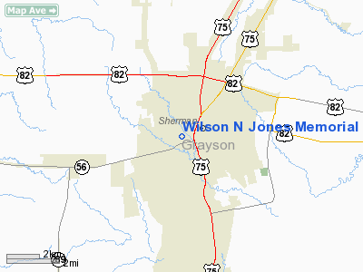
Wilson N Jones Memorial Hospital Heliport |
Location & QuickFacts
| FAA Information Effective: | 2008-09-25 |
| Airport Identifier: | 51TS |
| Airport Status: | Operational |
| Longitude/Latitude: | 096-37-27.4800W/33-38-13.9900N
-96.624300/33.637219 (Estimated) |
| Elevation: | 770 ft / 234.70 m (Estimated) |
| Land: | 0 acres |
| From nearest city: | 0 nautical miles N of Sherman, TX |
| Location: | Grayson County, TX |
| Magnetic Variation: | 07E (1980) |
Owner & Manager
| Ownership: | Privately owned |
| Owner: | Wilson N Jones Mem Hospital |
| Address: | 500 N Highland P O Box 1258
Sherman, TX 75090 |
| Phone number: | 903-870-4111 |
| Manager: | Weldon Mc Laughin |
| Address: | 500 N Highland P O Box 1258
Sherman, TX 75090 |
| Phone number: | 903-870-4111 |
Airport Operations and Facilities
| Airport Use: | Private
MEDICAL. |
| Wind indicator: | Yes |
| Segmented Circle: | No |
| Control Tower: | No |
| Lighting Schedule: | DUSK-DAWN |
| Beacon Color: | Clear-Green-Yellow (heliport) |
| Sectional chart: | Dallas-ft Worth |
| Region: | ASW - Southwest |
| Boundary ARTCC: | ZFW - Fort Worth |
| Tie-in FSS: | FTW - Fort Worth |
| FSS Phone: | 817-541-3474 |
| FSS Toll Free: | 1-800-WX-BRIEF |
Runway Information
Helipad H1
| Dimension: | 30 x 30 ft / 9.1 x 9.1 m |
| Surface: | CONC,
ROOFTOP HELIPAD. |
| |
Runway H1 |
Runway |
| Traffic Pattern: | Left | Left |
|
Radio Navigation Aids
| ID |
Type |
Name |
Ch |
Freq |
Var |
Dist |
| DNI | NDB | Denison | | 341.00 | 06E | 11.5 nm |
| DUA | NDB | Durant | | 359.00 | 05E | 21.5 nm |
| HJM | NDB | Rayburn | | 415.00 | 06E | 22.5 nm |
| GLE | NDB | Gainesville | | 330.00 | 06E | 29.1 nm |
| AUV | NDB | Arbuckle | | 284.00 | 07E | 39.7 nm |
| MII | NDB | Caddo Mills | | 316.00 | 06E | 40.5 nm |
| SYW | NDB | Cash | | 428.00 | 05E | 48.3 nm |
| PQF | NDB | Mesquite | | 248.00 | 06E | 50.0 nm |
| MJF | TACAN | Arvilla | 033X | | 05E | 44.5 nm |
| URH | VOR/DME | Texoma | 090X | 114.30 | 05E | 21.8 nm |
| CVE | VOR/DME | Cowboy | 109X | 116.20 | 06E | 47.0 nm |
| BYP | VORTAC | Bonham | 093X | 114.60 | 06E | 20.4 nm |
| ADM | VORTAC | Ardmore | 114X | 116.70 | 06E | 43.9 nm |
| DAL | VOT | Dallas Love Field | | 113.30 | | 48.8 nm |
Images and information placed above are from
http://www.airport-data.com/airport/51TS/
We thank them for the data!
| General Info
|
| Country |
United States
|
| State |
TEXAS
|
| FAA ID |
51TS
|
| Latitude |
33-38-15.382N
|
| Longitude |
096-37-26.971W
|
| Elevation |
788 feet
|
| Near City |
SHERMAN
|
We don't guarantee the information is fresh and accurate. The data may
be wrong or outdated.
For more up-to-date information please refer to other sources.
|
|


