 |
|
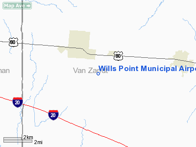
Location & QuickFacts
| FAA Information Effective: | 2008-09-25 |
| Airport Identifier: | 76F |
| Airport Status: | Operational |
| Longitude/Latitude: | 095-59-02.8840W/32-40-53.4670N
-95.984134/32.681519 (Estimated) |
| Elevation: | 518 ft / 157.89 m (Surveyed) |
| Land: | 78 acres |
| From nearest city: | 3 nautical miles SE of Wills Point, TX |
| Location: | Van Zandt County, TX |
| Magnetic Variation: | 06E (1985) |
Owner & Manager
| Ownership: | Publicly owned |
| Owner: | City Of Wills Point |
| Address: | Po Box 505
Wills Point, TX 75169 |
| Phone number: | 903-873-2578 |
| Manager: | Jim Stephens, City Mgr |
| Address: | Po Box 505
Wills Point, TX 75169 |
| Phone number: | 903-873-2578 |
Airport Operations and Facilities
| Airport Use: | Open to public |
| Wind indicator: | Yes |
| Segmented Circle: | Yes |
| Control Tower: | No |
| Lighting Schedule: | DUSK-DAWN |
| Beacon Color: | Clear-Green (lighted land airport) |
| Landing fee charge: | No |
| Sectional chart: | Dallas-ft Worth |
| Region: | ASW - Southwest |
| Boundary ARTCC: | ZFW - Fort Worth |
| Tie-in FSS: | FTW - Fort Worth |
| FSS on Airport: | No |
| FSS Phone: | 817-541-3474 |
| FSS Toll Free: | 1-800-WX-BRIEF |
| NOTAMs Facility: | FTW (NOTAM-d service avaliable) |
Airport Communications
Airport Services
| Airframe Repair: | MINOR
AIRFRAME & POWER PLANT REPAIRS BY PRIOR ARRANGEMENT, CALL 903-873-2578. |
| Power Plant Repair: | MINOR |
| Bottled Oxygen: | NONE |
| Bulk Oxygen: | NONE |
Runway Information
Runway 17/35
| Dimension: | 3230 x 50 ft / 984.5 x 15.2 m |
| Surface: | ASPH, Good Condition |
| Weight Limit: | Single wheel: 12000 lbs. |
| Edge Lights: | Low |
| |
Runway 17 |
Runway 35 |
| Traffic Pattern: | Left | Left |
| Markings: | Basic, Poor Condition
RYS 17 & 35 NUMBERS ARE EXTREMELY FADED AND DIFFICULT TO READ. | Basic, Poor Condition |
| Obstruction: | 35 ft tree, 844.0 ft from runway, 232 ft left of centerline, 18:1 slope to clear | , 50:1 slope to clear |
|
Radio Navigation Aids
| ID |
Type |
Name |
Ch |
Freq |
Var |
Dist |
| AVZ | NDB | Travis | | 260.00 | 06E | 14.2 nm |
| SYW | NDB | Cash | | 428.00 | 05E | 18.5 nm |
| MII | NDB | Caddo Mills | | 316.00 | 06E | 25.4 nm |
| JUG | NDB | Jecca | | 388.00 | 06E | 27.7 nm |
| PQF | NDB | Mesquite | | 248.00 | 06E | 28.6 nm |
| TY | NDB | Tyler | | 320.00 | 06E | 30.6 nm |
| AHX | NDB | Athens | | 269.00 | 06E | 32.3 nm |
| CSZ | NDB | Crossroads | | 215.00 | 08E | 37.2 nm |
| LNC | NDB | Lancaster | | 239.00 | 06E | 37.9 nm |
| LIQ | NDB | Lochridge Ranch | | 335.00 | 09E | 40.4 nm |
| CGQ | NDB | Powell | | 344.00 | 06E | 43.4 nm |
| ABG | NDB | Ambassador | | 404.00 | 07E | 44.5 nm |
| CRS | NDB | Corsicana | | 396.00 | 06E | 44.5 nm |
| RBD | NDB | Redbird | | 287.00 | 06E | 44.9 nm |
| MJF | TACAN | Arvilla | 033X | | 05E | 23.5 nm |
| UIM | VOR/DME | Quitman | 087X | 114.00 | 08E | 33.4 nm |
| TYR | VOR/DME | Tyler | 089X | 114.20 | 06E | 35.3 nm |
| SLR | VOR/DME | Sulphur Springs | 027X | 109.00 | 08E | 38.2 nm |
| FZT | VOR/DME | Frankston | 051X | 111.40 | 06E | 43.1 nm |
| CVE | VOR/DME | Cowboy | 109X | 116.20 | 06E | 48.1 nm |
| CQY | VORTAC | Cedar Creek | 095X | 114.80 | 06E | 32.1 nm |
| DAL | VOT | Dallas Love Field | | 113.30 | | 45.0 nm |
Images and information placed above are from
http://www.airport-data.com/airport/76F/
We thank them for the data!
| General Info
|
| Country |
United States
|
| State |
TEXAS
|
| FAA ID |
76F
|
| Latitude |
32-40-53.467N
|
| Longitude |
095-59-02.884W
|
| Elevation |
518 feet
|
| Near City |
WILLS POINT
|
We don't guarantee the information is fresh and accurate. The data may
be wrong or outdated.
For more up-to-date information please refer to other sources.
|
|


