|
|
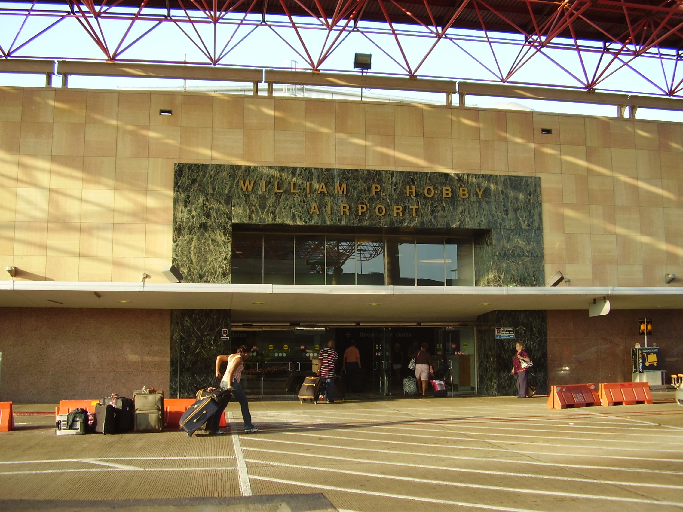
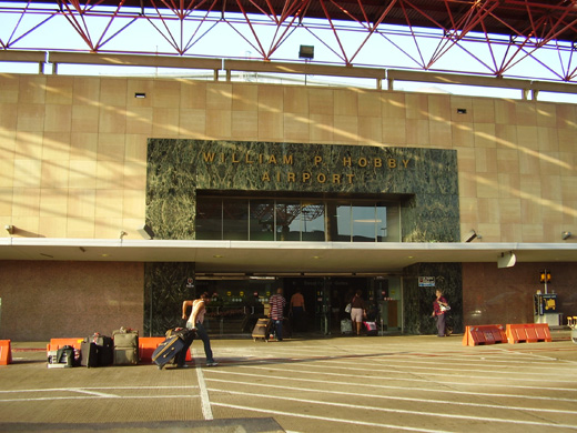
William P. Hobby Airport
Houston Hobby |
 |
 |
| IATA: HOU – ICAO: KHOU – FAA LID: HOU
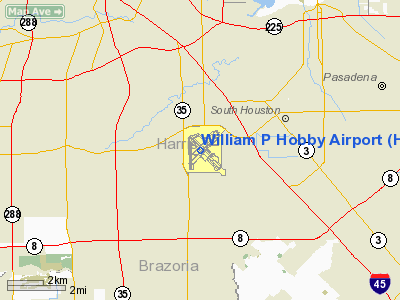
Location of the William P. Hobby Airport
|
| Summary |
| Owner |
City of Houston |
| Operator |
Houston Airport System |
| Serves |
Houston, Texas, United States |
| Location |
Houston, Texas, United States |
| Elevation AMSL |
46 ft / 14 m |
| Coordinates |
29°38′44″N 95°16′44″W / 29.64556°N 95.27889°W / 29.64556; -95.27889 |
| Website |
fly2houston.com/hobbyHome |
| Runways |
| Direction |
Length |
Surface |
| ft |
m |
| 4/22 |
7,602 |
2,317 |
Concrete |
| 12L/30R |
5,148 |
1,569 |
Concrete |
| 12R/30L |
7,602 |
2,317 |
Asphalt |
| 17/35 |
6,000 |
1,829 |
Asphalt/Concrete |
| Statistics (2006) |
| Aircraft operations |
236,637 |
| Based aircraft |
292 |
| Air carrier/taxi |
154,621 |
| General aviation |
81,791 |
| Source: Federal Aviation Administration
|
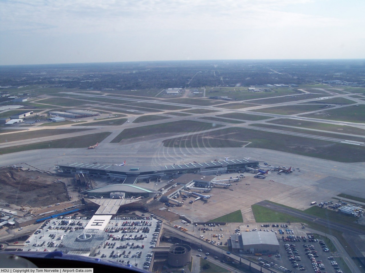
William P. Hobby Airport (IATA: HOU, ICAO: KHOU, FAA LID: HOU) is a public airport located 8 miles (13 km) southeast of the central business district of Houston, Texas, United States. The airport covers 1,304 acres (5.3 km²) and has four runways. Hobby Airport is Houston's oldest commercial airport and was the city's primary air terminal until the opening of Houston Intercontinental Airport (now George Bush Intercontinental Airport) in 1969. Hobby serves the city as a secondary airport handling domestic service and is a regional center for corporate and private aviation. The airport is home of the 1940 Air Terminal Museum which houses a collection in the original art deco building which served as the first terminal for passenger flight in Houston. It currently serves as a focus city for Southwest Airlines. History
 | |
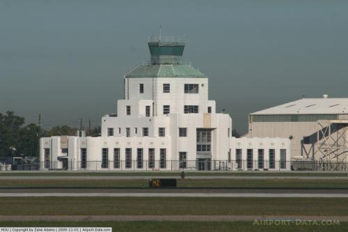
The 1940 Air Terminal Museum, originally an air terminal opened in 1940 |
Hobby Airport began service in 1927 as a private landing field in a 600 acre (2.4 km²) pasture known as W.T. Carter Field. The airfield was served by Braniff and Eastern Airlines. The site was acquired by the City of Houston and was named Houston Municipal Airport in 1937. The airport was renamed Howard R. Hughes Airport in 1938. Howard Hughes was responsible for several improvements to the airport, including its first control tower, built in 1938. The airport's name was changed back to Houston Municipal because Hughes was living at the time and regulations did not allow federal improvement funds for an airport named after a living person.
The City of Houston opened and dedicated a new air terminal and hangar in 1940.
In 1950, Pan Am initiated a Houston-Mexico City flight. In 1954, a new and expanded terminal building was opened to support the 53,640 airline flights that carried 910,047 passengers. The airport was renamed to Houston International Airport the same year.
In 1957, the first scheduled turbojet aircraft were utilized in service to the airport. KLM started Amsterdam operations in 1957. KLM later moved to Houston Intercontinental Airport (now George Bush Intercontinental Airport), where it remains today.
In 1967, the airport was renamed after former Texas governor William P. Hobby.
Houston Intercontinental Airport (now George Bush Intercontinental Airport) was built in 1969 because of expansion limitations at Hobby. All commercial aviation operations at Hobby were moved to Houston Intercontinental. The Civil Aeronautics Administration recommended years earlier that Houston begin to plan to replace Hobby, since the airport was inadequate for the new aviation travel market.
Hobby was reopened to commercial aviation in 1971. In 2008 the airport handled 8.8 million passengers [1]. Only US destinations and international destinations with border preclearance are served.
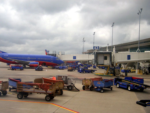
Operations
 | |
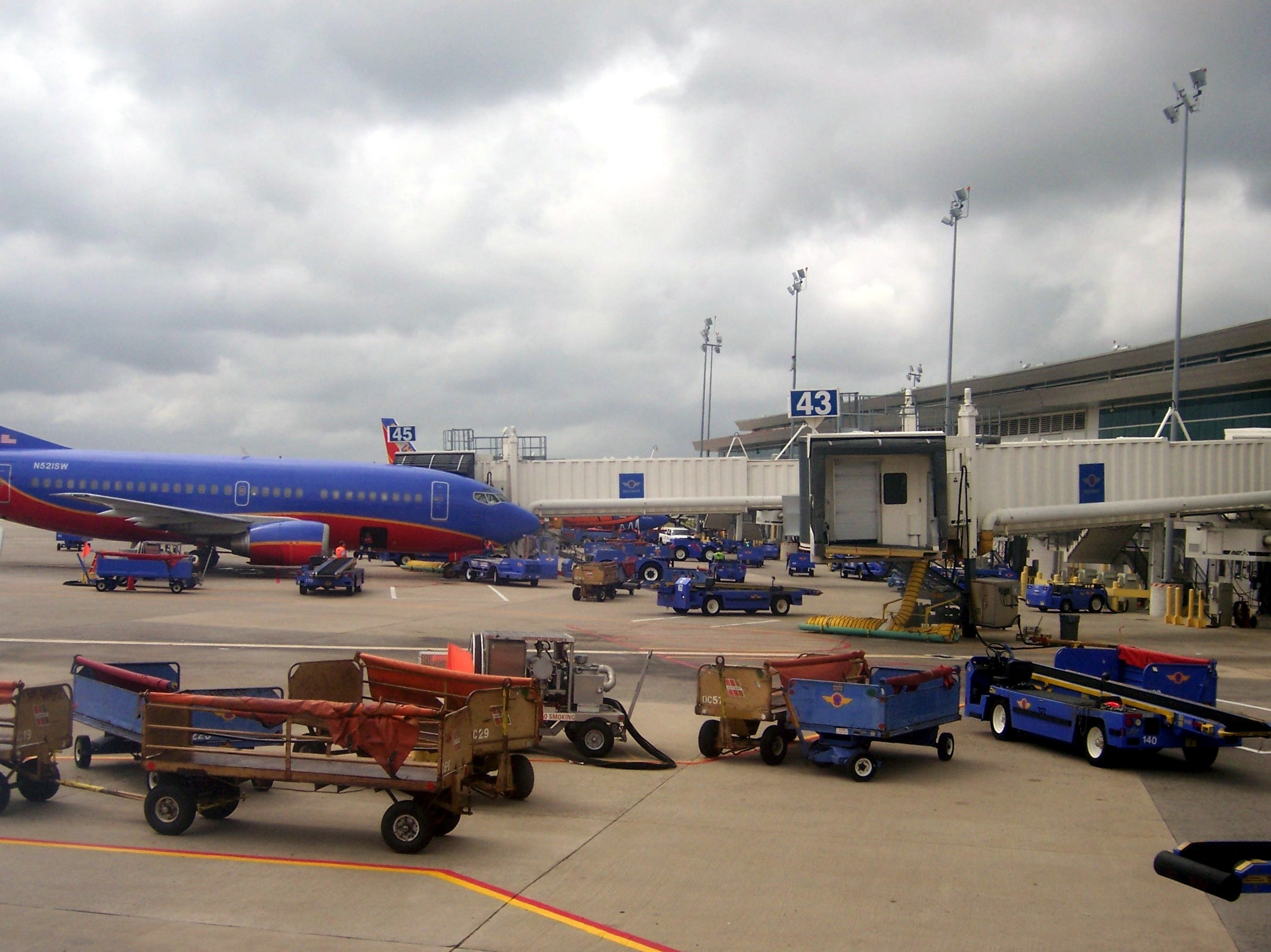
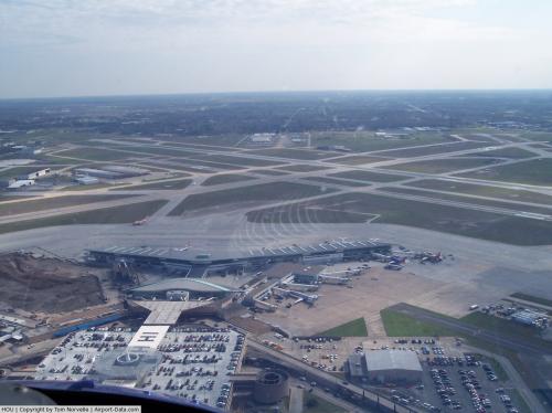
Ramp operations at Hobby Airport, with a Southwest Airlines Boeing 737-300 parked at a gate |
Hobby Airport handles domestic service for seven commercial airlines and is an international point of entry for general aviation activity between Texas and Mexico. The airport is capable of handling all but the largest narrow-body aircraft in operation. Hobby has multiple low cost carrier operations, as opposed to Bush Intercontinental Airport's hub operation with Continental Airlines.
In a survey among travelers in the United States by J.D. Power and Associates for an Aviation Week traveler satisfaction report, passengers have selected William P. Hobby Airport as the number one airport in the country for customer satisfaction in 2006 and again in 2007. Hobby ranked #2 in 2008.
Southwest Airlines operated more than 80 percent of the total enplanements at Hobby in 2005 and an average of 10 flights per day per gate. Southwest Airlines plans to maintain Houston as a focus city and is looking to serve new markets from Hobby.
Developments at Hobby in the 2000s include a new concourse to serve Southwest Airlines and the upgrade of Runway 4/22. In May 2009, a terminal renovation project was announced that will update the ticket counters, lobby area, and baggage claim.
The Houston Air Route Traffic Control Center serves as the airport's ARTCC.
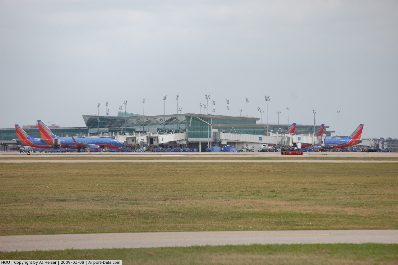
Terminal
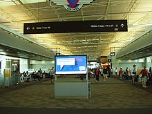 | |
The interior of the airport terminal |
William P. Hobby Airport consists of one Central Concourse terminal with 26 gates, all but 4 used by Southwest.
The terminal includes an interfaith chapel.
Airlines and destinations
| Airlines |
Destinations |
| AirTran Airways |
Atlanta |
| American Eagle |
Dallas/Fort Worth |
| Branson AirExpress operated by ExpressJet Airlines |
Branson |
| Delta Air Lines |
Atlanta |
| Delta Connection operated by Atlantic Southeast Airlines |
Atlanta |
| Delta Connection operated by Pinnacle Airlines |
Atlanta |
| Frontier Airlines |
Denver [Begins November 18] |
| JetBlue Airways |
New York-JFK |
| Southwest Airlines |
Albuquerque, Austin, Baltimore, Birmingham (AL), Chicago-Midway, Corpus Christi, Dallas-Love, Denver, El Paso, Fort Lauderdale, Harlingen, Jackson (MS), Jacksonville, Las Vegas, Little Rock, Los Angeles, Midland/Odessa, Nashville, New Orleans, Oakland, Oklahoma City, Orlando, Panama City (FL), Philadelphia, Phoenix, San Antonio, San Diego, St. Louis, Tampa, Tulsa |
Ground transportation
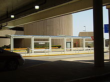 | |
Hobby Airport Transit Center |
Bus
The Metropolitan Transit Authority of Harris County, Texas, or METRO, stops at Curbzone 13.
Courtesy Vans
Courtesy vans are operated by various hotels and motels in and around the Houston Area. There are courtesy telephones in the baggage claim areas to request pick-up for most hotels and motels.
Shuttle Service
Shared-ride shuttle service is available at HOU. SuperShuttle takes reservations and picks-up travelers at their homes or businesses and transports them to the airport and vice versa. Additionally, regularly scheduled bus and shuttle service is provided by various carriers to locations from HOU to areas outside the Houston Metropolitan area and to Galveston and College Station. These services can be found in the baggage claim area.
Taxi
Taxis are available at Curb Zone 3.
Artwork
The first one that most visitors will see is by artists Paul Kittleson and Carter Ernst, is an enormous stainless steel bird’s nest, 30-feet wide, held 20-feet above the ground by three steel tree trunks, floating above a subtropical garden. The artwork, with its interwoven branches, re-created in industrial materials, is meant to reflect the spirit of Houston’s industries, working along the coastal plains. It is located at the Broadway entrance to the airport.
Accidents and incidents
The following involved flights departing or arriving at the airport:
- 1959: Braniff Flight 542 crashed in Buffalo, Texas, on September 29, 1959. It was en route to Dallas, Texas, from Houston, Texas. Twenty-nine passengers and five crew members died in the crash. The plane, a turboprop Lockheed L-188 Electra with the registration number N9705C, was eleven days old when it crashed. The Civil Aeronautics Board stated that the probable cause was "structural failure of the left wing resulting from forces generated by undampened propeller whirl mode."
- 1968: Braniff Flight 352: Broke into pieces during flight in a thunderstorm on Houston-Dallas route
The above content comes from Wikipedia and is published under free licenses – click here to read more.
 |
(Click on the photo to enlarge) |
 |
(Click on the photo to enlarge) |
 |
(Click on the photo to enlarge) |
Location & QuickFacts
| FAA Information Effective: | 2008-09-25 |
| Airport Identifier: | HOU |
| Airport Status: | Operational |
| Longitude/Latitude: | 095-16-44.0000W/29-38-43.5070N
-95.278889/29.645419 (Estimated) |
| Elevation: | 46 ft / 14.02 m (Surveyed) |
| Land: | 1304 acres |
| From nearest city: | 8 nautical miles SE of Houston, TX |
| Location: | Harris County, TX |
| Magnetic Variation: | 05E (2000) |
Owner & Manager
| Ownership: | Publicly owned |
| Owner: | City Of Houston |
| Address: | 16930 Jf Kennedy Blvd
Houston, TX 77032 |
| Phone number: | 281-233-3000 |
| Manager: | Mary Case |
| Address: | 7800 Airport Blvd
Houston, TX 77061 |
| Phone number: | 713-640-3000 |
Airport Operations and Facilities
| Airport Use: | Open to public |
| Wind indicator: | Yes |
| Segmented Circle: | No |
| Control Tower: | Yes |
| Lighting Schedule: | DUSK-DAWN |
| Beacon Color: | Clear-Green (lighted land airport) |
| Landing fee charge: | No |
| Sectional chart: | Houston |
| Region: | ASW - Southwest |
| Boundary ARTCC: | ZHU - Houston |
| Tie-in FSS: | CXO - Montgomery County |
| FSS on Airport: | No |
| FSS Toll Free: | 1-800-WX-BRIEF |
| NOTAMs Facility: | HOU (NOTAM-d service avaliable) |
| Certification type/date: | I C S 05/1973 |
| Federal Agreements: | NGY3 |
Airport Communications
Airport Services
| Fuel available: | 100LLA A1 |
| Airframe Repair: | MINOR |
| Power Plant Repair: | MINOR |
| Bottled Oxygen: | HIGH/LOW |
| Bulk Oxygen: | HIGH/LOW |
Runway Information
Runway 04/22
| Dimension: | 7602 x 150 ft / 2317.1 x 45.7 m |
| Surface: | CONC, Good Condition |
| Surface Treatment: | Saw-cut or plastic Grooved |
| Weight Limit: | Single wheel: 75000 lbs.
Dual wheel: 200000 lbs.
Dual tandem wheel: 400000 lbs. |
| Edge Lights: | High |
| |
Runway 04 |
Runway 22 |
| Longitude: | 095-17-07.1599W | 095-16-07.3643W |
| Latitude: | 29-38-20.7951N | 29-39-14.9697N |
| Elevation: | 42.00 ft | 39.00 ft |
| Alignment: | 44 | 127 |
| ILS Type: | ILS/DME
| LOC/DME
|
| Traffic Pattern: | Left | Left |
| Markings: | Precision instrument, Good Condition | Precision instrument, Good Condition |
| Crossing Height: | 56.00 ft | 52.00 ft |
| VASI: | 4-light PAPI on right side | 4-box on left side |
| Visual Glide Angle: | 3.00° | 3.00° |
| RVR Equipment: | touchdown, midfield, rollout | touchdown, midfield, rollout |
| Approach lights: | ALSF2 | MALS |
| Centerline Lights: | Yes | Yes |
| Touchdown Lights: | Yes | No |
| Obstruction: | , 50:1 slope to clear | 125 ft pole, 4400.0 ft from runway, 1000 ft left of centerline, 33:1 slope to clear |
| Decleard distances: | Take off run available 7602.00 ft
Take off distance available 7602.00 ft
Actual stop distance available 7602.00 ft
Landing distance available 7602.00 ft
| Take off run available 7602.00 ft
Take off distance available 7602.00 ft
Actual stop distance available 7602.00 ft
Landing distance available 7602.00 ft
|
|
Runway 12L/30R
| Dimension: | 5148 x 100 ft / 1569.1 x 30.5 m |
| Surface: | CONC, Fair Condition |
| Surface Treatment: | Saw-cut or plastic Grooved |
| Weight Limit: | Single wheel: 30000 lbs.
Dual wheel: 45000 lbs.
Dual tandem wheel: 80000 lbs. |
| Edge Lights: | Medium |
| |
Runway 12L |
Runway 30R |
| Longitude: | 095-17-01.9364W | 095-16-19.9293W |
| Latitude: | 29-39-09.3849N | 29-38-34.0154N |
| Elevation: | 45.00 ft | 40.00 ft |
| Alignment: | 127 | 127 |
| Traffic Pattern: | Left | Left |
| Markings: | Basic, Good Condition | Basic, Good Condition |
| Crossing Height: | 60.00 ft | 0.00 ft |
| VASI: | 4-light PAPI on left side | |
| Visual Glide Angle: | 3.00° | 0.00° |
| Decleard distances: | Take off run available 5148.00 ft
Take off distance available 5148.00 ft
Actual stop distance available 5148.00 ft
Landing distance available 5148.00 ft
| Take off run available 5148.00 ft
Take off distance available 5148.00 ft
Actual stop distance available 5148.00 ft
Landing distance available 5148.00 ft
|
|
Runway 12R/30L
| Dimension: | 7602 x 150 ft / 2317.1 x 45.7 m |
| Surface: | ASPH, Good Condition |
| Surface Treatment: | Saw-cut or plastic Grooved |
| Weight Limit: | Single wheel: 75000 lbs.
Dual wheel: 195000 lbs.
Dual tandem wheel: 220000 lbs. |
| Edge Lights: | High |
| |
Runway 12R |
Runway 30L |
| Longitude: | 095-17-07.8391W | 095-16-05.8243W |
| Latitude: | 29-39-03.3642N | 29-38-11.1258N |
| Elevation: | 45.00 ft | 42.00 ft |
| Alignment: | 127 | 127 |
| ILS Type: | ILS/DME
| ILS/DME
|
| Traffic Pattern: | Left | Left |
| Markings: | Precision instrument, Good Condition | Precision instrument, Good Condition |
| Crossing Height: | 49.00 ft | 71.00 ft |
| Displaced threshold: | 1034.00 ft | 0.00 ft |
| VASI: | 4-light PAPI on right side | 4-light PAPI on left side
PAPI UNUSABLE BYD 8 DEGS LEFT & RIGHT OF CRS. |
| Visual Glide Angle: | 3.00° | 3.00° |
| RVR Equipment: | touchdown | touchdown |
| Approach lights: | MALSR | |
| Runway End Identifier: | | Yes |
| Centerline Lights: | Yes | Yes |
| Touchdown Lights: | Yes | Yes |
| Obstruction: | 37 ft pole, 310.0 ft from runway, 500 ft right of centerline, 2:1 slope to clear
APCH RATIO 36:1 TO DSPLCD THLD. | 13 ft road, 200.0 ft from runway, 500 ft right of centerline |
| Decleard distances: | Take off run available 7602.00 ft
Take off distance available 7602.00 ft
Actual stop distance available 7602.00 ft
Landing distance available 6568.00 ft
| Take off run available 7602.00 ft
Take off distance available 7602.00 ft
Actual stop distance available 7602.00 ft
Landing distance available 7402.00 ft
|
|
Runway 17/35
| Dimension: | 6000 x 150 ft / 1828.8 x 45.7 m |
| Surface: | ASPH-CONC, Good Condition |
| Surface Treatment: | Saw-cut or plastic Grooved |
| Weight Limit: | Single wheel: 75000 lbs.
Dual wheel: 121000 lbs.
Dual tandem wheel: 195000 lbs. |
| Edge Lights: | Medium |
| |
Runway 17 |
Runway 35 |
| Longitude: | 095-17-04.7990W | 095-17-03.5445W |
| Latitude: | 29-39-08.4998N | 29-38-09.1178N |
| Elevation: | 45.00 ft | 43.00 ft |
| Alignment: | 127 | 127 |
| Traffic Pattern: | Left | Left |
| Markings: | Non-precision instrument, Good Condition | Non-precision instrument, Good Condition |
| Crossing Height: | 38.00 ft | 41.00 ft |
| VASI: | 4-box on left side | 4-box on right side |
| Visual Glide Angle: | 3.00° | 3.00° |
| Runway End Identifier: | | Yes |
| Obstruction: | 44 ft ant, 2000.0 ft from runway, 120 ft left of centerline, 40:1 slope to clear | 25 ft bldg, 653.0 ft from runway, 225 ft right of centerline, 18:1 slope to clear |
| Decleard distances: | Take off run available 6000.00 ft
Take off distance available 6000.00 ft
Actual stop distance available 6000.00 ft
Landing distance available 6000.00 ft
| Take off run available 6000.00 ft
Take off distance available 6000.00 ft
Actual stop distance available 6000.00 ft
Landing distance available 6000.00 ft
|
|
Radio Navigation Aids
| ID |
Type |
Name |
Ch |
Freq |
Var |
Dist |
| JPA | NDB | Sanjac | | 347.00 | 05E | 11.0 nm |
| SYG | NDB | Sandy Point | | 402.00 | 05E | 13.1 nm |
| SGR | NDB | Hull | | 388.00 | 05E | 19.7 nm |
| BVP | NDB | Nixin | | 326.00 | 05E | 21.2 nm |
| LYD | NDB | Lakeside | | 249.00 | 05E | 23.2 nm |
| EYQ | NDB | Weiser | | 286.00 | 06E | 25.6 nm |
| DWH | NDB | David Hooks | | 521.00 | 05E | 32.5 nm |
| CBC | NDB | Anahuac | | 413.00 | 05E | 33.1 nm |
| GLS | NDB | Galveston | | 206.00 | 08E | 33.1 nm |
| EFD | TACAN | Ellington | 031X | | 05E | 6.7 nm |
| HUB | VOR/DME | Hobby | 118X | 117.10 | 05E | 0.6 nm |
| MHF | VOR/DME | Trinity | 083X | 113.60 | 07E | 28.4 nm |
| IAH | VORTAC | Humble | 113X | 116.60 | 05E | 19.0 nm |
| VUH | VORTAC | Scholes | 077X | 113.00 | 06E | 31.2 nm |
| DAS | VORTAC | Daisetta | 116X | 116.90 | 05E | 46.5 nm |
Remarks
- GENERAL AVIATION PPR TO TAXI TO MAIN TERMINAL BLDG - CALL 713-640-3000.
- NMRS BIRDS ON AND IN VCNTY OF ARPT.
- CUSTOMS RAMP HAS MULTIPLE OBSTRUCTIONS; RECOMMEND LARGE ACFT USE CUSTOMS OVERFLOW RAMP.
- ASDE-X SURVEILLANCE SYSTEM IN USE: PILOTS SHOULD OPERATE TRANSPONDERS WITH MODE C ON ALL TWYS AND RWYS.
- ARPT CLSD TO ACFT WITH WING SPAN OVER 125 FT EXCP 24 HRS PPR CALL AMGR 713-640-3000.
- TWY G CNTRLN TO PARKED ACFT ON WEST SIDE ONLY 68 FT. TWY G CNTRLN TO EDGE OF ADJ SVC VEHICLE ROAD ON WEST SIDE ONLY 48 FT.
- ALL PILOTS AT TRANSIENT GATE COMPLY WITH SIGNAGE.
- DUE TO COMPLEX RY CONFIGURATION; WHEN TAXIING TO THRS 12L & 12R AND 17 CHECK COMPASS HEADING BEFORE DEPARTING.
- ACFT SOUTHBOUND ON TWY C TO RY 30L THLD USE EXTREME CARE; TWY C MAKES A 45 DEG DOGLEG TO THE LEFT CROSSING TWY K.
- ACFT IN TKOF POSITION ON RY 22 BE ALERT FOR POSSIBLE RADIO INTERFERENCE OR NULL ON FREQ 118.7. USE UPPER ANT IF SO EQUIPPED.
Images and information placed above are from
http://www.airport-data.com/airport/HOU/
We thank them for the data!
| General Info
|
| Country |
United States
|
| State |
TEXAS
|
| FAA ID |
HOU
|
| Latitude |
29-38-43.507N
|
| Longitude |
095-16-44.000W
|
| Elevation |
46 feet
|
| Near City |
HOUSTON
|
We don't guarantee the information is fresh and accurate. The data may
be wrong or outdated.
For more up-to-date information please refer to other sources.
|
|