 |
|
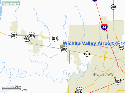
Location & QuickFacts
| FAA Information Effective: | 2008-09-25 |
| Airport Identifier: | F14 |
| Airport Status: | Operational |
| Longitude/Latitude: | 098-37-00.1000W/33-56-51.8000N
-98.616694/33.947722 (Estimated) |
| Elevation: | 1005 ft / 306.32 m (Surveyed) |
| Land: | 186 acres |
| From nearest city: | 8 nautical miles NW of Wichita Falls, TX |
| Location: | Wichita County, TX |
| Magnetic Variation: | 07E (1985) |
Owner & Manager
| Ownership: | Privately owned |
| Owner: | John Hooker |
| Address: | 2926 Haws Road
Iowa Park, TX 76367 |
| Phone number: | 940-592-2123 |
| Manager: | John Hooker |
| Address: | 2926 Haws Road
Iowa Park, TX 76367 |
| Phone number: | 940-592-2123 |
Airport Operations and Facilities
| Airport Use: | Open to public |
| Wind indicator: | Yes |
| Segmented Circle: | No |
| Control Tower: | No |
| Lighting Schedule: | DUSK-DAWN |
| Landing fee charge: | No |
| Sectional chart: | Dallas-ft Worth |
| Region: | ASW - Southwest |
| Boundary ARTCC: | ZFW - Fort Worth |
| Tie-in FSS: | FTW - Fort Worth |
| FSS on Airport: | No |
| FSS Phone: | 817-541-3474 |
| FSS Toll Free: | 1-800-WX-BRIEF |
| NOTAMs Facility: | FTW (NOTAM-d service avaliable) |
Airport Communications
| CTAF: | 122.800 |
| Unicom: | 122.800 |
Airport Services
| Fuel available: | 100LL
SELF SVC FUEL AVBL 24 HRS WITH MAJOR CREDIT CARD. |
| Airframe Repair: | MAJOR |
| Power Plant Repair: | MAJOR |
Runway Information
Runway 04/22
| Dimension: | 3050 x 100 ft / 929.6 x 30.5 m |
| Surface: | TURF, Good Condition |
| |
Runway 04 |
Runway 22 |
| Longitude: | 098-37-12.2090W | 098-36-44.2080W |
| Latitude: | 33-56-38.3460N | 33-56-58.3450N |
| Elevation: | 984.00 ft | 984.00 ft |
| Traffic Pattern: | Left | Left |
| Obstruction: | 30 ft pline, 50.0 ft from runway, 1:1 slope to clear | 25 ft trees, 20.0 ft from runway, 125 ft left of centerline |
|
Runway 13/31
| Dimension: | 3320 x 40 ft / 1011.9 x 12.2 m |
| Surface: | ASPH, Fair Condition |
| Weight Limit: | Single wheel: 8000 lbs.
Dual wheel: 12500 lbs. |
| Edge Lights: | Non-standard lighting system
NSTD LIRL. RY 13 THLD LGTS ARE 2 GREEN/RED; RY 31 THLD LGTS ARE 2 GREEN/RED OBSTN LGTS ON BANK ACROSS RY END. |
| |
Runway 13 |
Runway 31 |
| Longitude: | 098-37-12.5130W | 098-36-47.7330W |
| Latitude: | 33-57-04.5910N | 33-56-39.0560N |
| Elevation: | 1004.00 ft | 982.00 ft |
| Alignment: | 127 | 127 |
| Traffic Pattern: | Left | Left |
| Markings: | Basic, Good Condition
13/31 MARKINGS NSTD; NRS SMALL. | Basic, Fair Condition |
| Obstruction: | 15 ft road, 200.0 ft from runway, 80 ft right of centerline
+4 FT FENCE POSTS 60 FT FM THLD ACROSS APCH. | 27 ft trees, 426.0 ft from runway, 120 ft left of centerline, 8:1 slope to clear
+6' BANK 50' FM THR ACROSS APCH. |
|
Runway 16/34
| Dimension: | 2000 x 42 ft / 609.6 x 12.8 m |
| Surface: | TURF, Good Condition |
| |
Runway 16 |
Runway 34 |
| Longitude: | 098-36-56.2090W | 098-36-53.2080W |
| Latitude: | 33-57-05.3450N | 33-56-45.3460N |
| Elevation: | 983.00 ft | 995.00 ft |
| Traffic Pattern: | Left | Left |
| Obstruction: | 4 ft fence, 100.0 ft from runway, 25:1 slope to clear | 30 ft pline, 1000.0 ft from runway, 33:1 slope to clear |
|
Radio Navigation Aids
| ID |
Type |
Name |
Ch |
Freq |
Var |
Dist |
| SKB | NDB | Scotland | | 344.00 | 08E | 11.5 nm |
| VRT | NDB | Wilbarger | | 230.00 | 08E | 37.0 nm |
| ONY | NDB | Olney | | 272.00 | 07E | 37.2 nm |
| PFL | NDB | Post | | 308.00 | 08E | 41.1 nm |
| GMZ | NDB | Grindstone Mountain | | 356.00 | 07E | 46.9 nm |
| GHX | NDB | Graham | | 371.00 | 07E | 47.4 nm |
| SHP | TACAN | Sheppard | 045X | | 10E | 6.8 nm |
| LAW | VOR/DME | Lawton | 031X | 109.40 | 09E | 34.5 nm |
| DUC | VOR/DME | Duncan | 047X | 111.00 | 09E | 43.6 nm |
| SPS | VORTAC | Wichita Falls | 074X | 112.70 | 10E | 2.6 nm |
| UKW | VORTAC | Bowie | 071X | 112.40 | 06E | 46.8 nm |
Remarks
-
- INTENSIVE JET TRAINER TFC 2800-4500 FT MSL VICINITY OF ARPT & SHEPPARD AFB 6 MILES NE. CTC APCH CTL FOR TFC ADVISORIES.
- PRE DATES THE ACT.
Images and information placed above are from
http://www.airport-data.com/airport/F14/
We thank them for the data!
| General Info
|
| Country |
United States
|
| State |
TEXAS
|
| FAA ID |
F14
|
| Latitude |
33-56-51.800N
|
| Longitude |
098-37-00.100W
|
| Elevation |
1005 feet
|
| Near City |
WICHITA FALLS
|
We don't guarantee the information is fresh and accurate. The data may
be wrong or outdated.
For more up-to-date information please refer to other sources.
|
|


