 |
|
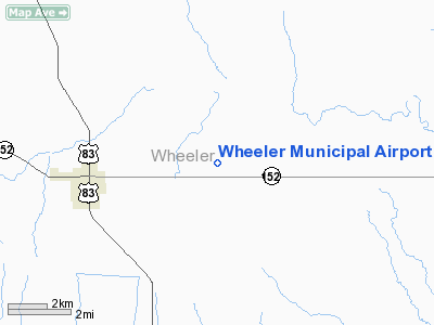
Location & QuickFacts
| FAA Information Effective: | 2008-09-25 |
| Airport Identifier: | T59 |
| Airport Status: | Operational |
| Longitude/Latitude: | 100-11-59.7000W/35-27-03.9000N
-100.199917/35.451083 (Estimated) |
| Elevation: | 2470 ft / 752.86 m (Surveyed) |
| Land: | 95 acres |
| From nearest city: | 4 nautical miles E of Wheeler, TX |
| Location: | Wheeler County, TX |
| Magnetic Variation: | 08E (1985) |
Owner & Manager
| Ownership: | Publicly owned |
| Owner: | City Of Wheeler Tx |
| Address: | Po Box 98
Wheeler, TX 79096 |
| Phone number: | 806-826-3222 |
| Manager: | Claudine Finsterwald
CITY SECRETARY. |
| Address: | Po Box 98
Wheeler, TX 79096 |
| Phone number: | 806-826-3222 |
Airport Operations and Facilities
| Airport Use: | Open to public |
| Wind indicator: | Yes |
| Segmented Circle: | Yes |
| Control Tower: | No |
| Lighting Schedule: | DUSK-DAWN |
| Beacon Color: | Clear-Green (lighted land airport) |
| Landing fee charge: | No |
| Sectional chart: | Dallas-ft Worth |
| Region: | ASW - Southwest |
| Boundary ARTCC: | ZAB - Albuquerque |
| Tie-in FSS: | FTW - Fort Worth |
| FSS on Airport: | No |
| FSS Phone: | 817-541-3474 |
| FSS Toll Free: | 1-800-WX-BRIEF |
| NOTAMs Facility: | FTW (NOTAM-d service avaliable) |
Airport Communications
Airport Services
| Fuel available: | 100LL
FOR FUEL CALL 806-826-5537 (SHERIFF'S OFFICE). |
Runway Information
Runway 17/35
| Dimension: | 3565 x 60 ft / 1086.6 x 18.3 m |
| Surface: | ASPH, |
| Weight Limit: | Single wheel: 12000 lbs. |
| Edge Lights: | Low |
| |
Runway 17 |
Runway 35 |
| Longitude: | 100-11-59.7805W | 100-11-59.5423W |
| Latitude: | 35-27-21.4739N | 35-26-46.2238N |
| Elevation: | 2431.00 ft | 2470.00 ft |
| Alignment: | 127 | 127 |
| Traffic Pattern: | Left | Left |
| Markings: | Non-precision instrument, Good Condition | Non-precision instrument, Good Condition |
| Displaced threshold: | 0.00 ft | 57.00 ft |
| Obstruction: | 10 ft tree, 621.0 ft from runway, 75 ft right of centerline, 42:1 slope to clear
3 FT BRUSH, 98 FT RIGHT, OB AND 94 FT LEFT, 36 FT FM THLD. | 20 ft road, 564.0 ft from runway, 18:1 slope to clear
APCH SLOPE 21:1 TO DSPLCD THLD. |
|
Radio Navigation Aids
| ID |
Type |
Name |
Ch |
Freq |
Var |
Dist |
| HHF | NDB | Hemphill County | | 400.00 | 08E | 28.3 nm |
| EZY | NDB | Elk City | | 241.00 | 08E | 39.3 nm |
| PPA | NDB | Pampa | | 368.00 | 09E | 39.9 nm |
| BZ | NDB | Fossi | | 393.00 | 08E | 48.9 nm |
| SYO | VORTAC | Sayre | 099X | 115.20 | 10E | 28.4 nm |
Remarks
- 407 FT AGL TWR 19 NM SSW OF ARPT.
Images and information placed above are from
http://www.airport-data.com/airport/T59/
We thank them for the data!
| General Info
|
| Country |
United States
|
| State |
TEXAS
|
| FAA ID |
T59
|
| Latitude |
35-27-03.900N
|
| Longitude |
100-11-59.700W
|
| Elevation |
2470 feet
|
| Near City |
WHEELER
|
We don't guarantee the information is fresh and accurate. The data may
be wrong or outdated.
For more up-to-date information please refer to other sources.
|
|


