 |
|
Coordinates: 29°49′06″N 095°40′21″W / 29.81833°N 95.6725°W / 29.81833; -95.6725
| West Houston Airport |
| IATA: IWS – ICAO: KIWS – FAA LID: IWS |
| Summary |
| Airport type |
Public |
| Owner |
West Houston Airport Corp. |
| Serves |
Houston, Texas |
| Elevation AMSL |
111 ft / 34 m |
| Website |
www.WestHoustonAirport.com |
| Runways |
| Direction |
Length |
Surface |
| ft |
m |
| 15/33 |
3,953 |
1,205 |
Asphalt |
| Statistics (2006) |
| Aircraft operations |
103,000 |
| Based aircraft |
292 |
| Source: Federal Aviation Administration |
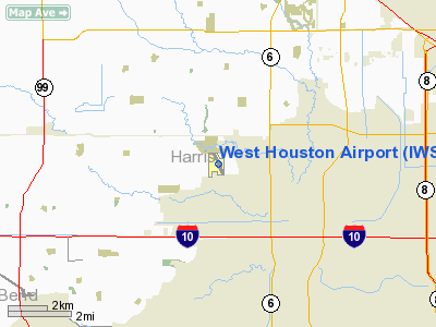
West Houston Airport (IATA: IWS, ICAO: KIWS) is a general aviation airport located in unincorporated western Harris County, Texas, United States, immediately west of the Houston city limits.
The airport is located 13 miles (21 km) west of Downtown Houston. Houston Air Route Traffic Control Center in Houston is the airport's designated ARTCC.
Facilities and aircraft
West Houston Airport covers an area of 200 acres (81 ha) which contains one runway designated 15/33 with a 3,953 x 75 ft (1,205 x 23 m) asphalt surface. For the 12-month period ending March 28, 2006, the airport had 103,000 aircraft operations, an average of 282 per day: 99% general aviation and 1% air taxi. At that time there were 292 aircraft based at this airport: 87% single-engine, 9% multi-engine, 2% jet and 2% helicopter.
The above content comes from Wikipedia and is published under free licenses – click here to read more.
Location & QuickFacts
| FAA Information Effective: | 2008-09-25 |
| Airport Identifier: | IWS |
| Airport Status: | Operational |
| Longitude/Latitude: | 095-40-21.4000W/29-49-05.5000N
-95.672611/29.818194 (Estimated) |
| Elevation: | 111 ft / 33.83 m (Estimated) |
| Land: | 200 acres |
| From nearest city: | 13 nautical miles W of Houston, TX |
| Location: | Harris County, TX |
| Magnetic Variation: | 05E (1995) |
Owner & Manager
| Ownership: | Privately owned |
| Owner: | West Houston Airport Corp |
| Address: | Box 941789
Houston, TX 77094-8789 |
| Phone number: | 281-492-2130 |
| Manager: | Woody Lesikar |
| Address: | Box 941789
Houston, TX 77094-8789 |
| Phone number: | 281-492-2130 |
Airport Operations and Facilities
| Airport Use: | Open to public |
| Wind indicator: | Yes |
| Segmented Circle: | Yes |
| Control Tower: | No |
| Lighting Schedule: | DUSK-DAWN
HIRL RY 15/33 PRESET LOW INTST; TO INCR INTST & ACTVT REIL RYS 15 & 33 - CTAF. |
| Beacon Color: | Clear-Green (lighted land airport) |
| Landing fee charge: | Yes
LNDG FEE FOR HELICOPTERS. FEE WAIVED WITH FUEL PURCHASE. |
| Sectional chart: | Houston |
| Region: | ASW - Southwest |
| Boundary ARTCC: | ZHU - Houston |
| Tie-in FSS: | CXO - Montgomery County |
| FSS on Airport: | No |
| FSS Toll Free: | 1-800-WX-BRIEF
FOR FP FILING CALL CXO FSS 1-800-992-7433. |
| NOTAMs Facility: | CXO (NOTAM-d service avaliable) |
| Federal Agreements: | N |
Airport Communications
| CTAF: | 123.050 |
| Unicom: | 123.050 |
Airport Services
| Fuel available: | 100LLA |
| Airframe Repair: | MAJOR |
| Power Plant Repair: | MAJOR |
| Bottled Oxygen: | HIGH |
| Bulk Oxygen: | HIGH |
Runway Information
Runway 15/33
| Dimension: | 3953 x 75 ft / 1204.9 x 22.9 m |
| Surface: | ASPH, Good Condition |
| Weight Limit: | Single wheel: 18000 lbs.
Dual wheel: 44000 lbs. |
| Edge Lights: | High |
| |
Runway 15 |
Runway 33 |
| Longitude: | 095-40-30.9689W | 095-40-11.7757W |
| Latitude: | 29-49-23.1675N | 29-48-47.7979N |
| Elevation: | 111.00 ft | 109.00 ft |
| Alignment: | 127 | 127 |
| Traffic Pattern: | Left | Left |
| Markings: | Nonstandard, Good Condition
15/33 NSTD PIR MKGS DUE TO RY LENGTH. | Nonstandard, Good Condition |
| Crossing Height: | 44.00 ft | 44.00 ft |
| VASI: | 2-light PAPI on right side | 2-light PAPI on left side |
| Visual Glide Angle: | 4.00° | 4.00° |
| Runway End Identifier: | Yes | Yes |
| Obstruction: | 41 ft tree, 343.0 ft from runway, 137 ft left of centerline, 4:1 slope to clear | 15 ft road, 200.0 ft from runway, 60 ft right of centerline
ROAD 150 FT EAST OF THLD & 57 FT TREE 247 FT L OF RY 190 FT FM THLD. |
|
Radio Navigation Aids
| ID |
Type |
Name |
Ch |
Freq |
Var |
Dist |
| LYD | NDB | Lakeside | | 249.00 | 05E | 0.3 nm |
| EYQ | NDB | Weiser | | 286.00 | 06E | 7.1 nm |
| SGR | NDB | Hull | | 388.00 | 05E | 11.2 nm |
| DWH | NDB | David Hooks | | 521.00 | 05E | 19.3 nm |
| SYG | NDB | Sandy Point | | 402.00 | 05E | 21.8 nm |
| BVP | NDB | Nixin | | 326.00 | 05E | 26.1 nm |
| JPA | NDB | Sanjac | | 347.00 | 05E | 32.7 nm |
| ARM | NDB | Wharton | | 245.00 | 06E | 42.1 nm |
| BNH | NDB | Brenham | | 362.00 | 06E | 43.8 nm |
| EFD | TACAN | Ellington | 031X | | 05E | 29.7 nm |
| HUB | VOR/DME | Hobby | 118X | 117.10 | 05E | 22.9 nm |
| ELA | VOR/DME | Eagle Lake | 111X | 116.40 | 08E | 34.9 nm |
| IAH | VORTAC | Humble | 113X | 116.60 | 05E | 19.0 nm |
| TNV | VORTAC | Navasota | 106X | 115.90 | 08E | 34.7 nm |
| IDU | VORTAC | Industry | 039X | 110.20 | 08E | 47.1 nm |
| HOU | VOT | Houston Wm P Hobby | | 108.40 | | 23.0 nm |
Remarks
- DEEP/WIDE DITCH APRXLY 25 FT FM AER 15; 40 FT & GTR TREES APRXLY 900 FT FM AER 15; ROAD ANGLING ACROSS APCH RY 33.
- NO TOUCH & GO LANDINGS BTN 2200-0600.
- NO NIGHT HELICOPTER TRAINING.
- NO MULTIPLE TRAINING FLIGHTS BY HELICOPTERS.
Images and information placed above are from
http://www.airport-data.com/airport/IWS/
We thank them for the data!
| General Info
|
| Country |
United States
|
| State |
TEXAS
|
| FAA ID |
IWS
|
| Latitude |
29-49-05.500N
|
| Longitude |
095-40-21.400W
|
| Elevation |
111 feet
|
| Near City |
HOUSTON
|
We don't guarantee the information is fresh and accurate. The data may
be wrong or outdated.
For more up-to-date information please refer to other sources.
|
|


