 |
|
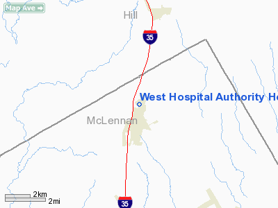
West Hospital Authority Heliport |
Location & QuickFacts
| FAA Information Effective: | 2008-09-25 |
| Airport Identifier: | 3TS2 |
| Airport Status: | Operational |
| Longitude/Latitude: | 097-05-34.0000W/31-48-59.0000N
-97.092778/31.816389 (Estimated) |
| Elevation: | 650 ft / 198.12 m (Estimated) |
| Land: | 0 acres |
| From nearest city: | 1 nautical miles N of West, TX |
| Location: | Mc Lennan County, TX |
| Magnetic Variation: | 06E (1990) |
Owner & Manager
| Ownership: | Privately owned |
| Owner: | West Community Hospital |
| Address: | 501 Meadow
West, TX 76691 |
| Phone number: | 817-826-7000 |
| Manager: | Tom Marek |
| Address: | 501 Meadow
West, TX 76691 |
| Phone number: | 254-826-3779 |
Airport Operations and Facilities
| Airport Use: | Private
MEDICAL. |
| Wind indicator: | Yes |
| Segmented Circle: | No |
| Control Tower: | No |
| Lighting Schedule: | DUSK-DAWN |
| Sectional chart: | San Antonio |
| Region: | ASW - Southwest |
| Boundary ARTCC: | ZFW - Fort Worth |
| Tie-in FSS: | FTW - Fort Worth |
| FSS on Airport: | No |
| FSS Phone: | 817-541-3474 |
| FSS Toll Free: | 1-800-WX-BRIEF |
Runway Information
Helipad H1
| Dimension: | 90 x 90 ft / 27.4 x 27.4 m |
| Surface: | ASPH, |
| |
Runway H1 |
Runway |
| Traffic Pattern: | Left | Left |
|
Radio Navigation Aids
| ID |
Type |
Name |
Ch |
Freq |
Var |
Dist |
| ROB | NDB | Robinson | | 400.00 | 07E | 18.8 nm |
| LXY | NDB | Mexia | | 329.00 | 07E | 31.5 nm |
| CGQ | NDB | Powell | | 344.00 | 06E | 37.0 nm |
| CRS | NDB | Corsicana | | 396.00 | 06E | 37.8 nm |
| PYF | NDB | Pyramid | | 418.00 | 06E | 45.8 nm |
| XQH | NDB | Cedar Hill | | 353.00 | 08E | 46.9 nm |
| LNC | NDB | Lancaster | | 239.00 | 06E | 49.5 nm |
| GNL | VOR/DME | Groesbeck | 025X | 108.80 | 05E | 31.2 nm |
| TPL | VOR/DME | Temple | 041X | 110.40 | 09E | 40.3 nm |
| ACT | VORTAC | Waco | 100X | 115.30 | 09E | 12.9 nm |
| JEN | VORTAC | Glen Rose | 097X | 115.00 | 06E | 45.0 nm |
| CQY | VORTAC | Cedar Creek | 095X | 114.80 | 06E | 49.8 nm |
Remarks
- PRVDD A LGTD WIND CONE INSTALLED AND AN OBSTRUCTION LGT IS PLACED ON ANTENNA.
Images and information placed above are from
http://www.airport-data.com/airport/3TS2/
We thank them for the data!
| General Info
|
| Country |
United States
|
| State |
TEXAS
|
| FAA ID |
3TS2
|
| Latitude |
31-48-59.000N
|
| Longitude |
097-05-34.000W
|
| Elevation |
650 feet
|
| Near City |
WEST
|
We don't guarantee the information is fresh and accurate. The data may
be wrong or outdated.
For more up-to-date information please refer to other sources.
|
|


