 |
|
| Weiser Air Park |
| IATA: none – ICAO: KEYQ – FAA LID: EYQ |
| Summary |
| Airport type |
Public |
| Owner |
Cecil & Robert Weiser |
| Serves |
Houston, Texas |
| Location |
Harris County, Texas |
| Elevation AMSL |
137 ft / 42 m |
| Coordinates |
29°56′07″N 095°38′23″W / 29.93528°N 95.63972°W / 29.93528; -95.63972 |
| Website |
www.WeiserAirpark.com |
| Runways |
| Direction |
Length |
Surface |
| ft |
m |
| 9/27 |
3,455 |
1,053 |
Asphalt |
| 16/34 |
2,000 |
610 |
Turf |
| Statistics (2006) |
| Aircraft operations |
38,020 |
| Based aircraft |
75 |
| Source: FAA and airport web site |
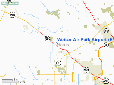
Weiser Air Park (ICAO: KEYQ, FAA LID: EYQ) is a privately-owned, public-use airport located on the Northwest Freeway (U.S. Highway 290) in Cypress, an unincorporated area of Harris County, Texas, United States. The airport is 11 nautical miles (20 km) northwest of the central business district of Houston
Although most U.S. airports use the same three-letter location identifier for the FAA and IATA, Weiser Air Park is assigned EYQ by the FAA but has no designation from the IATA.
Facilities and aircraft
Weiser Air Park covers an area of 98 acres (40 ha) at an elevation of 137 feet (42 m) above mean sea level. It has two runways: 9/27 has a 3,455 x 40 ft (1,053 x 12 m) asphalt pavement and 16/34 has a 2,000 x 33 ft (610 x 10 m) turf surface.
For the 12-month period ending March 3, 2006, the airport had 38,020 aircraft operations, an average of 104 per day: 99.9% general aviation and 0.1% air taxi. At that time there were 75 aircraft based at this airport: 93% single-engine and 7% multi-engine.
The above content comes from Wikipedia and is published under free licenses – click here to read more.
Location & QuickFacts
| FAA Information Effective: | 2008-09-25 |
| Airport Identifier: | EYQ |
| Airport Status: | Operational |
| Longitude/Latitude: | 095-38-22.5760W/29-56-06.7634N
-95.639604/29.935212 (Estimated) |
| Elevation: | 137 ft / 41.76 m (Surveyed) |
| Land: | 98 acres |
| From nearest city: | 11 nautical miles NW of Houston, TX |
| Location: | Harris County, TX |
| Magnetic Variation: | 06E (1985) |
Owner & Manager
| Ownership: | Privately owned |
| Owner: | Cecil & Robert Weiser |
| Address: | 10818 Huffmeister
Houston, TX 77065 |
| Phone number: | 281-469-8227 |
| Manager: | Cecil & Robert Weiser |
| Address: | 21904 Hempstead Hwy
Cypress, TX 77429 |
| Phone number: | 281-469-3009 |
Airport Operations and Facilities
| Airport Use: | Open to public |
| Wind indicator: | Yes |
| Segmented Circle: | No |
| Control Tower: | No |
| Lighting Schedule: | DUSK-DAWN |
| Beacon Color: | Clear-Green (lighted land airport) |
| Sectional chart: | Houston |
| Region: | ASW - Southwest |
| Boundary ARTCC: | ZHU - Houston |
| Tie-in FSS: | CXO - Montgomery County |
| FSS on Airport: | No |
| FSS Toll Free: | 1-800-WX-BRIEF
FOR FP FILING CALL CXO FSS 1-800-992-7433. |
| NOTAMs Facility: | CXO (NOTAM-d service avaliable) |
Airport Communications
| CTAF: | 122.800 |
| Unicom: | 122.800 |
Airport Services
| Fuel available: | 100LL
100LL SELF SERVE WITH MAJOR CREDIT CARD. |
| Airframe Repair: | MAJOR |
| Power Plant Repair: | MAJOR |
Runway Information
Runway 09/27
| Dimension: | 3455 x 40 ft / 1053.1 x 12.2 m |
| Surface: | ASPH, Good Condition |
| Weight Limit: | Single wheel: 10000 lbs. |
| Edge Lights: | Non-standard lighting system
NSTD LIRL. NORTH SIDE LGTS 30 FT FM RY EDGE; SOUTH SIDE LGTS 40 FT FM RY EDGE. |
| |
Runway 09 |
Runway 27 |
| Longitude: | 095-38-42.2064W | 095-38-02.9456W |
| Latitude: | 29-56-06.8115N | 29-56-06.7144N |
| Elevation: | 137.00 ft | 134.00 ft |
| Alignment: | 90 | 127 |
| Traffic Pattern: | Right | Left |
| Markings: | Nonstandard, Good Condition
RY 09/27 NRS ARE 17 FT TALL & 14 FT WIDE. STRIPES ARE 6 INCH WIDE BY 40 FT LONG WITH 25 FT SPACING. | Nonstandard, Good Condition |
| Runway End Identifier: | No | No |
| Obstruction: | 30 ft tree, 250.0 ft from runway, 60 ft right of centerline, 1:1 slope to clear
+6 FT FENCE AT 156 FT FM THLD; 15 FT BRUSH ALONG FENCE ALSO. | 44 ft pline, 1650.0 ft from runway, 32:1 slope to clear
+4 FT FENCE 135 FT FM THLD; 25 FT TREES 96 FT R EXTDD CNTRLN 135 FT FM THLD; & 10 FT TREES 135 FT FM THLD ON BOTH SIDES OF EXTDD RY CNTRLN. |
|
Runway 16/34
| Dimension: | 2000 x 33 ft / 609.6 x 10.1 m |
| Surface: | TURF, Fair Condition |
| Weight Limit: | Single wheel: 4000 lbs. |
| |
Runway 16 |
Runway 34 |
| Traffic Pattern: | Left | Left |
| Obstruction: | 40 ft trees | 36 ft tree, 20.0 ft from runway |
|
Radio Navigation Aids
| ID |
Type |
Name |
Ch |
Freq |
Var |
Dist |
| EYQ | NDB | Weiser | | 286.00 | 06E | 0.1 nm |
| LYD | NDB | Lakeside | | 249.00 | 05E | 7.4 nm |
| DWH | NDB | David Hooks | | 521.00 | 05E | 12.1 nm |
| SGR | NDB | Hull | | 388.00 | 05E | 18.2 nm |
| BVP | NDB | Nixin | | 326.00 | 05E | 22.4 nm |
| SYG | NDB | Sandy Point | | 402.00 | 05E | 27.5 nm |
| JPA | NDB | Sanjac | | 347.00 | 05E | 33.8 nm |
| BNH | NDB | Brenham | | 362.00 | 06E | 41.9 nm |
| UTS | NDB | Huntsville | | 308.00 | 06E | 48.5 nm |
| ARM | NDB | Wharton | | 245.00 | 06E | 48.9 nm |
| EFD | TACAN | Ellington | 031X | | 05E | 31.9 nm |
| HUB | VOR/DME | Hobby | 118X | 117.10 | 05E | 25.3 nm |
| ELA | VOR/DME | Eagle Lake | 111X | 116.40 | 08E | 39.0 nm |
| IAH | VORTAC | Humble | 113X | 116.60 | 05E | 15.4 nm |
| TNV | VORTAC | Navasota | 106X | 115.90 | 08E | 30.4 nm |
| IDU | VORTAC | Industry | 039X | 110.20 | 08E | 48.1 nm |
| HOU | VOT | Houston Wm P Hobby | | 108.40 | | 25.7 nm |
Remarks
- RY 16/34 EMERG USE ONLY.
- HELICOPTER OPNS RESTRICTED TO AN AREA NW OF THE INTERSECTION OF RYS 09/27 AND 16/34.
Images and information placed above are from
http://www.airport-data.com/airport/EYQ/
We thank them for the data!
| General Info
|
| Country |
United States
|
| State |
TEXAS
|
| FAA ID |
EYQ
|
| Latitude |
29-56-07.805N
|
| Longitude |
095-38-23.801W
|
| Elevation |
140 feet
|
| Near City |
HOUSTON
|
We don't guarantee the information is fresh and accurate. The data may
be wrong or outdated.
For more up-to-date information please refer to other sources.
|
|


