 |
|
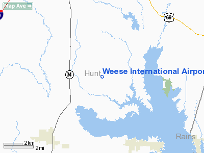
Location & QuickFacts
| FAA Information Effective: | 2008-09-25 |
| Airport Identifier: | XS14 |
| Airport Status: | Operational |
| Longitude/Latitude: | 096-04-14.0000W/32-58-10.0000N
-96.070556/32.969444 (Estimated) |
| Elevation: | 487 ft / 148.44 m (Estimated) |
| Land: | 0 acres |
| From nearest city: | 8 nautical miles S of Greenville, TX |
| Location: | Hunt County, TX |
| Magnetic Variation: | 06E (1990) |
Owner & Manager
| Ownership: | Privately owned |
| Owner: | Charles K Weese |
| Address: | 1347 Rancho Rd.
Quinlan, TX 75474 |
| Phone number: | 903-883-3020 |
| Manager: | Charles K Weese |
| Address: | 1347 Rancho Rd.
Quinlan, TX 75474 |
| Phone number: | 903-883-3020 |
Airport Operations and Facilities
| Airport Use: | Private |
| Segmented Circle: | No |
| Control Tower: | No |
| Sectional chart: | Dallas-ft Worth |
| Region: | ASW - Southwest |
| Boundary ARTCC: | ZFW - Fort Worth |
| Tie-in FSS: | FTW - Fort Worth |
| FSS on Airport: | No |
| FSS Phone: | 817-541-3474 |
| FSS Toll Free: | 1-800-WX-BRIEF |
Runway Information
Runway 18/36
| Dimension: | 5300 x 100 ft / 1615.4 x 30.5 m |
| Surface: | TURF, |
| |
Runway 18 |
Runway 36 |
| Traffic Pattern: | Left | Left |
|
Radio Navigation Aids
| ID |
Type |
Name |
Ch |
Freq |
Var |
Dist |
| SYW | NDB | Cash | | 428.00 | 05E | 0.8 nm |
| MII | NDB | Caddo Mills | | 316.00 | 06E | 9.9 nm |
| AVZ | NDB | Travis | | 260.00 | 06E | 15.5 nm |
| PQF | NDB | Mesquite | | 248.00 | 06E | 25.1 nm |
| JUG | NDB | Jecca | | 388.00 | 06E | 29.5 nm |
| HJM | NDB | Rayburn | | 415.00 | 06E | 39.1 nm |
| LNC | NDB | Lancaster | | 239.00 | 06E | 40.5 nm |
| RBD | NDB | Redbird | | 287.00 | 06E | 44.1 nm |
| TY | NDB | Tyler | | 320.00 | 06E | 45.1 nm |
| MJF | TACAN | Arvilla | 033X | | 05E | 5.8 nm |
| SLR | VOR/DME | Sulphur Springs | 027X | 109.00 | 08E | 29.9 nm |
| UIM | VOR/DME | Quitman | 087X | 114.00 | 08E | 35.9 nm |
| CVE | VOR/DME | Cowboy | 109X | 116.20 | 06E | 42.3 nm |
| PRX | VOR/DME | Paris | 083X | 113.60 | 07E | 46.5 nm |
| TTT | VOR/DME | Maverick | 078X | 113.10 | 06E | 49.3 nm |
| TYR | VOR/DME | Tyler | 089X | 114.20 | 06E | 50.0 nm |
| BYP | VORTAC | Bonham | 093X | 114.60 | 06E | 35.1 nm |
| CQY | VORTAC | Cedar Creek | 095X | 114.80 | 06E | 47.7 nm |
| DAL | VOT | Dallas Love Field | | 113.30 | | 40.1 nm |
Remarks
- PRVDD ALL TFC PATTERNS CONDUCTED ON EAST SIDE OF ARPT AND TFC PATTERN ALT WILL BE AT OR BELOW 1100 FT ABOVE SEA LEVEL.
Images and information placed above are from
http://www.airport-data.com/airport/XS14/
We thank them for the data!
| General Info
|
| Country |
United States
|
| State |
TEXAS
|
| FAA ID |
XS14
|
| Latitude |
32-58-10.000N
|
| Longitude |
096-04-14.000W
|
| Elevation |
487 feet
|
| Near City |
GREENVILLE
|
We don't guarantee the information is fresh and accurate. The data may
be wrong or outdated.
For more up-to-date information please refer to other sources.
|
|


