 |
|
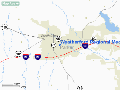
Weatherford Rgnl Medical Center Heliport |
Location & QuickFacts
| FAA Information Effective: | 2008-09-25 |
| Airport Identifier: | 98TA |
| Airport Status: | Operational |
| Longitude/Latitude: | 097-47-03.1200W/32-44-53.0000N
-97.784200/32.748056 (Estimated) |
| Elevation: | 1050 ft / 320.04 m (Estimated) |
| Land: | 0 acres |
| From nearest city: | 0 nautical miles N of Weatherford, TX |
| Location: | Parker County, TX |
| Magnetic Variation: | 07E (1990) |
Owner & Manager
| Ownership: | Privately owned |
| Owner: | Weatherford Tx Hospital Co Llc |
| Address: | 713 E. Anderson
Weatherford, TX 76086 |
| Phone number: | 817-599-1196 |
| Manager: | Paul Smith
DIRECTOR OF EMERGENCY MEDICAL SERVICE |
| Address: | 713 E. Anderson
Weatherford, TX 76086 |
| Phone number: | 817-599-1196 |
Airport Operations and Facilities
| Airport Use: | Private
MEDICAL USE. |
| Segmented Circle: | No |
| Control Tower: | No |
| Lighting Schedule: | PHONE REQ
FOR PERIMETER LGTS CALL 817-599-1111 |
| Sectional chart: | Dallas-ft Worth |
| Region: | ASW - Southwest |
| Boundary ARTCC: | ZFW - Fort Worth |
| Tie-in FSS: | FTW - Fort Worth |
| FSS on Airport: | No |
| FSS Phone: | 817-541-3474 |
| FSS Toll Free: | 1-800-WX-BRIEF |
Runway Information
Helipad H1
| Dimension: | 40 x 40 ft / 12.2 x 12.2 m |
| Surface: | CONC, |
| |
Runway H1 |
Runway |
| Traffic Pattern: | Left | Left |
|
Radio Navigation Aids
| ID |
Type |
Name |
Ch |
Freq |
Var |
Dist |
| MWL | NDB | Mineral Wells | | 266.00 | 06E | 14.0 nm |
| GZV | NDB | Brazos River | | 280.00 | 07E | 34.0 nm |
| XQH | NDB | Cedar Hill | | 353.00 | 08E | 41.9 nm |
| GHX | NDB | Graham | | 371.00 | 07E | 43.8 nm |
| RBD | NDB | Redbird | | 287.00 | 06E | 46.4 nm |
| NFW | TACAN | Nas Jrb Fort Worth | 024X | | 07E | 17.5 nm |
| TTT | VOR/DME | Maverick | 078X | 113.10 | 06E | 38.3 nm |
| CVE | VOR/DME | Cowboy | 109X | 116.20 | 06E | 45.3 nm |
| MQP | VORTAC | Millsap | 124X | 117.70 | 09E | 10.9 nm |
| FUZ | VORTAC | Ranger | 104X | 115.70 | 06E | 31.7 nm |
| JEN | VORTAC | Glen Rose | 097X | 115.00 | 06E | 35.7 nm |
| UKW | VORTAC | Bowie | 071X | 112.40 | 06E | 47.4 nm |
| FTW | VOT | Fort Worth Meacham | | 108.20 | | 21.9 nm |
| DAL | VOT | Dallas Love Field | | 113.30 | | 47.5 nm |
Remarks
- PRVDD VFR; SAFETY BARRIER IS INSTALLED; WARNING SIGNS PLACE NEAR THE ENTRANCE TO THE HELI; 3 TREES ADJ TO HELI ARE REMOVED; WIRES N ARE MKD; ANT ON TOP OF THE HOSPITAL IS OBSTRUCTION LGTD; & LGT STACHION S IS LOWERED OR REMOVED.
Images and information placed above are from
http://www.airport-data.com/airport/98TA/
We thank them for the data!
| General Info
|
| Country |
United States
|
| State |
TEXAS
|
| FAA ID |
98TA
|
| Latitude |
32-44-52.000N
|
| Longitude |
097-47-03.000W
|
| Elevation |
1060 feet
|
| Near City |
WEATHERFORD
|
We don't guarantee the information is fresh and accurate. The data may
be wrong or outdated.
For more up-to-date information please refer to other sources.
|
|


