 |
|
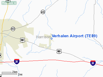
Location & QuickFacts
| FAA Information Effective: | 2008-09-25 |
| Airport Identifier: | TE89 |
| Airport Status: | Operational |
| Longitude/Latitude: | 094-14-10.0000W/32-32-15.5400N
-94.236111/32.537650 (Estimated) |
| Elevation: | 415 ft / 126.49 m (Estimated) |
| Land: | 40 acres |
| From nearest city: | 0 nautical miles NE of Scottsville, TX |
| Location: | Harrison County, TX |
| Magnetic Variation: | 04E (1995) |
Owner & Manager
| Ownership: | Privately owned |
| Owner: | George E. Verhalen |
| Address: | Po Box 456
Scottsville, TX 75688-0456 |
| Phone number: | 903-938-6320 |
| Manager: | George E. Verhalen |
| Address: | Po Box 456
Scottsville, TX 75688-0456 |
| Phone number: | 903-938-6320 |
Airport Operations and Facilities
| Airport Use: | Private |
| Segmented Circle: | No |
| Control Tower: | No |
| Lighting Schedule: | PHONE REQ
FOR LIRL RY 13/31 CALL 903-938-6320. |
| Sectional chart: | Memphis |
| Region: | ASW - Southwest |
| Boundary ARTCC: | ZFW - Fort Worth |
| Tie-in FSS: | FTW - Fort Worth |
| FSS Phone: | 817-541-3474 |
| FSS Toll Free: | 1-800-WX-BRIEF |
Runway Information
Runway 13/31
| Dimension: | 2130 x 90 ft / 649.2 x 27.4 m |
| Surface: | TURF, Good Condition |
| Edge Lights: | Low |
| |
Runway 13 |
Runway 31 |
| Traffic Pattern: | Left | Left |
|
Runway 15/33
| Dimension: | 1750 x 70 ft / 533.4 x 21.3 m |
| Surface: | TURF, Good Condition |
| |
Runway 15 |
Runway 33 |
| Traffic Pattern: | Left | Left |
|
Radio Navigation Aids
| ID |
Type |
Name |
Ch |
Freq |
Var |
Dist |
| RPF | NDB | Carthage | | 332.00 | 04E | 21.7 nm |
| VIV | NDB | Vivian | | 284.00 | 06E | 22.5 nm |
| ATA | NDB | Atlanta | | 347.00 | 04E | 34.1 nm |
| LST | NDB | Lone Star | | 305.00 | 05E | 34.8 nm |
| MSD | NDB | Mansfield | | 414.00 | 04E | 37.2 nm |
| HNO | NDB | Henderson | | 371.00 | 06E | 38.1 nm |
| CZJ | NDB | Amason | | 341.00 | 04E | 42.6 nm |
| ABG | NDB | Ambassador | | 404.00 | 07E | 44.5 nm |
| MNE | NDB | Minden | | 201.00 | 04E | 47.7 nm |
| SPH | NDB | Springhill | | 375.00 | 05E | 47.7 nm |
| BAD | TACAN | Barksdale | 105X | | 05E | 28.9 nm |
| DTN | VOR | Downtown | | 108.60 | 07E | 25.1 nm |
| EIC | VORTAC | Belcher | 121X | 117.40 | 07E | 25.7 nm |
| GGG | VORTAC | Gregg County | 070X | 112.30 | 07E | 27.2 nm |
| EMG | VORTAC | Elm Grove | 049X | 111.20 | 07E | 33.5 nm |
| SHV | VOT | Shreveport Regional | | 108.20 | | 20.8 nm |
Images and information placed above are from
http://www.airport-data.com/airport/TE89/
We thank them for the data!
| General Info
|
| Country |
United States
|
| State |
TEXAS
|
| FAA ID |
TE89
|
| Latitude |
32-32-15.540N
|
| Longitude |
094-14-10.000W
|
| Elevation |
415 feet
|
| Near City |
SCOTTSVILLE
|
We don't guarantee the information is fresh and accurate. The data may
be wrong or outdated.
For more up-to-date information please refer to other sources.
|
|


