 |
|
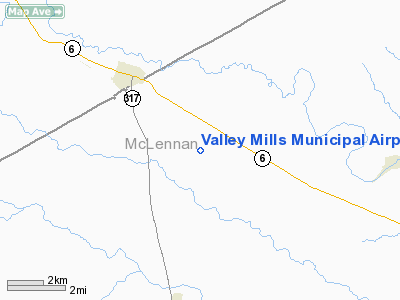
Valley Mills Muni Airport |
Location & QuickFacts
| FAA Information Effective: | 2008-09-25 |
| Airport Identifier: | 9F1 |
| Airport Status: | Operational |
| Longitude/Latitude: | 097-25-46.0510W/31-37-15.5850N
-97.429459/31.620996 (Estimated) |
| Elevation: | 751 ft / 228.90 m (Estimated) |
| Land: | 90 acres |
| From nearest city: | 3 nautical miles SE of Valley Mills, TX |
| Location: | Mc Lennan County, TX |
| Magnetic Variation: | 07E (1985) |
Owner & Manager
| Ownership: | Publicly owned |
| Owner: | City Of Valley Mills |
| Address: | Box 641
Valley Mills, TX 76689 |
| Phone number: | 254-932-6146 |
| Manager: | Jerry Brooks |
| Address: | Box 641
Valley Mills, TX 76689 |
| Phone number: | 254-932-6146 |
Airport Operations and Facilities
| Airport Use: | Open to public |
| Segmented Circle: | No |
| Control Tower: | No |
| Landing fee charge: | No |
| Sectional chart: | San Antonio |
| Region: | ASW - Southwest |
| Boundary ARTCC: | ZFW - Fort Worth |
| Tie-in FSS: | FTW - Fort Worth |
| FSS on Airport: | No |
| FSS Phone: | 817-541-3474 |
| FSS Toll Free: | 1-800-WX-BRIEF |
| NOTAMs Facility: | FTW (NOTAM-d service avaliable) |
| Federal Agreements: | R |
Airport Communications
Airport Services
| Airframe Repair: | NONE |
| Power Plant Repair: | NONE |
| Bottled Oxygen: | NONE |
| Bulk Oxygen: | NONE |
Runway Information
Runway 06/24
| Dimension: | 3028 x 40 ft / 922.9 x 12.2 m |
| Surface: | TURF, Fair Condition
AND 14/32 ROUGH. |
| |
Runway 06 |
Runway 24 |
| Traffic Pattern: | Left | Left |
| Obstruction: | , 50:1 slope to clear
+4' FENCE ACROSS APCH. | 11 ft tree, 105.0 ft from runway, 104 ft left of centerline, 9:1 slope to clear |
|
Runway 14/32
| Dimension: | 2788 x 40 ft / 849.8 x 12.2 m |
| Surface: | TURF, Fair Condition
AND 14/32 ROUGH. |
| |
Runway 14 |
Runway 32 |
| Traffic Pattern: | Left | Left |
| Obstruction: | 18 ft road, 220.0 ft from runway, 12:1 slope to clear | 5 ft fence, 0.0 ft from runway, 70 ft left of centerline
+4' FENCE 75' LEFT OF CNTRLN AT THR. |
|
Radio Navigation Aids
| ID |
Type |
Name |
Ch |
Freq |
Var |
Dist |
| ROB | NDB | Robinson | | 400.00 | 07E | 19.7 nm |
| HLR | NDB | Hood | | 347.00 | 07E | 32.9 nm |
| GR | NDB | Starn | | 323.00 | 07E | 35.7 nm |
| MNZ | NDB | Hamilton | | 251.00 | 07E | 36.8 nm |
| IL | NDB | Iresh | | 278.00 | 07E | 38.6 nm |
| LXY | NDB | Mexia | | 329.00 | 07E | 47.0 nm |
| TPL | VOR/DME | Temple | 041X | 110.40 | 09E | 24.7 nm |
| GRK | VOR/DME | Gray | 055X | 111.80 | 07E | 40.5 nm |
| GNL | VOR/DME | Groesbeck | 025X | 108.80 | 05E | 45.1 nm |
| ACT | VORTAC | Waco | 100X | 115.30 | 09E | 8.6 nm |
| JEN | VORTAC | Glen Rose | 097X | 115.00 | 06E | 39.6 nm |
| LZZ | VORTAC | Lampasas | 072X | 112.50 | 08E | 45.0 nm |
Remarks
- 1 FT DITCHES ON EDGES OF RY 24.
- ALL RWYS SOFT WHEN WET.
- REMOTE CONTROLLED AIRCRAFT OPERATING IN IMMEDIATE VICINITY OF ARPT.
- PRE-DATES ACT.
Images and information placed above are from
http://www.airport-data.com/airport/9F1/
We thank them for the data!
| General Info
|
| Country |
United States
|
| State |
TEXAS
|
| FAA ID |
9F1
|
| Latitude |
31-37-15.585N
|
| Longitude |
097-25-46.051W
|
| Elevation |
751 feet
|
| Near City |
VALLEY MILLS
|
We don't guarantee the information is fresh and accurate. The data may
be wrong or outdated.
For more up-to-date information please refer to other sources.
|
|


