|
|
| Valley International Airport |
 |
| IATA: HRL – ICAO: KHRL |
| Summary |
| Airport type |
Public |
| Operator |
City of Harlingen |
| Location |
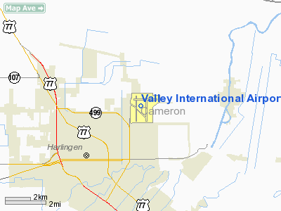
Harlingen, Texas |
| Elevation AMSL |
36 ft / 11 m |
| Coordinates |
26°13′43″N 97°39′16″W / 26.22861°N 97.65444°W / 26.22861; -97.65444 |
| Runways |
| Direction |
Length |
Surface |
| ft |
m |
| 13/31 |
7,257 |
2,212 |
Asphalt |
| 17L/35R |
5,949 |
1,813 |
Asphalt |
| 17R/35L |
8,301 |
2,530 |
Asphalt |
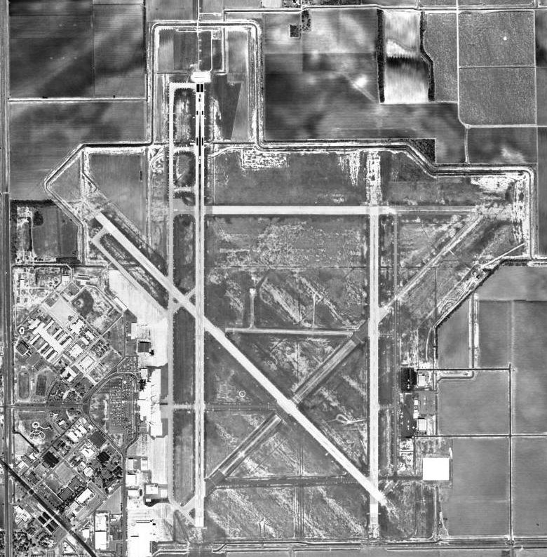
Valley International Airport (IATA: HRL, ICAO: KHRL) is an airport located in northeast Harlingen, Texas, United States. The airport has three runways and is also known as Rio Grande Valley International Airport. Airlines and destinations
| Airlines |
Destinations |
| Continental Express operated by ExpressJet Airlines |
Houston-Intercontinental |
| Southwest Airlines |
Austin, Houston-Hobby, San Antonio |
| Sun Country Airlines |
Minneapolis/St. Paul [seasonal] |
Airport Design
- The airport features seven gates, though only three are operational year-round (two by Southwest and one by Continental); an additional gate is operated seasonally by Sun Country Airlines.
- The airport is divided into two halves after security, right and left. Continental and Southwest dominate the right half, leaving the left half nearly abandoned and empty of concessions, especially when Sun Country is not providing passenger service. Continental previously had gates on the left half, though after American's departure, Continental took over American's Gate 7.
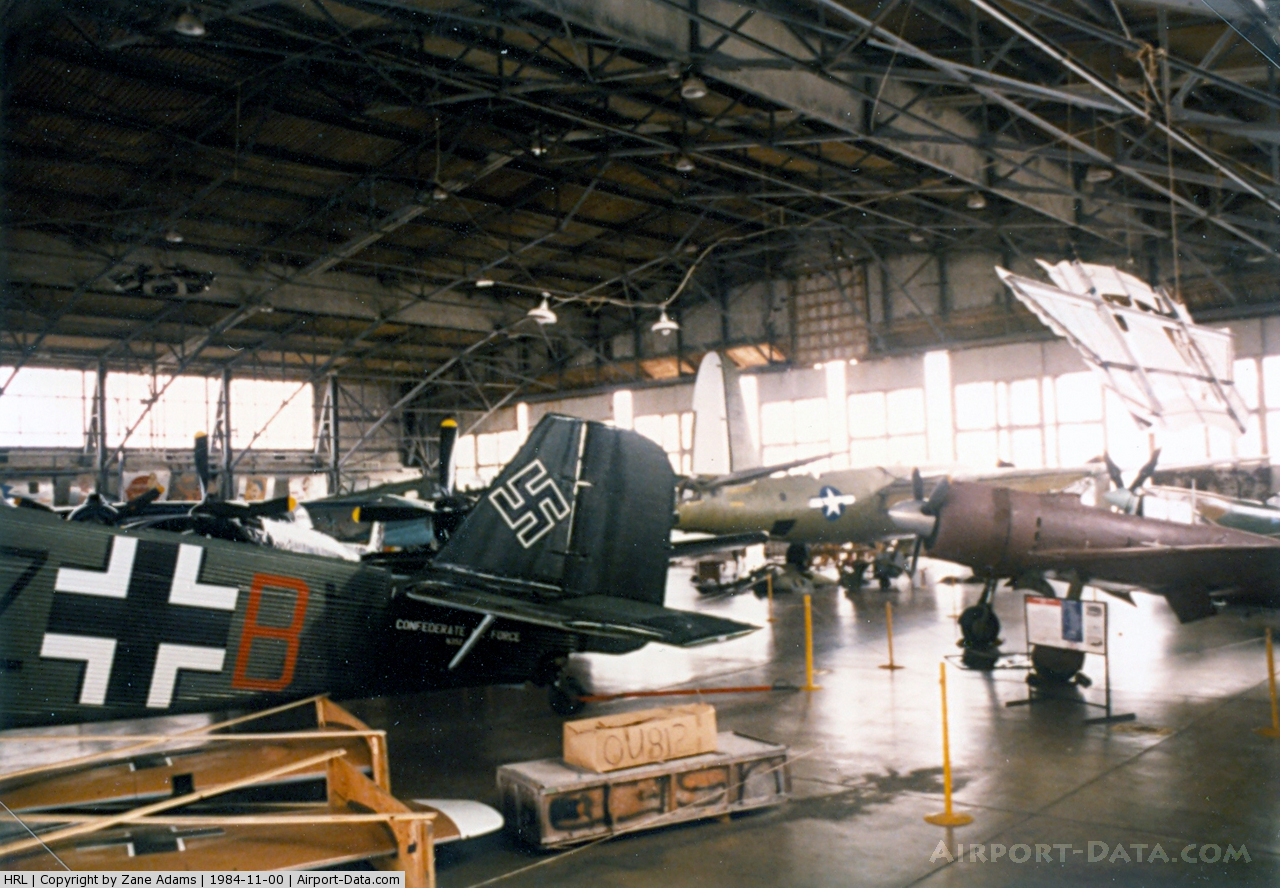
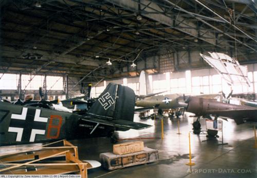
HistoryAfter the airport's closure by the military, it was turned over to the local government and the facilities were converted to civilian use as Valley International Airport after Hurricane Beulah significantly flooded the original Harlingen civilian airport in 1967.
The above content comes from Wikipedia and is published under free licenses – click here to read more.
 |
(Click on the photo to enlarge) |
Location & QuickFacts
| FAA Information Effective: | 2008-09-25 |
| Airport Identifier: | HRL |
| Airport Status: | Operational |
| Longitude/Latitude: | 097-39-15.8000W/26-13-42.6000N
-97.654389/26.228500 (Estimated) |
| Elevation: | 36 ft / 10.97 m (Surveyed) |
| Land: | 2428 acres |
| From nearest city: | 3 nautical miles NE of Harlingen, TX |
| Location: | Cameron County, TX |
| Magnetic Variation: | 07E (1980) |
Owner & Manager
| Ownership: | Publicly owned |
| Owner: | City Of Harlingen |
| Address: | Po Box 2207
Harlingen, TX 78551-2207 |
| Phone number: | 956-427-8700 |
| Manager: | Michael Browning |
| Address: | Airport Terminal Building, 3002 Heritage Way
Harlingen, TX 78550 |
| Phone number: | 956-430-8605 |
Airport Operations and Facilities
| Airport Use: | Open to public |
| Wind indicator: | Yes |
| Segmented Circle: | Yes |
| Control Tower: | Yes |
| Lighting Schedule: | DUSK-DAWN
WHEN ATCT CLSD MIRL RY 17L/35R NOT AVBL. |
| Beacon Color: | Clear-Green (lighted land airport) |
| Landing fee charge: | No |
| Sectional chart: | Brownsville |
| Region: | ASW - Southwest |
| Boundary ARTCC: | ZHU - Houston |
| Tie-in FSS: | SJT - San Angelo |
| FSS on Airport: | No |
| FSS Toll Free: | 1-800-WX-BRIEF |
| NOTAMs Facility: | HRL (NOTAM-d service avaliable) |
| Certification type/date: | I B S 05/1973 |
| Federal Agreements: | NGPY3 |
Airport Communications
| CTAF: | 119.300 |
| Unicom: | 122.950 |
Airport Services
| Fuel available: | 100LLA |
| Airframe Repair: | MAJOR |
| Power Plant Repair: | MAJOR |
| Bottled Oxygen: | HIGH |
Runway Information
Runway 13/31
| Dimension: | 7257 x 150 ft / 2211.9 x 45.7 m |
| Surface: | ASPH, Good Condition |
| Surface Treatment: | Saw-cut or plastic Grooved |
| Weight Limit: | Single wheel: 160000 lbs.
Dual wheel: 200000 lbs.
Dual tandem wheel: 350000 lbs.
Dual dual tandem wheel: 700000 lbs. |
| Edge Lights: | Medium |
| |
Runway 13 |
Runway 31 |
| Longitude: | 097-39-50.2791W | 097-38-54.5563W |
| Latitude: | 26-13-59.4639N | 26-13-08.0848N |
| Elevation: | 34.00 ft | 36.00 ft |
| Alignment: | 127 | 127 |
| Traffic Pattern: | Left | Left |
| Markings: | Non-precision instrument, Good Condition | Non-precision instrument, Good Condition |
| Crossing Height: | 59.00 ft | 55.00 ft |
| VASI: | 4-box on left side | 4-box on left side |
| Visual Glide Angle: | 3.00° | 3.00° |
| Runway End Identifier: | Yes | |
| Decleard distances: | Take off run available 7257.00 ft
Take off distance available 7257.00 ft
Actual stop distance available 7257.00 ft
Landing distance available 7257.00 ft
| Take off run available 7257.00 ft
Take off distance available 7257.00 ft
Actual stop distance available 7257.00 ft
Landing distance available 7257.00 ft
|
|
Runway 17L/35R
| Dimension: | 5949 x 150 ft / 1813.3 x 45.7 m |
| Surface: | ASPH, Good Condition |
| Weight Limit: | Single wheel: 160000 lbs.
Dual wheel: 200000 lbs.
Dual tandem wheel: 350000 lbs. |
| Edge Lights: | Medium |
| |
Runway 17L |
Runway 35R |
| Longitude: | 097-38-55.2915W | 097-38-56.0173W |
| Latitude: | 26-14-02.2292N | 26-13-03.3105N |
| Elevation: | 34.00 ft | 35.00 ft |
| Alignment: | 127 | 1 |
| Traffic Pattern: | Left | Right |
| Markings: | Non-precision instrument, Good Condition | Non-precision instrument, Good Condition |
| Displaced threshold: | 0.00 ft | 190.00 ft |
| Runway End Identifier: | Yes | |
| Obstruction: | , 50:1 slope to clear | 16 ft road, 400.0 ft from runway, 12:1 slope to clear
APCH RATIO 36:1 FM DSPLCD THR. |
| Decleard distances: | Take off run available 5949.00 ft
Take off distance available 5949.00 ft
Actual stop distance available 5949.00 ft
Landing distance available 5949.00 ft
| Take off run available 5949.00 ft
Take off distance available 5949.00 ft
Actual stop distance available 5949.00 ft
Landing distance available 5759.00 ft
|
|
Runway 17R/35L
| Dimension: | 8301 x 150 ft / 2530.1 x 45.7 m |
| Surface: | ASPH, Good Condition |
| Surface Treatment: | Saw-cut or plastic Grooved |
| Weight Limit: | Single wheel: 160000 lbs.
Dual wheel: 200000 lbs.
Dual tandem wheel: 350000 lbs.
Dual dual tandem wheel: 700000 lbs. |
| Edge Lights: | High |
| |
Runway 17R |
Runway 35L |
| Longitude: | 097-39-30.8555W | 097-39-31.8744W |
| Latitude: | 26-14-25.3827N | 26-13-03.1736N |
| Elevation: | 34.00 ft | 36.00 ft |
| Alignment: | 127 | 1 |
| ILS Type: | ILS/DME
| |
| Traffic Pattern: | Right | Left |
| Markings: | Precision instrument, Good Condition | Precision instrument, Good Condition |
| Crossing Height: | 0.00 ft | 59.00 ft |
| VASI: | | 4-box on left side |
| Visual Glide Angle: | 0.00° | 3.00° |
| Approach lights: | MALSR | |
| Decleard distances: | Take off run available 8301.00 ft
Take off distance available 8301.00 ft
Actual stop distance available 8301.00 ft
Landing distance available 8301.00 ft
| Take off run available 8301.00 ft
Take off distance available 8301.00 ft
Actual stop distance available 8301.00 ft
Landing distance available 8301.00 ft
|
|
Radio Navigation Aids
| ID |
Type |
Name |
Ch |
Freq |
Var |
Dist |
| REX | VOR | Reynosa | | 112.40 | 08E | 33.7 nm |
| HRL | VOR/DME | Harlingen | 029X | 109.20 | 05E | 0.1 nm |
| MAM | VOR/DME | Matamoros | 090X | 114.30 | 07E | 28.4 nm |
| MFE | VOR/DME | Mc Allen | 119X | 117.20 | 09E | 31.8 nm |
| BRO | VORTAC | Brownsville | 110X | 116.30 | 09E | 23.7 nm |
Remarks
- MIGRATORY BIRDS ON & INVOF ARPT.
- WHEN ATCT CLSD REQ ARFF THRU CORPUS APPROACH OR SAN ANGELO AFSS.
- TWY E CLSD EAST OF RY 17L/35R INDEFLY.
Images and information placed above are from
http://www.airport-data.com/airport/HRL/
We thank them for the data!
| General Info
|
| Country |
United States
|
| State |
TEXAS
|
| FAA ID |
HRL
|
| Latitude |
26-13-42.600N
|
| Longitude |
097-39-15.800W
|
| Elevation |
36 feet
|
| Near City |
HARLINGEN
|
We don't guarantee the information is fresh and accurate. The data may
be wrong or outdated.
For more up-to-date information please refer to other sources.
|
|