 |
|
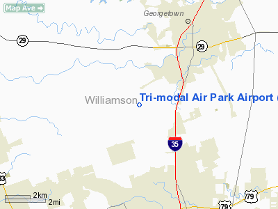
Tri-modal Air Park Airport |
Location & QuickFacts
| FAA Information Effective: | 2008-09-25 |
| Airport Identifier: | 30TA |
| Airport Status: | Operational |
| Longitude/Latitude: | 097-43-21.0340W/30-35-30.7030N
-97.722509/30.591862 (Estimated) |
| Elevation: | 812 ft / 247.50 m (Estimated) |
| Land: | 0 acres |
| From nearest city: | 3 nautical miles S of Georgetown, TX |
| Location: | Williamson County, TX |
| Magnetic Variation: | 07E (1985) |
Owner & Manager
| Ownership: | Privately owned |
| Owner: | Texas Crushed Stone Co |
| Address: | Po Box 1000
Georgetown, TX 78626 |
| Phone number: | 512-863-5511 |
| Manager: | W. B. (bill) Snead |
| Address: | Po Box 1000
Georgetown, TX 78626 |
| Phone number: | 512-863-5511 |
Airport Operations and Facilities
| Airport Use: | Private |
| Wind indicator: | No |
| Segmented Circle: | No |
| Control Tower: | No |
| Landing fee charge: | No |
| Sectional chart: | San Antonio |
| Region: | ASW - Southwest |
| Boundary ARTCC: | ZHU - Houston |
| Tie-in FSS: | SJT - San Angelo |
| FSS on Airport: | No |
| FSS Toll Free: | 1-800-WX-BRIEF |
Runway Information
Runway 13/31
| Dimension: | 4800 x 50 ft / 1463.0 x 15.2 m |
| Surface: | GRVL, |
| |
Runway 13 |
Runway 31 |
| Traffic Pattern: | Left | Left |
| Obstruction: | 30 ft hill, 600.0 ft from runway | 30 ft pline, 800.0 ft from runway |
|
Radio Navigation Aids
| ID |
Type |
Name |
Ch |
Freq |
Var |
Dist |
| GUO | NDB | Georgetown | | 332.00 | 06E | 6.0 nm |
| IL | NDB | Iresh | | 278.00 | 07E | 26.0 nm |
| BMQ | NDB | Burnet | | 341.00 | 07E | 28.0 nm |
| HLR | NDB | Hood | | 347.00 | 07E | 32.3 nm |
| MFS | NDB | Horseshoe Bay Resort | | 403.00 | 07E | 33.1 nm |
| GR | NDB | Starn | | 323.00 | 07E | 35.5 nm |
| GYB | NDB | Lee County | | 385.00 | 07E | 46.2 nm |
| GRK | VOR/DME | Gray | 055X | 111.80 | 07E | 26.9 nm |
| TPL | VOR/DME | Temple | 041X | 110.40 | 09E | 40.2 nm |
| CWK | VORTAC | Centex | 075X | 112.80 | 06E | 16.2 nm |
| LZZ | VORTAC | Lampasas | 072X | 112.50 | 08E | 41.7 nm |
Images and information placed above are from
http://www.airport-data.com/airport/30TA/
We thank them for the data!
| General Info
|
| Country |
United States
|
| State |
TEXAS
|
| FAA ID |
30TA
|
| Latitude |
30-35-30.703N
|
| Longitude |
097-43-21.034W
|
| Elevation |
812 feet
|
| Near City |
GEORGETOWN
|
We don't guarantee the information is fresh and accurate. The data may
be wrong or outdated.
For more up-to-date information please refer to other sources.
|
|


