 |
|
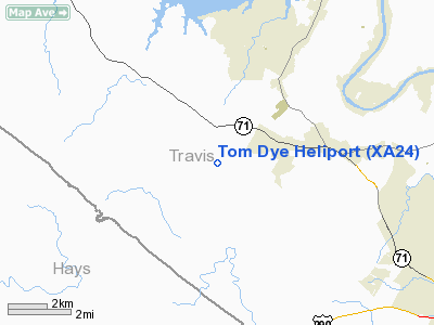
Location & QuickFacts
| FAA Information Effective: | 2008-09-25 |
| Airport Identifier: | XA24 |
| Airport Status: | Operational |
| Longitude/Latitude: | 098-00-07.0000W/30-18-03.0000N
-98.001944/30.300833 (Estimated) |
| Elevation: | 1165 ft / 355.09 m (Estimated) |
| Land: | 0 acres |
| From nearest city: | 14 nautical miles W of Austin, TX |
| Location: | Travis County, TX |
| Magnetic Variation: | () |
Owner & Manager
| Ownership: | Privately owned |
| Owner: | Tom Dye |
| Address: | 15840 Hamilton Pool Road
Austin, TX 78738 |
| Phone number: | 512-327-8786 |
| Manager: | Tom Dye |
| Address: | 15840 Hamilton Pool Road
Austin, TX 78738 |
| Phone number: | 512-327-8786 |
Airport Operations and Facilities
| Airport Use: | Private |
| Wind indicator: | Yes |
| Control Tower: | No |
| Sectional chart: | San Antonio |
| Region: | ASW - Southwest |
| Boundary ARTCC: | ZHU - Houston |
| Tie-in FSS: | SJT - San Angelo |
| FSS Toll Free: | 1-800-WX-BRIEF |
Runway Information
Helipad H1
| Dimension: | 40 x 40 ft / 12.2 x 12.2 m |
| Surface: | CONC, |
| |
Runway H1 |
Runway |
| Traffic Pattern: | Left | Left |
|
Radio Navigation Aids
| ID |
Type |
Name |
Ch |
Freq |
Var |
Dist |
| MFS | NDB | Horseshoe Bay Resort | | 403.00 | 07E | 22.8 nm |
| GUO | NDB | Georgetown | | 332.00 | 06E | 28.5 nm |
| BMQ | NDB | Burnet | | 341.00 | 07E | 29.1 nm |
| IL | NDB | Iresh | | 278.00 | 07E | 46.0 nm |
| DHK | TACAN | Randolph | 036X | | 09E | 48.0 nm |
| GRK | VOR/DME | Gray | 055X | 111.80 | 07E | 45.1 nm |
| CWK | VORTAC | Centex | 075X | 112.80 | 06E | 24.9 nm |
| STV | VORTAC | Stonewall | 085X | 113.80 | 08E | 37.0 nm |
| SAT | VORTAC | San Antonio | 115X | 116.80 | 08E | 46.2 nm |
| RND | VORTAC | Randolph | 70X | 112.30 | 09E | 49.2 nm |
Images and information placed above are from
http://www.airport-data.com/airport/XA24/
We thank them for the data!
|
|


