 |
|
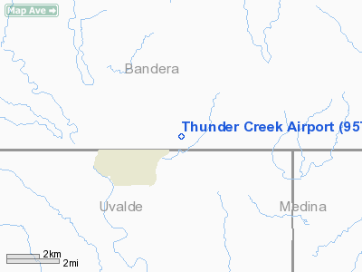
Location & QuickFacts
| FAA Information Effective: | 2008-09-25 |
| Airport Identifier: | 95TA |
| Airport Status: | Operational |
| Longitude/Latitude: | 099-28-56.1680W/29-38-05.8160N
-99.482269/29.634949 (Estimated) |
| Elevation: | 1500 ft / 457.20 m (Estimated) |
| Land: | 0 acres |
| From nearest city: | 5 nautical miles E of Utopia, TX |
| Location: | Bandera County, TX |
| Magnetic Variation: | 08E (1985) |
Owner & Manager
| Ownership: | Privately owned |
| Owner: | Thunder Creek Ranch Landowners |
| Address: | P.o. Box 790
Utopia, TX 78884 |
| Phone number: | 830-966-4611 |
| Manager: | Bill Kellner |
| Address: | P.o. Box 121
Utopia, TX 78884 |
| Phone number: | 830-966-3615
OR 830-796-1588. |
Airport Operations and Facilities
| Airport Use: | Private |
| Wind indicator: | Yes |
| Segmented Circle: | Yes |
| Control Tower: | No |
| Landing fee charge: | No |
| Sectional chart: | San Antonio |
| Region: | ASW - Southwest |
| Boundary ARTCC: | ZHU - Houston |
| Tie-in FSS: | SJT - San Angelo |
| FSS on Airport: | No |
| FSS Toll Free: | 1-800-WX-BRIEF |
Runway Information
Runway 04/22
| Dimension: | 2700 x 100 ft / 823.0 x 30.5 m |
| Surface: | TURF, Good Condition |
| |
Runway 04 |
Runway 22 |
| Traffic Pattern: | Left | Right |
|
Radio Navigation Aids
| ID |
Type |
Name |
Ch |
Freq |
Var |
Dist |
| HMA | NDB | Hondo | | 329.00 | 08E | 22.6 nm |
| ER | NDB | Shein | | 263.00 | 08E | 29.9 nm |
| UVA | NDB | Uvalde | | 281.00 | 07E | 30.3 nm |
| CVB | NDB | Castroville | | 338.00 | 08E | 37.4 nm |
| HHH | NDB | Devine | | 359.00 | 07E | 41.2 nm |
| LKX | NDB | La Pryor | | 223.00 | 09E | 46.7 nm |
| KSY | TACAN | Kelly | 057X | | 07E | 49.4 nm |
| HDO | VOR/DME | Hondo | 31X | 109.40 | 08E | 23.4 nm |
| CSI | VORTAC | Center Point | 122X | 117.50 | 08E | 22.2 nm |
| RSG | VORTAC | Rocksprings | 049X | 111.20 | 10E | 48.4 nm |
Remarks
- PROVIDED LANDING THRESHOLD ON SW END IS DISPLACED A SUFFICIENT DISTANCE TO PROVIDE A CLEAR APPROACH SLOPE OF 20:1 OVER ANY OBSTRUCTIONS.
Images and information placed above are from
http://www.airport-data.com/airport/95TA/
We thank them for the data!
| General Info
|
| Country |
United States
|
| State |
TEXAS
|
| FAA ID |
95TA
|
| Latitude |
29-38-05.816N
|
| Longitude |
099-28-56.168W
|
| Elevation |
1500 feet
|
| Near City |
UTOPIA
|
We don't guarantee the information is fresh and accurate. The data may
be wrong or outdated.
For more up-to-date information please refer to other sources.
|
|


